Old Maps of Barclay, Maryland
Explore 20 old maps of Barclay, spanning from 1899 to today. These high-resolution historic maps reveal how streets, neighborhoods, landmarks, and natural features evolved over time — perfect for genealogy, metal detecting, research, and local history exploration.
What you can do with these maps:
- See how Barclay changed over time: Compare historical maps to modern-day views to trace roads, homesites, rail lines & more.
- View detailed metadata: Each map includes creators, publishers, year, scale, and archive source.
- Overlay maps with satellite & LiDAR: Visualize the past alongside modern tools to explore terrain & human change.
- Trusted historical sources: Maps sourced from the USGS, Library of Congress, and other archives.
- Access maps your way: View online, download high-res files, or order prints for personal or research use.
Start exploring old maps of Barclay to uncover forgotten places, hidden landmarks, and the deep history beneath your feet.
Barclay, MD maps
(20)- 1899 Map of Dover
 1899 Dover1899 Print · USGSDelaware and Maryland river country thrived in the late nineteenth century as a network of landings and rail lines. Trace old wharves at Cassidy Ldg., explore the area around Bohemia Mills, or locate maritime landmarks like Bombay Hook Light.2 unique versions available
 - 1905 Map of Barclay
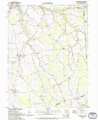
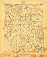 1905 Barclay1905 Print · USGSUpper Delmarva at the start of the twentieth century was a landscape of rail-connected farming towns and river landings. Trace family roots and old property lines near Sudlersville, the Ashland Hayden P O, and the Benedictine Convent.3 unique versions available
 - 1906 Map of Dover
 1906 Dover1906 Print · USGSCentral Delaware and Maryland's Eastern Shore appear at the start of the twentieth century, focused on the bustling rail-and-river economy. Genealogists can trace old family landing sites and crossroads villages like Bohemia Mills, Deakyneville Ldg., and Seven Hickories.3 unique versions available
 - 1920 Map of Dover
 1920 Dover1920 Print · USGSThe Maryland and Delaware borderlands at the end of the Great War reveal a landscape of tidewater landings and evolving rail lines. Trace family roots and vanished wharves through Fredericktown, the Mason and Dixon Line, and the Bombay Hook Light.
 - 1944 Map of Sudlersville
 1944 Sudlersville1944 Print · USGSThe rural borderlands of Maryland and Delaware are captured here in the mid-1940s, centered on the rail corridor at Sudlersville. Researchers can trace old family crossroads like Schenk Corners or locate country sites such as Prices Chapel and Busicks Ch.
 - 1946 Map of Wilmington, 1948 Print
 1946 Wilmington1948 Print · USGSThe Delaware Valley and Jersey Shore emerge in this mid-century portrait of a region defined by river commerce and seaside growth. Genealogists and historians can trace the rail networks of the Pennsylvania Railroad, locate early airfields like Dover Airpark, and find river defenses at Fort Delaware.2 unique versions available
 - 1951 Map of Barclay
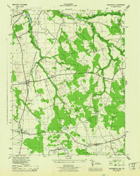
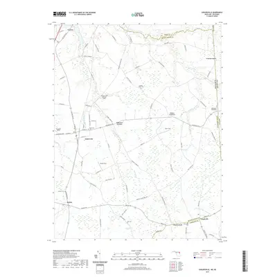
 1951 Barclay1951 Print · USGSMid-century Queen Anne's County is captured here in its prime agricultural era, just as modern drainage was reshaping the Delmarva landscape. Genealogists can trace family names at Hackett Corners or locate landmarks like St Gertrude Academy and the Pennsylvania rail line.2 unique versions available
 - 1953 Map of Sudlersville, 1955 Print
 1953 Sudlersville1955 Print · USGSThe Maryland-Delaware borderlands near the mid-century were defined by a rhythmic landscape of family crossroads and rail-side towns. Genealogists and historians can trace the foundations of local communities through sites like Holdens Ch, Unicorn Mill Pond, and the scattered settlements of Duhamel Corners and Barclay.2 unique versions available
 - 1955 Map of Wilmington
 1955 Wilmington1955 Print · USGSThe Delaware Valley and Jersey Shore are seen here during the mid-fifties era of rapid suburban expansion and highway development. You can trace the path of the New Jersey Turnpike, locate the Fort Dix Military Reservation, or explore the rail networks of the Pennsylvania Railroad.
 - 1957 Map of Wilmington
 1957 Wilmington1957 Print · USGSThe mid-Atlantic coastal plain comes alive in the mid-fifties as the New Jersey Turnpike and Garden State Parkway redefine travel. Researchers can trace the rail-to-road transition and find landmarks like Ship John Shoal Light and the Fort Dix Military Reservation.2 unique versions available
 - 1959 Map of Wilmington
 1959 Wilmington1959 Print · USGSThe Delaware Valley and Jersey Shore are seen here in the late fifties, during a period of massive suburban and highway expansion. Researchers can trace mid-century infrastructure like the N J Turnpike or locate coastal landmarks from Barnegat Bay to the Maurice River.3 unique versions available
 - 1966 Map of Wilmington, 1968 Print
 1966 Wilmington1968 Print · USGSThe Delaware Valley and Jersey Shore are seen here in the mid-1960s, documenting a landscape of dense industrial cities and emerging coastal resorts. Researchers can trace the sprawling rail networks of the Pennsylvania Railroad or locate landmarks like Fort Dix Military Reservation and Elk Neck State Park.4 unique versions available
 - 1972 Map of Wilmington, 1976 Print
 1972 Wilmington1976 Print · USGSThe Delaware Valley and Jersey Shore are seen here in the 1970s, showcasing the region's dense transport networks and vast state forests. Trace early coastal development near Atlantic City or locate rural landmarks like Mount Holly and Dover Air Force Base.2 unique versions available
 - 1984 Map of Dover, 1985 Print
 1984 Dover1985 Print · USGSThe Delaware Bay coastline and its surrounding communities are captured here in the mid-1980s. Genealogists and historians can trace the growth of Dover, locate rural landmarks like St Augustine, or study the rail networks of CONRAIL and the Dover Air Force Base.
 - 1993 Map of Sudlersville
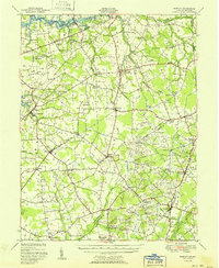
 1993 Sudlersville1993 Print · USGSQueen Anne's County is seen here in the early nineties as a network of crossroads hamlets and family farmsteads along the Delaware line. Genealogists can trace property near Sudlersville and Barclay, or locate old landmarks like Holdens Ch and Unicorn Mill Pond.
 - 2011 Map of Sudlersville, 2011 Print
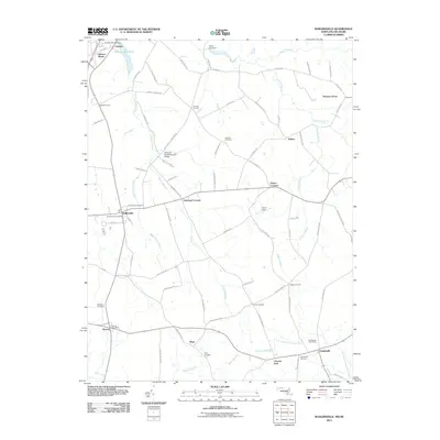 2011 Sudlersville2011 Print · USGSCovers Barclay, including Sudlersville, Templeville, and other nearby areas
 - 2014 Map of Sudlersville, 2014 Print
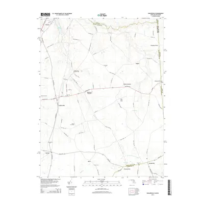 2014 Sudlersville2014 Print · USGSCovers Barclay, including Sudlersville, Templeville, and other nearby areas
 - 2017 Map of Sudlersville, 2017 Print
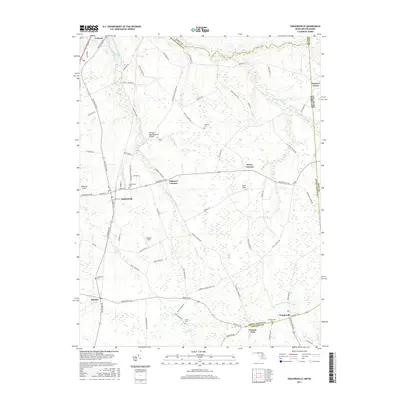 2017 Sudlersville2017 Print · USGSCovers Barclay, including Sudlersville, Templeville, and other nearby areas
 - 2019 Map of Sudlersville, 2019 Print
 2019 Sudlersville2019 Print · USGSCovers Barclay, including Sudlersville, Templeville, and other nearby areas
 - 2023 Map of Sudlersville, 2023 Print
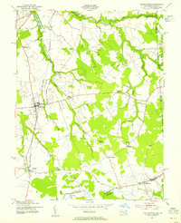
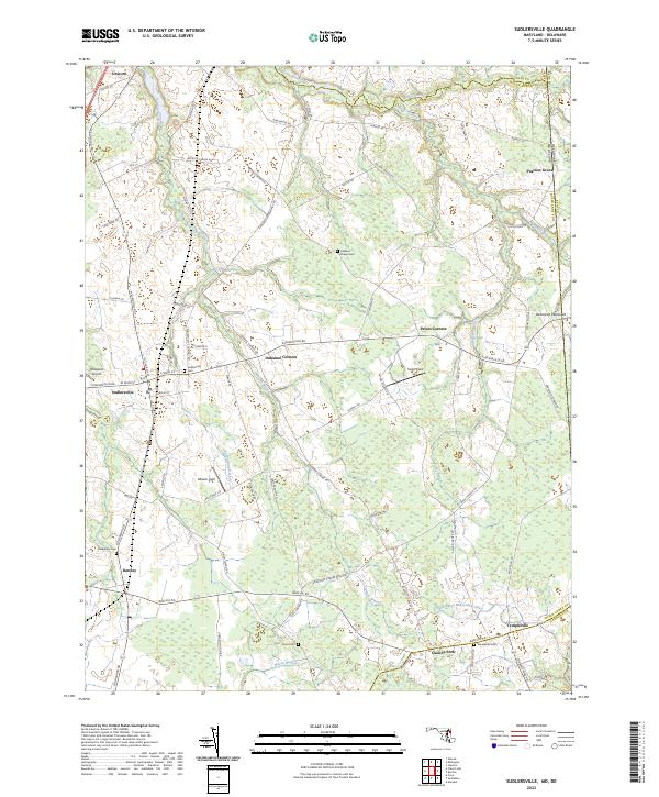 2023 Sudlersville2023 Print · USGSQueen Anne's County is shown in detail during the early 2020s, capturing the rural character and small crossroads of the Maryland-Delaware border. Genealogists can locate several local burial sites like Holdens Chapel Cem and Busic Cem or trace the development of Sudlersville and Barclay.
End of results
Showing maps 1-20 of 20
Top cities near Barclay
- Chestertown historical maps
- Centreville historical maps
- Greensboro historical maps
- Kingstown historical maps
- Ridgely historical maps
- Church Hill historical maps
See more
Frequently asked questions
- What are the different types of historical maps available for Barclay?
- What is the oldest map of Barclay?
- Where can I purchase historical maps of Barclay for my home or office?
- Where can I download high-res historical maps of Barclay?
- Are there historical topographic maps available for Barclay?
- Is there historical aerial imagery available for Barclay?
- Where are historical maps of Barclay sourced from?