Old Maps of Pinefield, Charles County
Explore 19 old maps of Pinefield, spanning from 1892 to today. These high-resolution historic maps reveal how streets, neighborhoods, landmarks, and natural features evolved over time — perfect for genealogy, metal detecting, research, and local history exploration.
What you can do with these maps:
- See how Pinefield changed over time: Compare historical maps to modern-day views to trace roads, homesites, rail lines & more.
- View detailed metadata: Each map includes creators, publishers, year, scale, and archive source.
- Overlay maps with satellite & LiDAR: Visualize the past alongside modern tools to explore terrain & human change.
- Trusted historical sources: Maps sourced from the USGS, Library of Congress, and other archives.
- Access maps your way: View online, download high-res files, or order prints for personal or research use.
Start exploring old maps of Pinefield to uncover forgotten places, hidden landmarks, and the deep history beneath your feet.
Pinefield, Charles County maps
(19)- 1892 Map of Brandywine
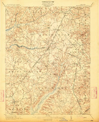
 1892 Brandywine1892 Print · USGSSouthern Maryland in the early 1890s shows a landscape of rail-driven growth and scattered crossroads. Genealogists can trace family landmarks and rail stops from Waldorf down to La Plata, including Zekiah Swamp and the Port Tobacco Sta.
 - 1895 Map of Brandywine
 1895 Brandywine1895 Print · USGSSouthern Maryland was a landscape of rail-driven market towns and deep wetlands in the late nineteenth century. Genealogists can trace the early layout of Waldorf, follow the Pope Creek Branch, or locate family sites near Beantown and Zekiah Swamp.2 unique versions available
 - 1899 Map of Patuxent
 1899 Patuxent1899 Print · USGSSouthern Maryland in the late nineteenth century was a world of river wharves and emerging rail lines. Genealogists can trace family names across landings and settlements like Bladensburg, Upper Marlboro, and Piscataway Reform School before the landscape was modernised.3 unique versions available
 - 1906 Map of Patuxent
 1906 Patuxent1906 Print · USGSThe Tidewater region of Maryland and the outskirts of the District of Columbia are shown here at the turn of the century. Researchers can trace the early footprints of Maryland Agril. College, find riverfront infrastructure at Milltown Landing, and follow long-established routes like the Marlboro Turnpike.4 unique versions available
 - 1911 Map of Brandywine, 1962 Print
 1911 Brandywine1962 Print · USGSSouthern Maryland at the turn of the century shows a landscape of rail-connected farming towns and expansive wetlands. Researchers can trace ancestral locations near LA PLATA, the old Reform School, or country parishes like St Peters Church and Piney Church.
 - 1913 Map of Brandywine
 1913 Brandywine1913 Print · USGSSouthern Maryland at the turn of the century shows a landscape transitioning through early rail and rural growth. Genealogists can trace family roots through landmarks like St Peters Church, Winkler Shop School, and old stops such as Malcolm Woodville Station.3 unique versions available
 - 1944 Map of Brandywine
 1944 Brandywine1944 Print · USGSMid-century Southern Maryland comes into focus here, showing the rural crossroads of Prince George's and Charles counties as military and institutional land use expanded. Researchers can trace family-named landmarks and local hubs like Horsehead, Cheltenham School for Boys, and St Michaels Ch.
 - 1945 Map of Brandywine
 1945 Brandywine1945 Print · USGSSouthern Prince George's County at the end of the war shows a landscape of rural parishes and state-protected woodlands. Genealogists and researchers can locate family sites near Cheltenham Church, the Cedarville Sch, and the old rail line at Brandywine.
 - 1948 Map of Washington
 1948 Washington1948 Print · USGSThe Potomac and Chesapeake regions in the late 1940s reveal a landscape of expanding military reach and deep-rooted Tidewater settlements. Trace old rail corridors like the Richmond Fredericksburg & Potomac RR or locate landmarks like the Wakefield Washington Monument and St. Marys College.2 unique versions available
 - 1956 Map of Brandywine, 1958 Print
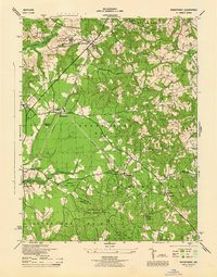
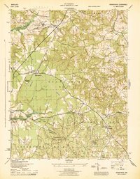
 1956 Brandywine1958 Print · USGSSouthern Maryland in the mid-1950s shows a landscape of small crossroads communities and growing federal installations. Genealogists and historians can trace family roots through the network of local sites like St Thomas Church, Cheltenham, and the Boys Village of Maryland.4 unique versions available
 - 1957 Map of Washington, 1966 Print
 1957 Washington1966 Print · USGSThe mid-Atlantic region during the mid-fifties and early sixties reveals a landscape of growing suburbs and vital military outposts. Researchers can trace historic river towns and shorelines from Alexandria to the Hooper Islands and St Clements Island.5 unique versions available
 - 1961 Map of Washington
 1961 Washington1961 Print · USGSThe mid-Atlantic region in the late fifties is presented in remarkable detail, from the Blue Ridge foothills to the Chesapeake Eastern Shore. Researchers can trace historic river landings and military sites like Mount Vernon, Fort Belvoir, and Point Lookout.2 unique versions available
 - 1983 Map of Washington East, 1984 Print
 1983 Washington East1984 Print · USGSThe Chesapeake Bay region in the early eighties shows the Maryland capital and its suburbs meeting the maritime traditions of the Eastern Shore. Researchers can trace land patterns from Andrews Air Force Base to waterfront settlements like Oxford and Chesapeake Beach.2 unique versions available
 - 1989 Map of Washington
 1989 Washington1989 Print · USGSThe Potomac River valley and Chesapeake Bay are shown in comprehensive detail during the late 1980s. Genealogists and historians can trace the transition from urban Alexandria to the rural Northern Neck, locating landmarks like Mount Vernon and Stratford Hall.
 - 2011 Map of Brandywine, 2011 Print
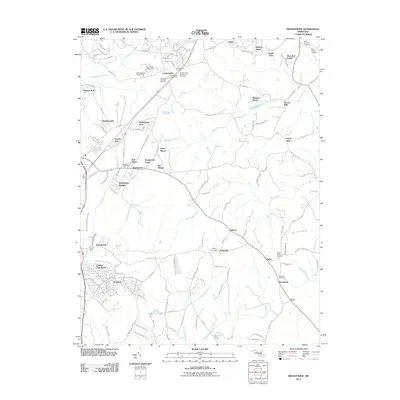 2011 Brandywine2011 Print · USGSCovers Pinefield, including Brandywine, Baden, and other nearby areas
 - 2014 Map of Brandywine, 2014 Print
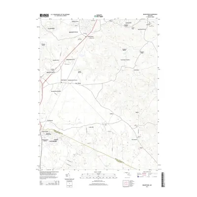 2014 Brandywine2014 Print · USGSCovers Pinefield, including Brandywine, Baden, and other nearby areas
 - 2016 Map of Brandywine, 2016 Print
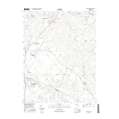 2016 Brandywine2016 Print · USGSCovers Pinefield, including Brandywine, Baden, and other nearby areas
 - 2019 Map of Brandywine, 2019 Print
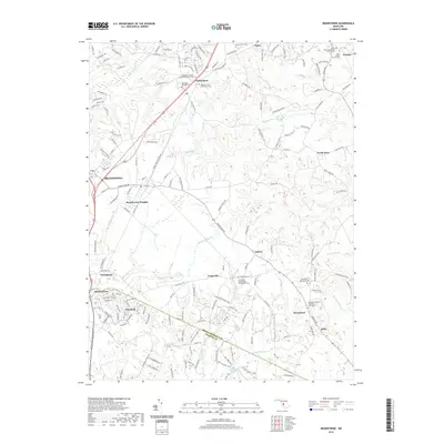 2019 Brandywine2019 Print · USGSCovers Pinefield, including Brandywine, Baden, and other nearby areas
 - 2023 Map of Brandywine, 2023 Print
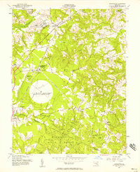
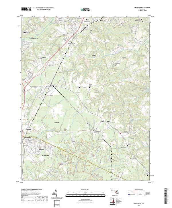 2023 Brandywine2023 Print · USGSSouthern Maryland at the border of Prince George's and Charles counties shows a mix of suburban growth and deep-rooted rural crossroads. Genealogists can trace family heritage through sites like Maryland Veterans Cem, Horsehead, and Saint Thomas Episcopal Church Cem.
End of results
Showing maps 1-19 of 19
Frequently asked questions
- What are the different types of historical maps available for Pinefield?
- What is the oldest map of Pinefield?
- Where can I purchase historical maps of Pinefield for my home or office?
- Where can I download high-res historical maps of Pinefield?
- Are there historical topographic maps available for Pinefield?
- Is there historical aerial imagery available for Pinefield?
- Where are historical maps of Pinefield sourced from?