1900s (20th Century) Maps of Devilbiss Estates, Frederick County
Explore 12 historic maps of Devilbiss Estates from the 1900s (20th Century). These maps offer a rare glimpse into what life looked like during the 1900s — showing old roads, neighborhoods, homes, and landmarks that have changed or disappeared over time.
Whether you're researching your family's past, planning a metal detecting trip, or studying how Devilbiss Estates's landscape evolved across the 1900s, these high-resolution maps are a powerful tool for exploring the history of this region.
- Focus on a specific era: All maps on this page are from the 1900s, giving you a focused view of this time period.
- See what’s changed: Compare century-old streets, trails, and buildings to today's modern landscape using overlays and satellite layers.
- Research with precision: Use these maps for genealogy, historical research, land use analysis, or educational projects.
- View, download, or print: Maps are fully viewable online in high resolution, and can be downloaded or printed for your own records.
Start exploring Devilbiss Estates's history through authentic maps from the 1900s. This is your window into the past.
Devilbiss Estates, Frederick County maps
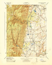
(12)- 1911 Map of Emmitsburg
 1911 Emmitsburg1911 Print · USGSMaryland's northern borderlands and the Catoctin mountains thrived in the early twentieth century as a hub for institutions, railroads, and milling. Genealogists and historians can locate family homes and old crossroads near St Josephs Academy, Sabillasville, and the Western Maryland RR.6 unique versions available
 - 1942 Map of Gettysburg, 1944 Print
 1942 Gettysburg1944 Print · USGSGettysburg and its surrounding borderlands are shown in great detail during the early 1940s, capturing the region's dense network of rural schools and mills. Genealogists can trace family-named landmarks such as Galt Kump PO, Hafers Mill, and Philips Delight Sch.
 - 1943 Map of Emmitsburg
 1943 Emmitsburg1943 Print · USGSMaryland's northern border and the Frederick Valley appear during the early 1940s, where the Catoctin range meets the Monocacy plain. Genealogists can trace family names at Hoovers Mill, locate historic institutions like Mount St Marys College, or follow the Western Maryland RR.4 unique versions available
 - 1944 Map of Catoctin Furnace
 1944 Catoctin Furnace1944 Print · USGSMid-century Frederick County comes into focus as the Western Maryland railroad connects valley hamlets to the mountain slopes. Trace family roots and local history through landmarks like Catoctin Furnace, the Lewistown Consolidated School, and Mountaindale Sta.
 - 1948 Map of Baltimore
 1948 Baltimore1948 Print · USGSMaryland and Pennsylvania crossroads are captured in the late 1940s, showing a landscape defined by historic rail lines and major military installations. Genealogists can trace family connections in Gettysburg, Westminster, and near the U.S. Naval Academy in Annapolis.2 unique versions available
 - 1953 Map of Catoctin Furnace, 1955 Print
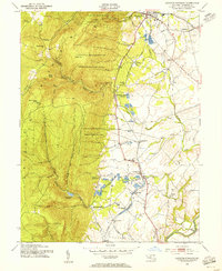 1953 Catoctin Furnace1955 Print · USGSFrederick County's mountain-and-valley landscape is captured here during the post-war era, showing the transition from mountain recreation to valley industry. Researchers can trace the Western Maryland rail line through Catoctin Furnace and locate local landmarks like the Lewistown State Fish Hatchery.7 unique versions available
 - 1954 Map of Baltimore
 1954 Baltimore1954 Print · USGSThe Mid-Atlantic region in the early fifties shows a landscape of growing suburban centers and heavy rail corridors. Trace mid-century transit networks and military landmarks from the Aberdeen Proving Ground to the Gettysburg National Military Park.
 - 1956 Map of Baltimore
 1956 Baltimore1956 Print · USGSMid-century Maryland and Pennsylvania are captured here during a period of massive suburban and military growth across the Chesapeake region. Genealogists and historians can trace the rail corridors of the Baltimore & Ohio RR and locate landmarks like Fort McHenry or the Aberdeen Proving Ground.
 - 1957 Map of Baltimore, 1964 Print
 1957 Baltimore1964 Print · USGSMaryland and Southern Pennsylvania are shown during the mid-century expansion of the Baltimore-Washington corridor. Researchers can trace the extensive rail lines of the Baltimore & Ohio RR and locate sites like Fort Detrick and Gettysburg National Military Park.5 unique versions available
 - 1961 Map of Baltimore
 1961 Baltimore1961 Print · USGSMaryland and Pennsylvania are captured at a mid-century peak of industrial and military expansion. Genealogists and historians can trace rail corridors like the Western Maryland Ry or locate regional landmarks such as Camp Detrick and Kent Island.
 - 1983 Map of Hagerstown, 1984 Print
 1983 Hagerstown1984 Print · USGSThe tri-state borderlands of Maryland, Pennsylvania, and West Virginia are shown in the early eighties as a hub of military installations and valley towns. Genealogists and historians can trace the landscape from Gettysburg National Military Park to the banks of the Potomac River.2 unique versions available
 - 1989 Map of Baltimore
 1989 Baltimore1989 Print · USGSThe Mid-Atlantic corridor in the late eighties is captured here, from the Baltimore harbor to the Blue Ridge foothills. Researchers can trace the sprawling footprints of Aberdeen Proving Ground, the historic grounds of Gettysburg National Military Park, and the winding Susquehanna River.
End of results
Showing maps 1-12 of 12
Frequently asked questions
- What are the different types of historical maps available for Devilbiss Estates?
- What is the oldest map of Devilbiss Estates?
- Where can I purchase historical maps of Devilbiss Estates for my home or office?
- Where can I download high-res historical maps of Devilbiss Estates?
- Are there historical topographic maps available for Devilbiss Estates?
- Is there historical aerial imagery available for Devilbiss Estates?
- Where are historical maps of Devilbiss Estates sourced from?