Old Maps of Thurmont, Maryland
Explore 24 old maps of Thurmont, spanning from 1911 to today. These high-resolution historic maps reveal how streets, neighborhoods, landmarks, and natural features evolved over time — perfect for genealogy, metal detecting, research, and local history exploration.
What you can do with these maps:
- See how Thurmont changed over time: Compare historical maps to modern-day views to trace roads, homesites, rail lines & more.
- View detailed metadata: Each map includes creators, publishers, year, scale, and archive source.
- Overlay maps with satellite & LiDAR: Visualize the past alongside modern tools to explore terrain & human change.
- Trusted historical sources: Maps sourced from the USGS, Library of Congress, and other archives.
- Access maps your way: View online, download high-res files, or order prints for personal or research use.
Start exploring old maps of Thurmont to uncover forgotten places, hidden landmarks, and the deep history beneath your feet.
Thurmont, MD maps
(24)- 1911 Map of Emmitsburg
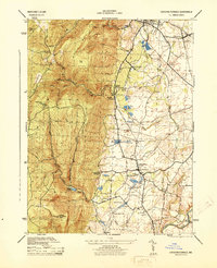
 1911 Emmitsburg1911 Print · USGSMaryland's northern borderlands and the Catoctin mountains thrived in the early twentieth century as a hub for institutions, railroads, and milling. Genealogists and historians can locate family homes and old crossroads near St Josephs Academy, Sabillasville, and the Western Maryland RR.6 unique versions available
 - 1942 Map of Gettysburg, 1944 Print
 1942 Gettysburg1944 Print · USGSGettysburg and its surrounding borderlands are shown in great detail during the early 1940s, capturing the region's dense network of rural schools and mills. Genealogists can trace family-named landmarks such as Galt Kump PO, Hafers Mill, and Philips Delight Sch.
 - 1943 Map of Emmitsburg
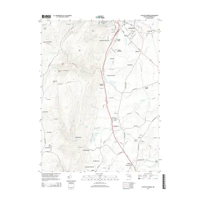
 1943 Emmitsburg1943 Print · USGSMaryland's northern border and the Frederick Valley appear during the early 1940s, where the Catoctin range meets the Monocacy plain. Genealogists can trace family names at Hoovers Mill, locate historic institutions like Mount St Marys College, or follow the Western Maryland RR.4 unique versions available
 - 1944 Map of Catoctin Furnace
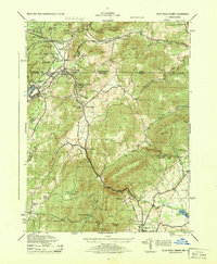
 1944 Catoctin Furnace1944 Print · USGSMid-century Frederick County comes into focus as the Western Maryland railroad connects valley hamlets to the mountain slopes. Trace family roots and local history through landmarks like Catoctin Furnace, the Lewistown Consolidated School, and Mountaindale Sta.
 - 1944 Map of Blue Ridge Summit
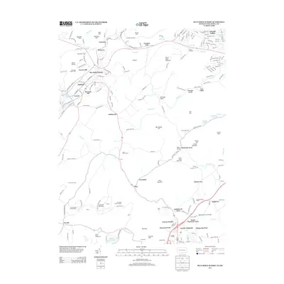
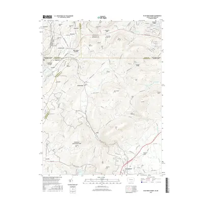
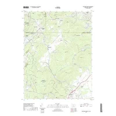
 1944 Blue Ridge Summit1944 Print · USGSThe borderlands of Maryland and Pennsylvania are captured here during the 1940s, showing the vital rail and military presence in the Blue Ridge mountains. Researchers can trace the Western Maryland line through Blue Ridge Summit and locate wartime sites like Camp Ritchie.
 - 1948 Map of Baltimore
 1948 Baltimore1948 Print · USGSMaryland and Pennsylvania crossroads are captured in the late 1940s, showing a landscape defined by historic rail lines and major military installations. Genealogists can trace family connections in Gettysburg, Westminster, and near the U.S. Naval Academy in Annapolis.2 unique versions available
 - 1953 Map of Catoctin Furnace, 1955 Print
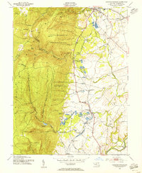 1953 Catoctin Furnace1955 Print · USGSFrederick County's mountain-and-valley landscape is captured here during the post-war era, showing the transition from mountain recreation to valley industry. Researchers can trace the Western Maryland rail line through Catoctin Furnace and locate local landmarks like the Lewistown State Fish Hatchery.7 unique versions available
 - 1953 Map of Blue Ridge Summit, 1955 Print
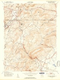 1953 Blue Ridge Summit1955 Print · USGSMaryland and Pennsylvania meet along the mountain crests in the early fifties, where the railroad and state line define local life. Genealogists and hikers can trace the Western Maryland tracks past Wesley Chapel, Charmian, and the Victor Cullen State Hospital.7 unique versions available
 - 1954 Map of Baltimore
 1954 Baltimore1954 Print · USGSThe Mid-Atlantic region in the early fifties shows a landscape of growing suburban centers and heavy rail corridors. Trace mid-century transit networks and military landmarks from the Aberdeen Proving Ground to the Gettysburg National Military Park.
 - 1956 Map of Baltimore
 1956 Baltimore1956 Print · USGSMid-century Maryland and Pennsylvania are captured here during a period of massive suburban and military growth across the Chesapeake region. Genealogists and historians can trace the rail corridors of the Baltimore & Ohio RR and locate landmarks like Fort McHenry or the Aberdeen Proving Ground.
 - 1957 Map of Baltimore, 1964 Print
 1957 Baltimore1964 Print · USGSMaryland and Southern Pennsylvania are shown during the mid-century expansion of the Baltimore-Washington corridor. Researchers can trace the extensive rail lines of the Baltimore & Ohio RR and locate sites like Fort Detrick and Gettysburg National Military Park.5 unique versions available
 - 1961 Map of Baltimore
 1961 Baltimore1961 Print · USGSMaryland and Pennsylvania are captured at a mid-century peak of industrial and military expansion. Genealogists and historians can trace rail corridors like the Western Maryland Ry or locate regional landmarks such as Camp Detrick and Kent Island.
 - 1983 Map of Hagerstown, 1984 Print
 1983 Hagerstown1984 Print · USGSThe tri-state borderlands of Maryland, Pennsylvania, and West Virginia are shown in the early eighties as a hub of military installations and valley towns. Genealogists and historians can trace the landscape from Gettysburg National Military Park to the banks of the Potomac River.2 unique versions available
 - 1989 Map of Baltimore
 1989 Baltimore1989 Print · USGSThe Mid-Atlantic corridor in the late eighties is captured here, from the Baltimore harbor to the Blue Ridge foothills. Researchers can trace the sprawling footprints of Aberdeen Proving Ground, the historic grounds of Gettysburg National Military Park, and the winding Susquehanna River.
 - 2011 Map of Catoctin Furnace, 2011 Print
 2011 Catoctin Furnace2011 Print · USGSCovers Thurmont, including Covered Bridge Estates, Williar, and other nearby areas
 - 2011 Map of Blue Ridge Summit, 2011 Print
 2011 Blue Ridge Summit2011 Print · USGSCovers Thurmont, including Carroll Valley, Highfield-Cascade, and other nearby areas
 - 2013 Map of Blue Ridge Summit, 2013 Print
 2013 Blue Ridge Summit2013 Print · USGSCovers Thurmont, including Carroll Valley, Highfield-Cascade, and other nearby areas
 - 2014 Map of Catoctin Furnace, 2014 Print
 2014 Catoctin Furnace2014 Print · USGSCovers Thurmont, including Covered Bridge Estates, Williar, and other nearby areas
 - 2016 Map of Blue Ridge Summit, 2016 Print
 2016 Blue Ridge Summit2016 Print · USGSCovers Thurmont, including Carroll Valley, Highfield-Cascade, and other nearby areas
 - 2016 Map of Catoctin Furnace, 2016 Print
 2016 Catoctin Furnace2016 Print · USGSCovers Thurmont, including Covered Bridge Estates, Williar, and other nearby areas
 - 2019 Map of Blue Ridge Summit, 2019 Print
 2019 Blue Ridge Summit2019 Print · USGSCovers Thurmont, including Carroll Valley, Highfield-Cascade, and other nearby areas
 - 2019 Map of Catoctin Furnace, 2019 Print
 2019 Catoctin Furnace2019 Print · USGSCovers Thurmont, including Covered Bridge Estates, Williar, and other nearby areas
 - 2023 Map of Blue Ridge Summit, 2023 Print
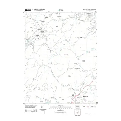
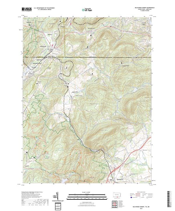 2023 Blue Ridge Summit2023 Print · USGSBlue Ridge Summit and the surrounding borderlands of Franklin and Frederick Counties are captured here in the 2020s. Researchers can trace historic family burial sites and military landmarks from Fort Ritchie to the Benchoff Family Cem and Otterbein Chapel Cem.
 - 2023 Map of Catoctin Furnace, 2023 Print
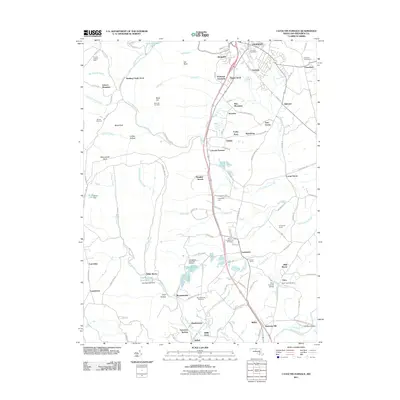
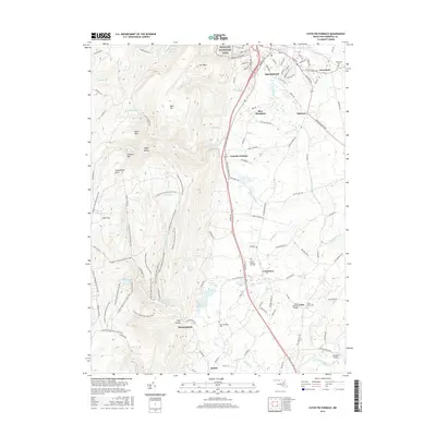
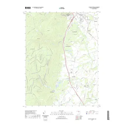
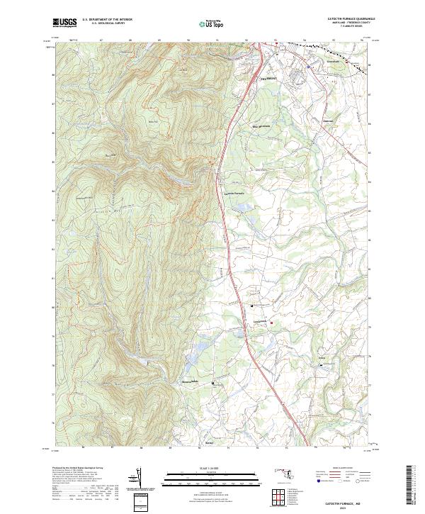 2023 Catoctin Furnace2023 Print · USGSMaryland's Blue Ridge front comes into focus during this 2023 survey of the Frederick Valley and its neighboring peaks. Genealogists and hikers can trace the connections between Thurmont and local landmarks like Catoctin Furnace, Graceham Cem, and Saint Pauls Cem.
End of results
Showing maps 1-24 of 24
Top cities near Thurmont
- Frederick historical maps
- Waynesboro historical maps
- Gettysburg historical maps
- Taneytown historical maps
- Quincy Township historical maps
- Spring Ridge historical maps
See more
Top neighborhoods of Thurmont
- Altogether historical maps
- Gateway historical maps
- Catoctin Highlands historical maps
- Colonial Heights historical maps
- Catoctin Heights historical maps
- Thurmont West historical maps
Frequently asked questions
- What are the different types of historical maps available for Thurmont?
- What is the oldest map of Thurmont?
- Where can I purchase historical maps of Thurmont for my home or office?
- Where can I download high-res historical maps of Thurmont?
- Are there historical topographic maps available for Thurmont?
- Is there historical aerial imagery available for Thurmont?
- Where are historical maps of Thurmont sourced from?