1940s Maps of Colony Village, Walkersville
Explore 3 historic maps of Colony Village from the 1940s. These maps offer a rare glimpse into what life looked like during the 1940s — showing old roads, neighborhoods, homes, and landmarks that have changed or disappeared over time.
Whether you're researching your family's past, planning a metal detecting trip, or studying how Colony Village's landscape evolved across the 1940s, these high-resolution maps are a powerful tool for exploring the history of this region.
- Focus on a specific era: All maps on this page are from the 1940s, giving you a focused view of this time period.
- See what’s changed: Compare century-old streets, trails, and buildings to today's modern landscape using overlays and satellite layers.
- Research with precision: Use these maps for genealogy, historical research, land use analysis, or educational projects.
- View, download, or print: Maps are fully viewable online in high resolution, and can be downloaded or printed for your own records.
Start exploring Colony Village's history through authentic maps from the 1940s. This is your window into the past.
Colony Village, Walkersville maps
(3)- 1942 Map of Frederick
 1942 Frederick1942 Print · USGSMid-century Maryland's central corridor is centered on Frederick as it appeared before the modern interstate system. Researchers can trace the routes of the B & O Canal, locate the Montevue Almshouse, and see the intersection of the Northern Central RR with early turnpikes.
 - 1944 Map of Walkersville
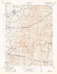 1944 Walkersville1944 Print · USGSFrederick County at the height of the Second World War shows a rural landscape of limestone quarries, rail corridors, and small crossroads hamlets. Genealogists can trace family footprints through Walkersville, Libertytown, and New Market, or locate industrial sites like the Lime Kiln and Old Quarry.2 unique versions available
 - 1948 Map of Baltimore
 1948 Baltimore1948 Print · USGSMaryland and Pennsylvania crossroads are captured in the late 1940s, showing a landscape defined by historic rail lines and major military installations. Genealogists can trace family connections in Gettysburg, Westminster, and near the U.S. Naval Academy in Annapolis.2 unique versions available
End of results
Showing maps 1-3 of 3
Frequently asked questions
- What are the different types of historical maps available for Colony Village?
- What is the oldest map of Colony Village?
- Where can I purchase historical maps of Colony Village for my home or office?
- Where can I download high-res historical maps of Colony Village?
- Are there historical topographic maps available for Colony Village?
- Is there historical aerial imagery available for Colony Village?
- Where are historical maps of Colony Village sourced from?