Old Maps of Oak Bluffs, Massachusetts
Explore 52 old maps of Oak Bluffs, spanning from 1886 to today. These high-resolution historic maps reveal how streets, neighborhoods, landmarks, and natural features evolved over time — perfect for genealogy, metal detecting, research, and local history exploration.
What you can do with these maps:
- See how Oak Bluffs changed over time: Compare historical maps to modern-day views to trace roads, homesites, rail lines & more.
- View detailed metadata: Each map includes creators, publishers, year, scale, and archive source.
- Overlay maps with satellite & LiDAR: Visualize the past alongside modern tools to explore terrain & human change.
- Trusted historical sources: Maps sourced from the USGS, Library of Congress, and other archives.
- Access maps your way: View online, download high-res files, or order prints for personal or research use.
Start exploring old maps of Oak Bluffs to uncover forgotten places, hidden landmarks, and the deep history beneath your feet.
Oak Bluffs, MA maps
(52)- 1886 Map of Falmouth
 1886 Falmouth1886 Print · USGSThe Cape Cod peninsula during the late nineteenth century shows a landscape transitioning between maritime tradition and rail-driven growth. Genealogists can trace family footprints in Waquoit Village, Teaticket, and Menauhant while following the Old Colony Railroad corridor.
 - 1887 Map of Marthas Vineyard
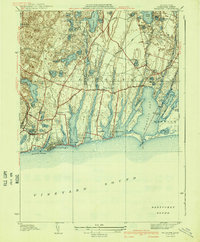
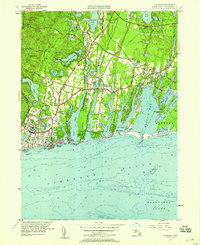
 1887 Marthas Vineyard1887 Print · USGSMartha's Vineyard in the late nineteenth century remains a landscape of maritime commerce and quiet island life. Genealogists can trace family names and early settlements from Cottage City and Edgartown to the rural roads of West Tisbury.
 - 1888 Map of Falmouth
 1888 Falmouth1888 Print · USGSThe Buzzards Bay coastline and upper Cape Cod are captured here in the late nineteenth century, documenting the critical arrival of the railroad. Researchers can trace the Old Colony Railroad to its terminus at Woods Holl or locate maritime landmarks like Wing's Neck Light.
 - 1889 Map of Marthas Vineyard
 1889 Marthas Vineyard1889 Print · USGSThe eastern shores of the Vineyard come alive in the late Victorian era, showcasing the early growth of Cottage City and Edgartown. Genealogists and historians can trace old road networks connecting West Tisbury to the coast and locate historic beacons like West Chop Light.
 - 1893 Map of Falmouth
 1893 Falmouth1893 Print · USGSCape Cod's western shore and the upper reaches of Buzzards Bay are captured here in the late nineteenth century as rail travel transformed the coast. Genealogists can trace family names at Waquoit Village or follow the Old Colony Railroad through Woods Holl and Falmouth Station.9 unique versions available
 - 1894 Map of Marthas Vineyard, 1898 Print
 1894 Marthas Vineyard1898 Print · USGSMartha's Vineyard in the 1890s appears as a land of maritime necessity and early coastal villages. Genealogists can trace family settlements in Vineyard Haven and Edgartown or locate lighthouses like West Chop Light and Cape Poge Light.7 unique versions available
 - 1915 Map of Falmouth, 1943 Print
 1915 Falmouth1943 Print · USGSUpper Cape Cod during the mid-forties reveals a landscape of growing military activity alongside traditional coastal villages. Genealogists and historians can trace the foundations of Camp Edwards and find historic post offices at Waquoit Village or Monument Beach.
 - 1920 Map of Falmouth
 1920 Falmouth1920 Print · USGSCoastal Barnstable County comes to life in this post-war military survey of the Falmouth peninsula and its maritime approaches. Researchers can trace the Old Colony RR to Falmouth Station or locate landmarks like Nobska Point Light and Waquoit Village.
 - 1936 Map of Falmouth
 1936 Falmouth1936 Print · USGSCoastal Barnstable County is documented here in the mid-1930s, showing the early layouts of seaside villages and their surrounding finger ponds. Genealogists and historians can trace the foundations of Falmouth Heights, Waquoit Village, and the Harbor Lighthouse.
 - 1941 Map of Falmouth
 1941 Falmouth1941 Print · USGSCape Cod's south shore appears just before the mid-century boom, showing the maritime and residential character of the 1930s. Genealogists and historians can trace family-named areas like Smarttown, old congregations at East End Ch, and the development of Waquoit Village.3 unique versions available
 - 1942 Map of Marthas Vineyard
 1942 Marthas Vineyard1942 Print · USGSMartha's Vineyard and the Elizabeth Islands appear here during the early years of the second World War. Researchers can trace historical lighthouse locations like Gay Head LH and Tarpaulin Cove LH, and explore the 1940s boundaries of Edgartown and Vineyard Haven.
 - 1942 Map of New Bedford
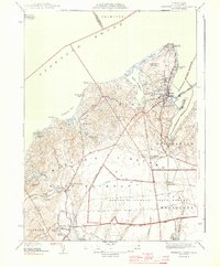
 1942 New Bedford1942 Print · USGSSoutheastern Massachusetts at the start of the 1940s shows a region defined by maritime defense and industrial rail corridors. Genealogists and historians can trace the massive Camp Edwards boundary, old rail stops like Rock Station, and vanished local industry at Paper Mill Village.2 unique versions available
 - 1942 Map of Nantucket, 1943 Print
 1942 Nantucket1943 Print · USGSNantucket and Chappaquiddick Islands are captured here during the early years of the Second World War. Genealogists and historians can trace the early roads to Siasconset, the Steamship Ferry route, and the locations of Madd Aket LSS and Coskata LSS.
 - 1944 Map of Vineyard Haven
 1944 Vineyard Haven1944 Print · USGSThe northern shores of Martha's Vineyard appear here just before the mid-century, documenting the island's coastal villages and interior woodlands. Local historians can trace family-named sites like Looks Pond and Crocker Pond or locate West Chop Lighthouse.3 unique versions available
 - 1944 Map of Edgartown
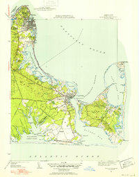
 1944 Edgartown1944 Print · USGSMartha's Vineyard at the height of the Second World War shows a coastal landscape of maritime aids and early airfields. Genealogists and historians can trace the roads through Jenneganville or locate the Oak Grove Cem and East Chop Lighthouse.3 unique versions available
 - 1946 Map of Falmouth, 1954 Print
 1946 Falmouth1954 Print · USGSUpper Cape Cod's coastline and interior ponds are captured in detail during the mid-1940s, showing the early growth of seaside summer communities. Genealogists and historians can trace family roots through settlements like Teaticket, Mara Vista, and Waquoit Village before later modern development.2 unique versions available
 - 1947 Map of Providence, 1948 Print
 1947 Providence1948 Print · USGSSouthern New England is captured in the mid-1940s, showing a landscape defined by busy industrial ports and expanding military installations. Researchers can trace the rail lines of the N.Y. N.H. & H. RR or locate coastal defenses like Fort Adams and Quonset Point.5 unique versions available
 - 1948 Map of Falmouth, 1949 Print
 1948 Falmouth1949 Print · USGSThe Falmouth coastline and the interior ponds of Cape Cod are shown here just after the war. Researchers can trace family history through sites like Oak Grove Cemetery, St Anthonys Church, and the vanished lanes of Smalltown.
 - 1948 Map of Providence, 1951 Print
 1948 Providence1951 Print · USGSSouthern New England’s coastal reaches are captured here in the late 1940s, from the industrial heart of Providence to the tip of Provincetown. Genealogists and historians can trace rail lines like the Central Vermont Railway and locate active military sites such as Otis Air Force Base and Fort Rodman.
 - 1949 Map of Falmouth
 1949 Falmouth1949 Print · USGSThe southern coast of Cape Cod comes alive in this post-war mosaic, showing a landscape of cranberry bogs and seasonal colonies. Trace old family plots at Oak Grove Cem or explore coastal reaches like Seconsett Island and Waquoit Village.
 - 1951 Map of Edgartown
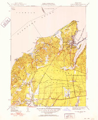
 1951 Edgartown1951 Print · USGSMartha's Vineyard at mid-century reveals a landscape of maritime tradition and coastal hamlets. Genealogists and island historians can trace old neighborhoods like Clevelandtown, find Oak Grove Cem, and locate the historic Edgartown Lighthouse.4 unique versions available
 - 1951 Map of Vineyard Haven
 1951 Vineyard Haven1951 Print · USGSMarthas Vineyard in the early fifties reveals a landscape of quiet coastal villages and expanding seasonal retreats. Researchers can trace the layout of Vineyard Haven or locate specific landmarks like the Lamberts Cove Ch and the West Chop Lighthouse.5 unique versions available
 - 1957 Map of Providence
 1957 Providence1957 Print · USGSCoastal New England at the height of the mid-century era shows a landscape shaped by maritime industry and Cold War defense. Genealogists and historians can trace the reach of the New York, New Haven & Hartford RR and locate legacy sites like Fort Adams and Quonset Point Naval Air Station.
 - 1957 Map of Falmouth, 1958 Print
 1957 Falmouth1958 Print · USGSCoastal Barnstable County comes alive in this mid-century portrait of established seaside villages and seasonal shorefront developments. Genealogists and historians can trace neighborhood growth through Waquoit Village, locate St Patricks Cath Ch, and find long-standing family Cranberry Bogs.3 unique versions available
 - 1958 Map of Providence
 1958 Providence1958 Print · USGSThe Rhode Island and Massachusetts coastlines are shown in detail during the late 1950s, from the urban cores to the tips of the islands. Researchers can trace the mid-century footprint of Quonset Point Naval Air Station, the defense works at Fort Adams, and the rail network of the New York, New Haven and Hartford RR.
Showing maps 1-25 of 52
Top cities near Oak Bluffs
- Falmouth historical maps
- Sandwich historical maps
- Hyannis historical maps
- Bourne historical maps
- Mashpee historical maps
- Mattapoisett historical maps
See more
Top neighborhoods of Oak Bluffs
- Eastville historical maps
- Harthaven historical maps
- Hartsville historical maps
- Lagoon Heights historical maps
- Vineyard Highlands historical maps
- East Chop historical maps
See more
Frequently asked questions
- What are the different types of historical maps available for Oak Bluffs?
- What is the oldest map of Oak Bluffs?
- Where can I purchase historical maps of Oak Bluffs for my home or office?
- Where can I download high-res historical maps of Oak Bluffs?
- Are there historical topographic maps available for Oak Bluffs?
- Is there historical aerial imagery available for Oak Bluffs?
- Where are historical maps of Oak Bluffs sourced from?