Old Maps of Groveland, Massachusetts
Explore 70 old maps of Groveland, spanning from 1886 to today. These high-resolution historic maps reveal how streets, neighborhoods, landmarks, and natural features evolved over time — perfect for genealogy, metal detecting, research, and local history exploration.
What you can do with these maps:
- See how Groveland changed over time: Compare historical maps to modern-day views to trace roads, homesites, rail lines & more.
- View detailed metadata: Each map includes creators, publishers, year, scale, and archive source.
- Overlay maps with satellite & LiDAR: Visualize the past alongside modern tools to explore terrain & human change.
- Trusted historical sources: Maps sourced from the USGS, Library of Congress, and other archives.
- Access maps your way: View online, download high-res files, or order prints for personal or research use.
Start exploring old maps of Groveland to uncover forgotten places, hidden landmarks, and the deep history beneath your feet.
Groveland, MA maps
(70)- 1886 Map of Lawrence
 1886 Lawrence1886 Print · USGSThe Merrimack Valley at the close of the nineteenth century was a bustling hub of industry and transit. Researchers can trace ancestral roots through vanished hamlets like Frye Village, locate the original Andover Theological Seminary, and follow the old Salem and Lawrence Railroad line.
 - 1888 Map of Newburyport
 1888 Newburyport1888 Print · USGSThe North Shore and Seacoast regions meet at the turn of the century along the Merrimac River. Trace the early rail lines of the Boston and Maine Railroad or locate coastal landmarks like the U.S. Life Saving Station and Range Light.
 - 1888 Map of Haverhill
 1888 Haverhill1888 Print · USGSThe Merrimack Valley at the end of the nineteenth century reveals a landscape shaped by heavy rail and river industry. Genealogists can trace family footprints through historic hubs like Salem Depot, Ayers Village, and the bustling streets of Haverhill.
 - 1888 Map of Lawrence
 1888 Lawrence1888 Print · USGSThe Merrimack Valley industrial corridor is captured here in the late nineteenth century as a thriving rail and textile hub. Researchers can trace the footprints of the Andover Theological Seminary, locate the State Almshouse, and follow the iron tracks through Ballardvale.
 - 1888 Map of Salem
 1888 Salem1888 Print · USGSThe North Shore in the late nineteenth century is captured here in its era of peak rail development. Genealogists and historians can trace family-named sites like Doles Corner and institutions such as Dummer Academy or the Insane Asylum.
 - 1890 Map of Haverhill
 1890 Haverhill1890 Print · USGSSoutheastern New Hampshire and northern Massachusetts meet here in the 1890s along the industrial corridor of the Merrimac River. Local historians can trace the early rail network through Newton Junction, Salem Depot, and the dense street grids of Haverhill.
 - 1890 Map of Newburyport
 1890 Newburyport1890 Print · USGSThe coastal borderlands of Massachusetts and New Hampshire are shown here during a peak era of maritime and rail activity. Genealogists and local historians can trace family-named sites across Newbury Old Town, Byfield, and the bustling docks at Salisbury Point.
 - 1893 Map of Salem
 1893 Salem1893 Print · USGSCoastal Massachusetts at the end of the nineteenth century reveals a landscape defined by industrial rail lines and ancient marshlands. Genealogists and historians can trace family-named hills and early institutional sites like Dummer Academy, the Insane Asylum, and the Ipswich Light.11 unique versions available
 - 1893 Map of Lawrence
 1893 Lawrence1893 Print · USGSThe Merrimac River valley and its surrounding textile and rail hubs are captured here at their industrial peak during the 1880s. Genealogists can trace family footprints through the State Almshouse, the Andover Theological Seminary, and vanished stops like Burtts Crossing Station.10 unique versions available
 - 1893 Map of Haverhill
 1893 Haverhill1893 Print · USGSThe Merrimack Valley at the end of the nineteenth century was a bustling network of rail-side villages and river industry. Genealogists can trace family lines through transit hubs like Newton Junction, rural hamlets like Ayer Village, and local landmarks like Spicket Hill.7 unique versions available
 - 1894 Map of Newburyport
 1894 Newburyport1894 Print · USGSCoastal Massachusetts and New Hampshire are captured here in the late nineteenth century, from the bustling riverfront of Newburyport to the marshes of Hampton. Genealogists and historians can trace rail lines, coastal landmarks like the U.S. Life Saving Station, and old neighborhoods in Amesbury or Newbury Old Town.7 unique versions available
 - 1917 Map of Salem
 1917 Salem1917 Print · USGSCoastal Massachusetts at the end of the Great War reveals a landscape of maritime commerce and rail-connected villages. Trace the local economy from Salem Harbor to Ipswich Light, or locate historic sites like Dummer Academy and the Insane Asylum.
 - 1918 Map of Lawrence
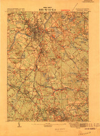 1918 Lawrence1918 Print · USGSGreater Lawrence and the Merrimac Valley are captured here during the late First World War era, showing a landscape defined by industrial rail and historic village centers. Researchers can trace the sprawling Boston and Maine Railroad network to specific sites like the State Almshouse or the Andover Theological Seminary.2 unique versions available
 - 1919 Map of Salem
 1919 Salem1919 Print · USGSThe North Shore and its rail-connected towns are captured here during the height of the steam era. Genealogists and historians can trace the local landscape through landmarks like Dummer Academy, the Insane Asylum, and the vanished Box Factory.2 unique versions available
 - 1932 Map of Newburyport
 1932 Newburyport1932 Print · USGSThe New Hampshire seacoast and southern Rockingham County are shown here in the early thirties, just as coastal recreation and inland farming reached a mature balance. Genealogists can locate family-named landmarks like Nason Corner, Dearborn Academy, and various district schools.4 unique versions available
 - 1934 Map of Exeter
 1934 Exeter1934 Print · USGSThe New Hampshire seacoast and Merrimack Valley met the Atlantic in the mid-thirties as a network of rail and river commerce. Genealogists can trace family lines through Newbury Old Town or locate historic institutions like Phillips Exeter Academy and Dearborn Academy.5 unique versions available
 - 1935 Map of Haverhill
 1935 Haverhill1935 Print · USGSThe borderlands of New Hampshire and Massachusetts appear here in the mid-1930s, showing a landscape defined by the Merrimack River and a dense rail network. Genealogists can trace family landmarks like Philbrick Hill or locate old schoolhouses including South Road Sch and the Depot Sch.5 unique versions available
 - 1943 Map of Lowell
 1943 Lowell1943 Print · USGSCentral New England industrial hubs and rural borderlands are mapped here during the early 1940s. Genealogists can trace family names across Mt Misery, Barrett Hill, and small settlements like Collinsville or North Pelham.
 - 1943 Map of Haverhill
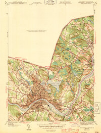 1943 Haverhill1943 Print · USGSThe Merrimack River valley during the early 1940s reveals a bustling corridor of industry and education between Haverhill and Groveland. Genealogists and historians can trace neighborhood school sites like Hannah Duston Sch and significant cemeteries such as Linwood Cem.2 unique versions available
 - 1943 Map of Cape Ann
 1943 Cape Ann1943 Print · USGSCoastal Massachusetts and New Hampshire appear here during the wartime era, showing the maritime and rail infrastructure that defined the North Shore. Genealogists can trace family names across Asbury Grove, Merrimacport, and the Boston & Maine RR rail corridor.
 - 1944 Map of South Groveland
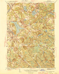 1944 South Groveland1944 Print · USGSThe northern reaches of the Merrimack Valley are captured here during the mid-1940s, a period when the area's many glacial ponds still anchored small village centers. Genealogists and researchers can trace the roads around Lake Cochichewick or locate family sites near South Groveland and the Brooks School.3 unique versions available
 - 1944 Map of Georgetown
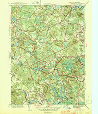 1944 Georgetown1944 Print · USGSCoastal Massachusetts during the mid-forties reveals a landscape of wooded state forests and traditional village centers. Researchers can trace family roots through Harmony Cem, the halls of Dummer Academy, or along the old Boston and Maine rail line.2 unique versions available
 - 1944 Map of Newburyport West
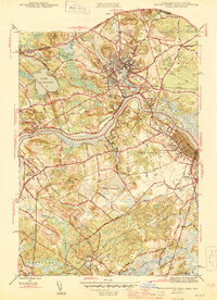 1944 Newburyport West1944 Print · USGSThe Lower Merrimack Valley at the height of the 1940s reveals a landscape of manufacturing towns and riverside villages. Genealogists can trace family footprints across Union Cem, Bridge Street Cem, and the old neighborhoods of Amesbury and Newburyport.3 unique versions available
 - 1948 Map of Boston
 1948 Boston1948 Print · USGSEastern Massachusetts and southern New Hampshire appear at an industrial peak in the late 1940s, just as suburban growth began to accelerate. Genealogists and historians can trace rail lines like the Boston and Albany RR or locate coastal landmarks like Graves Lighthouse and Fort Devens.2 unique versions available
 - 1952 Map of Haverhill, 1953 Print
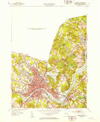 1952 Haverhill1953 Print · USGSHaverhill and the Merrimack River valley are captured in the early fifties, showing a thriving industrial city and its surrounding hill country. Genealogists can locate family names and sites across Bradford Junior College, Whittier Birthplace, and several local schools.2 unique versions available
Showing maps 1-25 of 70
Top cities near Groveland
- Lawrence historical maps
- Haverhill historical maps
- Peabody historical maps
- Methuen historical maps
- Salem historical maps
- Beverly historical maps
See more
Top neighborhoods of Groveland
Frequently asked questions
- What are the different types of historical maps available for Groveland?
- What is the oldest map of Groveland?
- Where can I purchase historical maps of Groveland for my home or office?
- Where can I download high-res historical maps of Groveland?
- Are there historical topographic maps available for Groveland?
- Is there historical aerial imagery available for Groveland?
- Where are historical maps of Groveland sourced from?