2020s Maps of Conway, Massachusetts
Explore 8 historic maps of Conway from the 2020s. These maps offer a rare glimpse into what life looked like during the 2020s — showing old roads, neighborhoods, homes, and landmarks that have changed or disappeared over time.
Whether you're researching your family's past, planning a metal detecting trip, or studying how Conway's landscape evolved across the 2020s, these high-resolution maps are a powerful tool for exploring the history of this region.
- Focus on a specific era: All maps on this page are from the 2020s, giving you a focused view of this time period.
- See what’s changed: Compare century-old streets, trails, and buildings to today's modern landscape using overlays and satellite layers.
- Research with precision: Use these maps for genealogy, historical research, land use analysis, or educational projects.
- View, download, or print: Maps are fully viewable online in high resolution, and can be downloaded or printed for your own records.
Start exploring Conway's history through authentic maps from the 2020s. This is your window into the past.
Conway, MA maps
(8)- 2021 Map of Ashfield, 2021 Print
 2021 Ashfield2021 Print · USGSCovers Conway, including Buckland, Ashfield, and other nearby areas
 - 2021 Map of Williamsburg, 2021 Print
 2021 Williamsburg2021 Print · USGSCovers Conway, including Northampton, Deerfield, and other nearby areas
 - 2021 Map of Shelburne Falls, 2021 Print
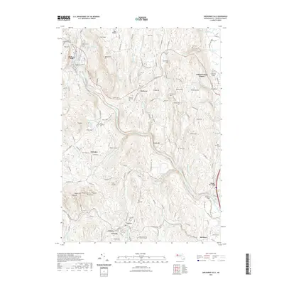 2021 Shelburne Falls2021 Print · USGSCovers Conway, including Greenfield, Deerfield, and other nearby areas
 - 2021 Map of Goshen, 2021 Print
 2021 Goshen2021 Print · USGSCovers Conway, including Williamsburg, Ashfield, and other nearby areas
 - 2024 Map of Goshen, 2024 Print
 2024 Goshen2024 Print · USGSHampshire County hill towns are documented here in the early twenty-first century, showcasing the terrain around Goshen and Chesterfield. Genealogists and historians can trace family plots at Goshen Cem or locate old crossing points along the WESTFIELD WILD AND SCENIC RIVER.
 - 2024 Map of Ashfield, 2024 Print
 2024 Ashfield2024 Print · USGSFranklin County's upland villages and winding river valleys are captured here in the contemporary era. Genealogists and local historians can trace family locations through numerous rural burial sites like Spruce Corner Cem and historic hamlets such as Dodge Corner.
 - 2024 Map of Williamsburg, 2024 Print
 2024 Williamsburg2024 Print · USGSThe hill towns of the Franklin and Hampshire county border are seen here in their modern context, where historic industry meets new recreation. Genealogists can trace family names through sites like Cricket Hill Cem, High Street School, and the Brass Millpond.
 - 2024 Map of Shelburne Falls, 2024 Print
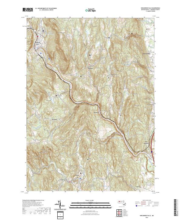 2024 Shelburne Falls2024 Print · USGSShelburne Falls and the Deerfield River valley are shown in comprehensive modern detail as they appear today. Researchers can trace historic family lineages through local burial sites like Howland Cem and North Shire Cem or explore the settlements of Bardwell and Burkville.
End of results
Showing maps 1-8 of 8
Top cities near Conway
- Amherst historical maps
- Northampton historical maps
- Greenfield historical maps
- South Hadley historical maps
- Easthampton historical maps
- Montague historical maps
See more
Top neighborhoods of Conway
Frequently asked questions
- What are the different types of historical maps available for Conway?
- What is the oldest map of Conway?
- Where can I purchase historical maps of Conway for my home or office?
- Where can I download high-res historical maps of Conway?
- Are there historical topographic maps available for Conway?
- Is there historical aerial imagery available for Conway?
- Where are historical maps of Conway sourced from?