Old Maps of Ware, Massachusetts
Explore 43 old maps of Ware, spanning from 1887 to today. These high-resolution historic maps reveal how streets, neighborhoods, landmarks, and natural features evolved over time — perfect for genealogy, metal detecting, research, and local history exploration.
What you can do with these maps:
- See how Ware changed over time: Compare historical maps to modern-day views to trace roads, homesites, rail lines & more.
- View detailed metadata: Each map includes creators, publishers, year, scale, and archive source.
- Overlay maps with satellite & LiDAR: Visualize the past alongside modern tools to explore terrain & human change.
- Trusted historical sources: Maps sourced from the USGS, Library of Congress, and other archives.
- Access maps your way: View online, download high-res files, or order prints for personal or research use.
Start exploring old maps of Ware to uncover forgotten places, hidden landmarks, and the deep history beneath your feet.
Ware, MA maps
(43)- 1887 Map of Brookfield
 1887 Brookfield1887 Print · USGSCovers Ware, including Southbridge, Charlton, and other nearby areas
 - 1887 Map of Palmer
 1887 Palmer1887 Print · USGSCovers Ware, including Springfield, Ludlow, and other nearby areas
 - 1887 Map of Belchertown
 1887 Belchertown1887 Print · USGSCovers Ware, including Amherst, Belchertown, and other nearby areas
 - 1887 Map of Barre
 1887 Barre1887 Print · USGSCovers Ware, including Spencer, Rutland, and other nearby areas
 - 1889 Map of Palmer
 1889 Palmer1889 Print · USGSCovers Ware, including Springfield, Ludlow, and other nearby areas
 - 1889 Map of Barre
 1889 Barre1889 Print · USGSCovers Ware, including Spencer, Rutland, and other nearby areas
 - 1890 Map of Belchertown
 1890 Belchertown1890 Print · USGSCovers Ware, including Amherst, Belchertown, and other nearby areas
 - 1890 Map of Brookfield
 1890 Brookfield1890 Print · USGSCovers Ware, including Southbridge, Charlton, and other nearby areas
 - 1893 Map of Palmer
 1893 Palmer1893 Print · USGSCovers Ware, including Springfield, Ludlow, and other nearby areas9 unique versions available
 - 1893 Map of Belchertown
 1893 Belchertown1893 Print · USGSCovers Ware, including Amherst, Belchertown, and other nearby areas8 unique versions available
 - 1893 Map of Brookfield
 1893 Brookfield1893 Print · USGSCovers Ware, including Southbridge, Charlton, and other nearby areas7 unique versions available
 - 1894 Map of Barre
 1894 Barre1894 Print · USGSCovers Ware, including Spencer, Rutland, and other nearby areas7 unique versions available
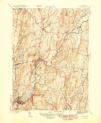
 - 1908 Map of Ware
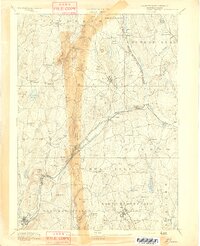
 1908 Ware1908 Print · USGSCovers Ware, including Springfield, Amherst, and other nearby areas2 unique versions available
 - 1915 Map of Brookfield
 1915 Brookfield1915 Print · USGSCovers Ware, including Southbridge, Charlton, and other nearby areas
 - 1919 Map of Palmer
 1919 Palmer1919 Print · USGSCovers Ware, including Springfield, Ludlow, and other nearby areas
 - 1921 Map of Brookfield
 1921 Brookfield1921 Print · USGSCovers Ware, including Southbridge, Charlton, and other nearby areas
 - 1942 Map of Ware
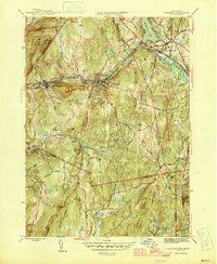
 1942 Ware1942 Print · USGSCovers Ware, including Springfield, Amherst, and other nearby areas
 - 1943 Map of Brookfield
 1943 Brookfield1943 Print · USGSCovers Ware, including Southbridge, Charlton, and other nearby areas
 - 1944 Map of Winsor Dam
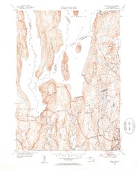
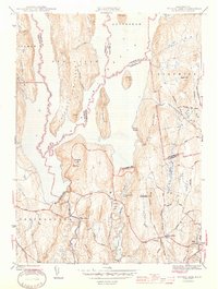 1944 Winsor Dam1944 Print · USGSCovers Ware, including Belchertown, Hardwick, and other nearby areas3 unique versions available
 - 1946 Map of Palmer
 1946 Palmer1946 Print · USGSCovers Ware, including Belchertown, Palmer, and other nearby areas4 unique versions available
 - 1946 Map of Warren
 1946 Warren1946 Print · USGSCovers Ware, including Palmer, Sturbridge, and other nearby areas3 unique versions available
 - 1946 Map of Ware
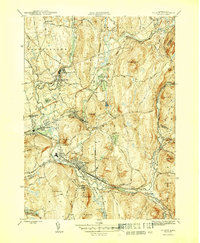
 1946 Ware1946 Print · USGSCovers Ware, including Barre, Warren, and other nearby areas2 unique versions available
 - 1947 Map of Palmer
 1947 Palmer1947 Print · USGSCovers Ware, including Belchertown, Palmer, and other nearby areas
 - 1948 Map of Albany, 1951 Print
 1948 Albany1951 Print · USGSCovers Ware, including Springfield, Albany, and other nearby areas
 - 1952 Map of Winsor Dam, 1953 Print
 1952 Winsor Dam1953 Print · USGSCovers Ware, including Belchertown, Hardwick, and other nearby areas4 unique versions available
Showing maps 1-25 of 43
Top cities near Ware
- Springfield historical maps
- Amherst historical maps
- Ludlow historical maps
- Southbridge historical maps
- East Longmeadow historical maps
- Wilbraham historical maps
See more
Top neighborhoods of Ware
- Gibbs Crossing historical maps
- Ware Center historical maps
- West Ware historical maps
- Ware Millyard Historic District historical maps
- Church Street Historic District historical maps
- Ware Center Historic District historical maps
Frequently asked questions
- What are the different types of historical maps available for Ware?
- What is the oldest map of Ware?
- Where can I purchase historical maps of Ware for my home or office?
- Where can I download high-res historical maps of Ware?
- Are there historical topographic maps available for Ware?
- Is there historical aerial imagery available for Ware?
- Where are historical maps of Ware sourced from?