Old Maps of Harvard Yard, Cambridge for Hiking & Exploration
Hike through history with 23 historic maps of Harvard Yard. Explore old trails, ghost towns, and forgotten backroads — perfect for outdoor adventurers and local explorers.
- Rediscover forgotten places: Map out old mining camps, roads, and footpaths that no longer exist on modern maps.
- Layer with modern tools: Combine with LiDAR or satellite views to plan hikes through historical terrain.
- Made for exploration: Popular among hikers, overlanders, and local history lovers.
Use these maps to find adventure and explore the hidden past of Harvard Yard.
Harvard Yard, Cambridge maps
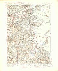
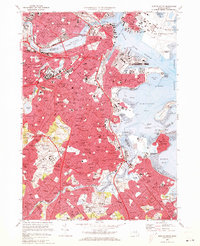
(23)- 1893 Map of Boston
 1893 Boston1893 Print · USGSCovers Harvard Yard, including Boston, Cambridge, and other nearby areas4 unique versions available
 - 1903 Map of Boston
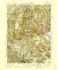
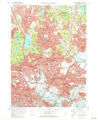
 1903 Boston1903 Print · USGSCovers Harvard Yard, including Boston, Cambridge, and other nearby areas14 unique versions available
 - 1943 Map of Boston
 1943 Boston1943 Print · USGSCovers Harvard Yard, including Boston, Cambridge, and other nearby areas
 - 1943 Map of Boston North
 1943 Boston North1943 Print · USGSCovers Harvard Yard, including Boston, Cambridge, and other nearby areas
 - 1944 Map of Boston South
 1944 Boston South1944 Print · USGSCovers Harvard Yard, including Boston, Cambridge, and other nearby areas
 - 1946 Map of Boston South
 1946 Boston South1946 Print · USGSCovers Harvard Yard, including Boston, Cambridge, and other nearby areas3 unique versions available
 - 1946 Map of Boston North
 1946 Boston North1946 Print · USGSCovers Harvard Yard, including Boston, Cambridge, and other nearby areas2 unique versions available
 - 1948 Map of Boston
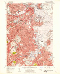
 1948 Boston1948 Print · USGSCovers Harvard Yard, including Boston, Worcester, and other nearby areas2 unique versions available
 - 1949 Map of Boston North, 1957 Print
 1949 Boston North1957 Print · USGSCovers Harvard Yard, including Boston, Cambridge, and other nearby areas
 - 1954 Map of Boston South
 1954 Boston South1954 Print · USGSCovers Harvard Yard, including Boston, Cambridge, and other nearby areas
 - 1956 Map of Boston South, 1958 Print
 1956 Boston South1958 Print · USGSCovers Harvard Yard, including Boston, Cambridge, and other nearby areas3 unique versions available
 - 1956 Map of Boston North, 1958 Print
 1956 Boston North1958 Print · USGSCovers Harvard Yard, including Boston, Cambridge, and other nearby areas3 unique versions available
 - 1956 Map of Boston, 1967 Print
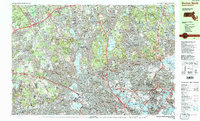
 1956 Boston1967 Print · USGSCovers Harvard Yard, including Boston, Worcester, and other nearby areas6 unique versions available
 - 1958 Map of Boston
 1958 Boston1958 Print · USGSCovers Harvard Yard, including Boston, Worcester, and other nearby areas2 unique versions available
 - 1961 Map of Boston
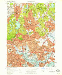
 1961 Boston1961 Print · USGSCovers Harvard Yard, including Boston, Worcester, and other nearby areas2 unique versions available
 - 1970 Map of Boston South, 1973 Print
 1970 Boston South1973 Print · USGSCovers Harvard Yard, including Boston, Cambridge, and other nearby areas2 unique versions available
 - 1971 Map of Boston North, 1973 Print
 1971 Boston North1973 Print · USGSCovers Harvard Yard, including Boston, Cambridge, and other nearby areas2 unique versions available
 - 1977 Map of Boston South, 1980 Print
 1977 Boston South1980 Print · USGSCovers Harvard Yard, including Boston, Cambridge, and other nearby areas
 - 1977 Map of Boston North, 1980 Print
 1977 Boston North1980 Print · USGSCovers Harvard Yard, including Boston, Cambridge, and other nearby areas
 - 1985 Map of Boston, 1986 Print
 1985 Boston1986 Print · USGSCovers Harvard Yard, including Boston, Worcester, and other nearby areas
 - 1985 Map of Boston North, 1986 Print
 1985 Boston North1986 Print · USGSCovers Harvard Yard, including Boston, Cambridge, and other nearby areas3 unique versions available
 - 1987 Map of Boston South
 1987 Boston South1987 Print · USGSCovers Harvard Yard, including Boston, Cambridge, and other nearby areas2 unique versions available
 - 1989 Map of Boston
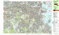
 1989 Boston1989 Print · USGSCovers Harvard Yard, including Boston, Worcester, and other nearby areas2 unique versions available
End of results
Showing maps 1-23 of 23
Frequently asked questions
- What are the different types of historical maps available for Harvard Yard?
- What is the oldest map of Harvard Yard?
- Where can I purchase historical maps of Harvard Yard for my home or office?
- Where can I download high-res historical maps of Harvard Yard?
- Are there historical topographic maps available for Harvard Yard?
- Is there historical aerial imagery available for Harvard Yard?
- Where are historical maps of Harvard Yard sourced from?