Old Maps of Littleton, Massachusetts
Explore 37 old maps of Littleton, spanning from 1886 to today. These high-resolution historic maps reveal how streets, neighborhoods, landmarks, and natural features evolved over time — perfect for genealogy, metal detecting, research, and local history exploration.
What you can do with these maps:
- See how Littleton changed over time: Compare historical maps to modern-day views to trace roads, homesites, rail lines & more.
- View detailed metadata: Each map includes creators, publishers, year, scale, and archive source.
- Overlay maps with satellite & LiDAR: Visualize the past alongside modern tools to explore terrain & human change.
- Trusted historical sources: Maps sourced from the USGS, Library of Congress, and other archives.
- Access maps your way: View online, download high-res files, or order prints for personal or research use.
Start exploring old maps of Littleton to uncover forgotten places, hidden landmarks, and the deep history beneath your feet.
Littleton, MA maps
(37)- 1886 Map of Lowell
 1886 Lowell1886 Print · USGSThe industrial heart of the Merrimack Valley is captured here in the late nineteenth century, showing the expansion of textile hubs and rail networks. Genealogists and historians can trace family-named hills and early transit stops like Bedford Springs Station, Forge Village, and the Hudson Poor Farm.
 - 1893 Map of Lowell
 1893 Lowell1893 Print · USGSThe Merrimack Valley’s industrial and rail landscape comes alive in the late nineteenth century, centering on the growing city of Lowell. Genealogists and historians can trace old property lines across Pelham, locate the Flat Rock Quarry, or follow the routes of the Stony Brook Railroad through Graniteville.9 unique versions available
 - 1893 Map of Groton, 1905 Print
 1893 Groton1905 Print · USGSNorthern Massachusetts and the New Hampshire borderlands are shown here in the late nineteenth century as a hub of river industry and rail commerce. Researchers can trace historic sites like Shaker Village, the Groton School, and manufacturing hubs at Paper Mill Village.8 unique versions available
 - 1918 Map of Lowell
 1918 Lowell1918 Print · USGSGreater Lowell and the Merrimack Valley are shown at their industrial peak during the First World War. Genealogists can trace family connections to mill-town life in Middlesex Village or locate rural landmarks like Flat Rock Quarry and the Old Middlesex Canal.
 - 1921 Map of Lowell
 1921 Lowell1921 Print · USGSThe industrial corridor of the Merrimack Valley is captured here during the early twentieth century, showing the dense urban grid of Lowell alongside rural Middlesex County. Researchers can trace the extensive reach of the Boston and Maine Railroad and locate local landmarks like the Poor Farm or Flat Rock Quarry.
 - 1935 Map of Ayer
 1935 Ayer1935 Print · USGSThe intersection of Middlesex and Worcester counties in the mid-1930s reveals a landscape of military bases, historic academies, and industrial ponds. Researchers can trace the layout of Fort Devens, the grounds of the Groton School, and the unique settlement at Shaker Village.
 - 1935 Map of Groton
 1935 Groton1935 Print · USGSCrossing the New Hampshire border in the 1930s, this area was a bustling hub of rail transport and riverside industry. Researchers can trace the legacy of communal life at Shaker Village, locate the campus of Groton School, or follow the lines of the Boston and Maine RR through towns like Pepperell and Shirley.
 - 1935 Map of Lowell
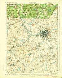 1935 Lowell1935 Print · USGSGreater Lowell and the Merrimack Valley are captured in the mid-1930s, showing a region defined by its industrial riverfront and extensive rail networks. Researchers can trace historic neighborhoods like Wamesit, local landmarks like St Marie Convent, and early industry at Flat Rock Quarry.3 unique versions available
 - 1936 Map of Groton
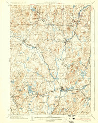 1936 Groton1936 Print · USGSNorthern Middlesex County and southern New Hampshire appear here in the mid-1930s, showing a landscape shaped by river power and a dense rail network. Researchers can trace historic sites like the Shaker Village and Groton School, or locate old depots at Townsend Harbor and Ayer.3 unique versions available
 - 1939 Map of Ayer
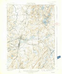 1939 Ayer1939 Print · USGSMiddlesex County in the late 1930s is a hub of military activity and historic settlements at the crossroads of the rail. Trace ancestral roots at Shaker Village, Pingryville, or the expansive grounds of Fort Devens.6 unique versions available
 - 1940 Map of Westford
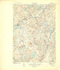 1940 Westford1940 Print · USGSWestford and Littleton appear at the outbreak of World War II as a network of rail-side mill villages and family-held hills. Genealogists can trace old cemeteries like Westlawn Cem, rural depots at Westford Sta, and the layout of Littleton Common.
 - 1941 Map of Westford
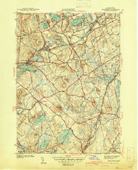 1941 Westford1941 Print · USGSMiddlesex County in the late 1930s shows a landscape of industrious mill villages and hilltop farms connected by the Boston and Maine line. Trace the rail routes through Graniteville, locate the grounds of Westlawn Cem, or explore the shores of Forge Pond.2 unique versions available
 - 1943 Map of Lowell
 1943 Lowell1943 Print · USGSCentral New England industrial hubs and rural borderlands are mapped here during the early 1940s. Genealogists can trace family names across Mt Misery, Barrett Hill, and small settlements like Collinsville or North Pelham.
 - 1943 Map of Fitchburg
 1943 Fitchburg1943 Print · USGSSouthern New Hampshire and northern Massachusetts are captured during the war years, showing a landscape of river-powered mill towns and mountain trails. You can trace family roots in Peterboro, locate the historic Groton School, or study the rail lines of the Boston & Maine RR.
 - 1946 Map of Westford
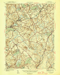 1946 Westford1946 Print · USGSMiddlesex County in the mid-1940s shows a landscape of busy rail corridors and established villages. Researchers can trace historic family names and sites like Fairview Cem, the Clay Pit, and rail stops at Westford Sta or Carlisle Sta.2 unique versions available
 - 1948 Map of Boston
 1948 Boston1948 Print · USGSEastern Massachusetts and southern New Hampshire appear at an industrial peak in the late 1940s, just as suburban growth began to accelerate. Genealogists and historians can trace rail lines like the Boston and Albany RR or locate coastal landmarks like Graves Lighthouse and Fort Devens.2 unique versions available
 - 1950 Map of Westford, 1952 Print
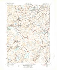 1950 Westford1952 Print · USGSMiddlesex County in the early fifties shows a region defined by its rail heritage and historic village centers. Trace old family lines through Graniteville, Forge Village, and Littleton Common, or locate ancestral burial sites at Russian Cem and Nutting Cem.4 unique versions available
 - 1950 Map of Ayer, 1958 Print
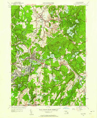 1950 Ayer1958 Print · USGSMiddlesex and Worcester counties are shown here at mid-century, highlighting the massive expansion of the Fort Devens military footprint. Researchers can trace the layout of Shaker Village, find the Harvard University Observatory, and locate the Groton School.
 - 1956 Map of Boston, 1967 Print
 1956 Boston1967 Print · USGSThe Massachusetts coastline and industrial interior are seen here during the mid-century peak of suburban and highway expansion. Researchers can trace historic harbor defenses like Fort Revere, local landmarks such as Faneuil Hall, and the vast Parker River National Wildlife Refuge.6 unique versions available
 - 1958 Map of Boston
 1958 Boston1958 Print · USGSEastern Massachusetts and southern New Hampshire are shown at the height of the industrial era, before the full expansion of the interstate system. Trace coastal defenses at Fort Warren, historic rail lines like the Boston and Maine, and the development of the Mass. 128 corridor.2 unique versions available
 - 1961 Map of Boston
 1961 Boston1961 Print · USGSThe Massachusetts coastline and its industrial interior are detailed here in the mid-twentieth century, from the Monadnock highlands to Cape Cod. Researchers can trace the rail routes of the Boston and Maine or locate landmarks like Fort Devens and the Wachusett Reservoir.2 unique versions available
 - 1966 Map of Ayer, 1968 Print
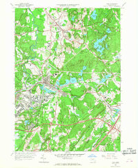 1966 Ayer1968 Print · USGSMiddlesex County in the mid-sixties reveals a landscape of massive military installations and storied academic institutions. Researchers can locate Shaker Village, trace the Boston and Maine rail lines, and find landmarks like the Harvard University Observatory.3 unique versions available
 - 1966 Map of Westford, 1969 Print
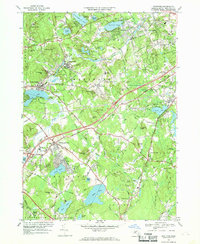 1966 Westford1969 Print · USGSMiddlesex County in the mid-1960s shows a landscape of rail-side industrial villages and expanding school campuses. Genealogists and historians can trace sites like Russian Cem, the Westford Academy, and the old depot at Brookside Station.2 unique versions available
 - 1984 Map of Lowell
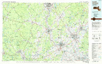 1984 Lowell1984 Print · USGSThe Merrimack Valley industrial corridor is captured here in the mid-eighties, showing the interconnected growth of Lowell, Nashua, and Lawrence. Genealogists and historians can trace the paths of the Boston and Maine railroad or locate institutional landmarks like Merrimack College and the Fort Devens Military Reservation.
 - 1987 Map of Billerica
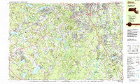 1987 Billerica1987 Print · USGSMiddlesex County in the late eighties shows a landscape of historic village centers and expanding suburban corridors. Genealogists and historians can trace lineage and local development through sites like Forefathers Burying Ground, Edson Cem, and the old rail stops at Forge Village and Nabnasset.
Showing maps 1-25 of 37
Top cities near Littleton
- Lowell historical maps
- Nashua historical maps
- Newton historical maps
- Framingham historical maps
- Waltham historical maps
- Leominster historical maps
See more
Top neighborhoods of Littleton
Frequently asked questions
- What are the different types of historical maps available for Littleton?
- What is the oldest map of Littleton?
- Where can I purchase historical maps of Littleton for my home or office?
- Where can I download high-res historical maps of Littleton?
- Are there historical topographic maps available for Littleton?
- Is there historical aerial imagery available for Littleton?
- Where are historical maps of Littleton sourced from?