Old Maps of Holden, Massachusetts
Explore 57 old maps of Holden, spanning from 1885 to today. These high-resolution historic maps reveal how streets, neighborhoods, landmarks, and natural features evolved over time — perfect for genealogy, metal detecting, research, and local history exploration.
What you can do with these maps:
- See how Holden changed over time: Compare historical maps to modern-day views to trace roads, homesites, rail lines & more.
- View detailed metadata: Each map includes creators, publishers, year, scale, and archive source.
- Overlay maps with satellite & LiDAR: Visualize the past alongside modern tools to explore terrain & human change.
- Trusted historical sources: Maps sourced from the USGS, Library of Congress, and other archives.
- Access maps your way: View online, download high-res files, or order prints for personal or research use.
Start exploring old maps of Holden to uncover forgotten places, hidden landmarks, and the deep history beneath your feet.
Holden, MA maps
(57)- 1885 Map of Worcester
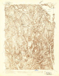
 1885 Worcester1885 Print · USGSWorcester and its surrounding mill towns are captured here in the late nineteenth century during a peak era of rail expansion and industrial growth. Researchers can trace ancestral roots through specific local hubs like Wire Village, the Sterling Camp Grounds, and the grounds of the State Lunatic Hospital.
 - 1886 Map of Worcester
 1886 Worcester1886 Print · USGSWorcester and its surrounding hill towns are captured here in the mid-1880s, revealing a landscape of early industrial hamlets and expanding rail lines. Genealogists and local historians can trace the foundations of the State Lunatic Hospital or locate historic settlements like Quinapoxet Village and Wire Village.
 - 1892 Map of Worcester
 1892 Worcester1892 Print · USGSWorcester and its northern hill towns are captured here in the late nineteenth century before the expansion of modern reservoirs. Researchers can trace the early rail networks through Sterling Junction or locate landmarks like the State Lunatic Hospital and Wire Village.10 unique versions available
 - 1908 Map of Quinsigamond
 1908 Quinsigamond1908 Print · USGSCentral Massachusetts and its bordering states are seen here in the early twentieth century as industry and transit reshaped the Blackstone Valley. Genealogists and historians can trace the early footprints of Worcester, the expansion of the Wachusett Reservoir, and rail lines like the Boston and Albany Railroad.3 unique versions available
 - 1934 Map of Worcester
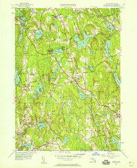
 1934 Worcester1934 Print · USGSMid-depression Worcester and Holden emerge as a dense network of industrial ponds, institutions, and rail lines. Genealogists can trace family connections through the Grove Cem, numerous local schools like Chaffin Sch, and the neighborhoods around Union Sta.
 - 1937 Map of Paxton
 1937 Paxton1937 Print · USGSWorcester County's upland terrain is captured here in the late 1930s, featuring a landscape of hill-top settlements and industrial hamlets. Genealogists and historians can trace the foundations of Upper Wire Village, locate the Veterans Hospital, or explore the shores of Lake Whittemore.
 - 1939 Map of Wachusett Mtn
 1939 Wachusett Mtn1939 Print · USGSWorcester County is captured here in the late 1930s, showing the intersection of new state infrastructure and historic rail villages. Researchers can trace family sites at Woodlawn Cem or follow the engineering of the Quabbin Aqueduct near Hubbardston Sta.
 - 1939 Map of Worcester North
 1939 Worcester North1939 Print · USGSThe Worcester hills and reservoirs appear in detail during the late 1930s, documenting a landscape of expanding educational institutions and civic infrastructure. Genealogists and historians can trace Assumption College, Grove Cem, and the old City Farm near Morningdale.5 unique versions available
 - 1940 Map of Wachusett Mtn
 1940 Wachusett Mtn1940 Print · USGSCentral Massachusetts hill country and valley settlements are captured here just before the 1940s. Genealogists and historians can trace the Boston and Maine Railroad lines and locate the State Sanatorium or Rural Glen Cem.2 unique versions available
 - 1940 Map of Sterling
 1940 Sterling1940 Print · USGSWorcester County communities like Oakdale and Sterling appear just before the mid-century, defined by the expansion of the regional water supply. Researchers can trace the path of the Quabbin Aqueduct or locate family landmarks like the Sterling Camp Grounds and Legge Cem.2 unique versions available
 - 1941 Map of Paxton
 1941 Paxton1941 Print · USGSPaxton and the high country of Worcester County are captured here in the early 1940s, showing a region of reservoirs and rural industry. Genealogists can locate family landmarks at Tafts Corner or trace the early industrial sites of Upper Wire Village.3 unique versions available
 - 1942 Map of Sterling
 1942 Sterling1942 Print · USGSNorthern Worcester County is shown here in the early 1940s during the development of major water infrastructure. Local historians can trace the Quagbin Aqueduct, see the Sterling Camp Grounds, and locate family burial sites like Legge Cem.
 - 1942 Map of Wachusett Mtn.
 1942 Wachusett Mtn.1942 Print · USGSThe Worcester County highlands appear in the late 1930s as a landscape of mountain trails, sanatoriums, and rail corridors. You can trace the Boston and Maine Railroad past Princeton Sta or locate the aqueduct shafts and cemeteries like Woodlawn Cem.2 unique versions available
 - 1943 Map of Quinsigamond
 1943 Quinsigamond1943 Print · USGSCentral Massachusetts and its bordering states appear here during the Second World War as a powerhouse of rail infrastructure and public institutions. Researchers can trace the legacy of the region through landmarks like Grafton State Hospital, the Wachusett Reservoir, and the deep industrial roots of the Blackstone River.
 - 1946 Map of Sterling
 1946 Sterling1946 Print · USGSSterling and its neighboring towns appear here in the mid-1940s, showcasing a landscape of glacial ponds, family farms, and critical water infrastructure. You can trace the path of the Boston and Maine RR or locate landmarks like the Worcester County Training School and West Sterling Cem.2 unique versions available
 - 1946 Map of Wachusett Mtn
 1946 Wachusett Mtn1946 Print · USGSWorcester County's highland terrain is captured here in the years following the war, showing the industrial waterworks and sanatoriums of the era. Genealogists and local historians can trace the Boston and Maine Railroad lines and locate Rural Glen Cem or the Central New England Sanitorium.3 unique versions available
 - 1948 Map of Boston
 1948 Boston1948 Print · USGSEastern Massachusetts and southern New Hampshire appear at an industrial peak in the late 1940s, just as suburban growth began to accelerate. Genealogists and historians can trace rail lines like the Boston and Albany RR or locate coastal landmarks like Graves Lighthouse and Fort Devens.2 unique versions available
 - 1948 Map of Worcester North, 1958 Print
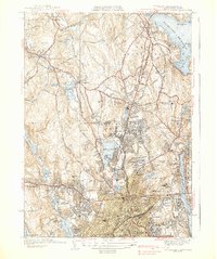
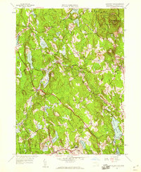
 1948 Worcester North1958 Print · USGSMid-century Worcester and Holden are shown during a period of significant institutional expansion. Researchers can trace the development of Assumption College, locate the Rural Cem, and follow the path of the Boston and Maine Railroad.
 - 1950 Map of Sterling, 1952 Print
 1950 Sterling1952 Print · USGSThe Sterling area in the early fifties shows a landscape shaped by the Wachusett Reservoir and the Boston and Maine Railroad. Trace family history at Legge Cem, visit the Sterling Camp Grounds, or locate the Butterick Sch.4 unique versions available
 - 1950 Map of Paxton, 1958 Print
 1950 Paxton1958 Print · USGSThe hill country of central Massachusetts is revealed here at mid-century, featuring the intersection of industrial villages and municipal water systems. Genealogists and historians can locate legacy sites like Upper Wire Village, the State Sanitorium, and Quaker Cem.2 unique versions available
 - 1956 Map of Wachusett Mtn, 1959 Print
 1956 Wachusett Mtn1959 Print · USGSThe foothills of Worcester County are shown in the late 1950s, a time when sanatoriums and rail depots still defined the local character. Researchers can locate long-standing landmarks like the Rutland State Sanatorium, Hubbardston Sta, and Goose Hill Cem.2 unique versions available
 - 1956 Map of Boston, 1967 Print
 1956 Boston1967 Print · USGSThe Massachusetts coastline and industrial interior are seen here during the mid-century peak of suburban and highway expansion. Researchers can trace historic harbor defenses like Fort Revere, local landmarks such as Faneuil Hall, and the vast Parker River National Wildlife Refuge.6 unique versions available
 - 1958 Map of Boston
 1958 Boston1958 Print · USGSEastern Massachusetts and southern New Hampshire are shown at the height of the industrial era, before the full expansion of the interstate system. Trace coastal defenses at Fort Warren, historic rail lines like the Boston and Maine, and the development of the Mass. 128 corridor.2 unique versions available
 - 1960 Map of Worcester North, 1962 Print
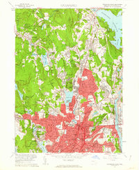 1960 Worcester North1962 Print · USGSMid-century Worcester and Holden appear here as a landscape of dense neighborhoods, academic institutions, and growing infrastructure. Genealogists and historians can trace family locations near the Rural Cemetery or locate old industrial nodes like Canada Mills and Chaffinville.2 unique versions available
 - 1961 Map of Boston
 1961 Boston1961 Print · USGSThe Massachusetts coastline and its industrial interior are detailed here in the mid-twentieth century, from the Monadnock highlands to Cape Cod. Researchers can trace the rail routes of the Boston and Maine or locate landmarks like Fort Devens and the Wachusett Reservoir.2 unique versions available
Showing maps 1-25 of 57
Top cities near Holden
- Worcester historical maps
- Leominster historical maps
- Fitchburg historical maps
- Shrewsbury historical maps
- Gardner historical maps
- Westborough historical maps
See more
Top neighborhoods of Holden
- Lovellville historical maps
- Unionville historical maps
- Camp Kinneywood historical maps
- Dawson historical maps
- Jefferson historical maps
- Ruralville historical maps
See more
Frequently asked questions
- What are the different types of historical maps available for Holden?
- What is the oldest map of Holden?
- Where can I purchase historical maps of Holden for my home or office?
- Where can I download high-res historical maps of Holden?
- Are there historical topographic maps available for Holden?
- Is there historical aerial imagery available for Holden?
- Where are historical maps of Holden sourced from?