Old Maps of Old Centre Historic District, Winchendon for Hiking & Exploration
Hike through history with 18 historic maps of Old Centre Historic District. Explore old trails, ghost towns, and forgotten backroads — perfect for outdoor adventurers and local explorers.
- Rediscover forgotten places: Map out old mining camps, roads, and footpaths that no longer exist on modern maps.
- Layer with modern tools: Combine with LiDAR or satellite views to plan hikes through historical terrain.
- Made for exploration: Popular among hikers, overlanders, and local history lovers.
Use these maps to find adventure and explore the hidden past of Old Centre Historic District.
Old Centre Historic District, Winchendon maps
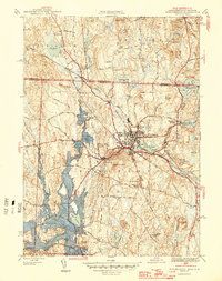
(18)- 1887 Map of Winchendon
 1887 Winchendon1887 Print · USGSCovers Old Centre Historic District, including Gardner, Athol, and other nearby areas
 - 1890 Map of Winchendon
 1890 Winchendon1890 Print · USGSCovers Old Centre Historic District, including Gardner, Athol, and other nearby areas
 - 1894 Map of Winchendon
 1894 Winchendon1894 Print · USGSCovers Old Centre Historic District, including Gardner, Athol, and other nearby areas6 unique versions available
 - 1932 Map of Winchendon
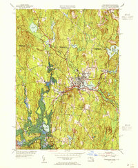
 1932 Winchendon1932 Print · USGSCovers Old Centre Historic District, including Athol, Winchendon, and other nearby areas
 - 1935 Map of Winchendon
 1935 Winchendon1935 Print · USGSCovers Old Centre Historic District, including Gardner, Athol, and other nearby areas4 unique versions available
 - 1942 Map of Keene
 1942 Keene1942 Print · USGSCovers Old Centre Historic District, including Keene, Gardner, and other nearby areas
 - 1946 Map of Winchendon
 1946 Winchendon1946 Print · USGSCovers Old Centre Historic District, including Winchendon, Templeton, and other nearby areas2 unique versions available
 - 1948 Map of Albany, 1951 Print
 1948 Albany1951 Print · USGSCovers Old Centre Historic District, including Springfield, Albany, and other nearby areas
 - 1954 Map of Winchendon, 1955 Print
 1954 Winchendon1955 Print · USGSCovers Old Centre Historic District, including Winchendon, Templeton, and other nearby areas3 unique versions available
 - 1956 Map of Albany, 1968 Print
 1956 Albany1968 Print · USGSCovers Old Centre Historic District, including Springfield, Albany, and other nearby areas2 unique versions available
 - 1957 Map of Albany
 1957 Albany1957 Print · USGSCovers Old Centre Historic District, including Springfield, Albany, and other nearby areas
 - 1959 Map of Albany
 1959 Albany1959 Print · USGSCovers Old Centre Historic District, including Springfield, Albany, and other nearby areas
 - 1962 Map of Albany
 1962 Albany1962 Print · USGSCovers Old Centre Historic District, including Springfield, Albany, and other nearby areas
 - 1971 Map of Winchendon, 1973 Print
 1971 Winchendon1973 Print · USGSCovers Old Centre Historic District, including Winchendon, Templeton, and other nearby areas5 unique versions available
 - 1975 Map of Winchendon, 1981 Print
 1975 Winchendon1981 Print · USGSCovers Old Centre Historic District, including Winchendon, Templeton, and other nearby areas
 - 1986 Map of Keene
 1986 Keene1986 Print · USGSCovers Old Centre Historic District, including Keene, Gardner, and other nearby areas3 unique versions available
 - 1988 Map of Winchendon
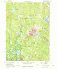
 1988 Winchendon1988 Print · USGSCovers Old Centre Historic District, including Athol, Winchendon, and other nearby areas2 unique versions available
 - 2024 Map of Winchendon, 2024 Print
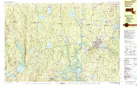
 2024 Winchendon2024 Print · USGSCovers Old Centre Historic District, including Winchendon, Templeton, and other nearby areas
End of results
Showing maps 1-18 of 18
Frequently asked questions
- What are the different types of historical maps available for Old Centre Historic District?
- What is the oldest map of Old Centre Historic District?
- Where can I purchase historical maps of Old Centre Historic District for my home or office?
- Where can I download high-res historical maps of Old Centre Historic District?
- Are there historical topographic maps available for Old Centre Historic District?
- Is there historical aerial imagery available for Old Centre Historic District?
- Where are historical maps of Old Centre Historic District sourced from?