Old Maps of Shingleton, Munising Township for Academic Research
Study the evolution of Shingleton with 13 high-resolution historic maps. Whether you're teaching, researching, or modeling changes in land use, these maps provide essential visual documentation of urban, environmental, and geographic change.
- Analyze long-term change: Track patterns in development, transportation, and natural features.
- Ideal for environmental or urban studies: Support academic projects with primary historical map data.
- Use in the classroom or lab: Educators and researchers rely on these maps to bring historical context to life.
These maps are a powerful tool for teaching, research, and visualizing how Shingleton has changed over the decades.
Shingleton, Munising Township maps
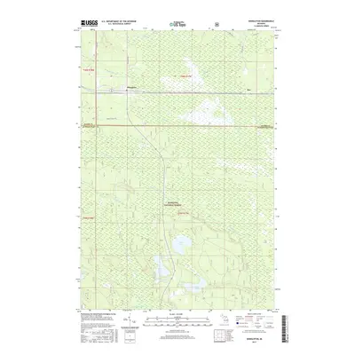
(13)- 1931 Map of Shingleton SW
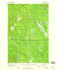
 1931 Shingleton SW1931 Print · USGSThe Upper Peninsula timber and rail landscape at Shingleton comes alive in the early 1930s. Genealogists and historians can trace the intersection of the Duluth South Shore and Atlantic railroad and landmarks like Lilley Lake or Boot Lake.
 - 1958 Map of Shingleton, 1959 Print
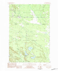
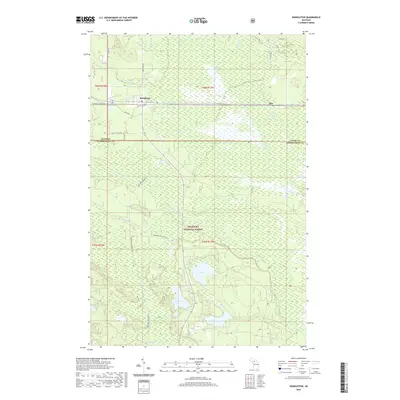
 1958 Shingleton1959 Print · USGSUpper Peninsula timber and rail history come alive in the late fifties across the Alger and Schoolcraft county lines. Trace old transport routes through Shingleton and Creighton, or locate logging era sites like Hartman Camp and the Old Railroad Grade.3 unique versions available
 - 1958 Map of Marquette, 1968 Print
 1958 Marquette1968 Print · USGSThe Upper Peninsula’s central corridor is captured here in the mid-twentieth century as mining and timber industries thrived alongside new military installations. Genealogists and historians can trace the rail lines of the Soo Line Railroad through settlements like Gwinn, Turin, and Chatham.2 unique versions available
 - 1960 Map of Marquette
 1960 Marquette1960 Print · USGSUpper Peninsula mining and maritime commerce reach their peak in the late fifties across the Lake Superior shoreline. Genealogists and historians can locate remote settlements like Big Bay and Dukes, while tracing the Cyr Mine and the active rail lines of the Lake Superior and Ishpeming railroad.
 - 1961 Map of Marquette
 1961 Marquette1961 Print · USGSUpper Peninsula life in the early sixties centered on the iron docks and timber stands of the Lake Superior shore. Genealogists and historians can trace rail-to-port connections via the Lake Superior and Ishpeming Railroad and locate active sites like Republic Mine or the K.I. Sawyer Air Force Base.
 - 1968 Map of Marquette, 1977 Print
 1968 Marquette1977 Print · USGSThe Upper Peninsula iron range and Lake Superior coastline are captured here in the late sixties. Genealogists and historians can trace the rail-to-port infrastructure and the Cold War presence of K I Sawyer Air Force Base alongside towns like Ishpeming and Munising.
 - 1983 Map of Munising
 1983 Munising1983 Print · USGSThe Upper Peninsula lakefront and deep timberlands are documented here in the early eighties, centered on the Munising harbor. Genealogists and historians can trace rail stops along the Soo Line and remote outposts like Shingleton, Eben Junction, and Traunik.2 unique versions available
 - 1983 Map of Shingleton, 1984 Print
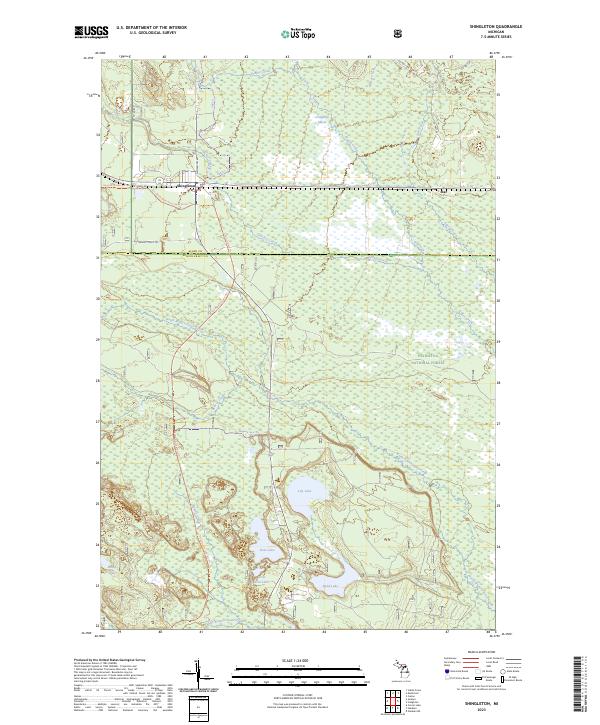
 1983 Shingleton1984 Print · USGSUpper Peninsula timberlands and conservation areas are documented here during the early eighties near the Schoolcraft and Alger county line. Trace the Soo Line railroad through Shingleton or locate the Camp Cusino State Prison and Haywire Grade.
 - 2011 Map of Shingleton, 2011 Print
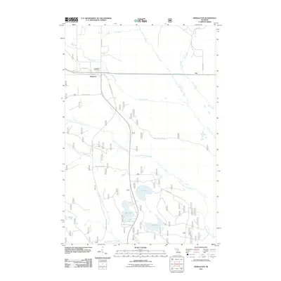 2011 Shingleton2011 Print · USGSCovers Shingleton, including Star, Hiawatha Township, and other nearby areas
 - 2014 Map of Shingleton, 2014 Print
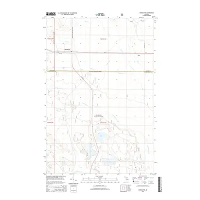 2014 Shingleton2014 Print · USGSCovers Shingleton, including Star, Hiawatha Township, and other nearby areas
 - 2017 Map of Shingleton, 2017 Print
 2017 Shingleton2017 Print · USGSCovers Shingleton, including Star, Hiawatha Township, and other nearby areas
 - 2020 Map of Shingleton, 2020 Print
 2020 Shingleton2020 Print · USGSCovers Shingleton, including Star, Hiawatha Township, and other nearby areas
 - 2023 Map of Shingleton, 2023 Print
 2023 Shingleton2023 Print · USGSUpper Peninsula timberlands and lake basins are captured here in recent years, showing the intersection of local history and recreational trails. Genealogists and outdoor historians can trace the paths of the Haywire State Trl and the Marquette-Manistique Route Trl near the community of Shingleton.
End of results
Showing maps 1-13 of 13
Top cities near Shingleton
Frequently asked questions
- What are the different types of historical maps available for Shingleton?
- What is the oldest map of Shingleton?
- Where can I purchase historical maps of Shingleton for my home or office?
- Where can I download high-res historical maps of Shingleton?
- Are there historical topographic maps available for Shingleton?
- Is there historical aerial imagery available for Shingleton?
- Where are historical maps of Shingleton sourced from?