Old Maps of Overisel Township, Michigan
Explore 37 old maps of Overisel Township, spanning from 1928 to today. These high-resolution historic maps reveal how streets, neighborhoods, landmarks, and natural features evolved over time — perfect for genealogy, metal detecting, research, and local history exploration.
What you can do with these maps:
- See how Overisel Township changed over time: Compare historical maps to modern-day views to trace roads, homesites, rail lines & more.
- View detailed metadata: Each map includes creators, publishers, year, scale, and archive source.
- Overlay maps with satellite & LiDAR: Visualize the past alongside modern tools to explore terrain & human change.
- Trusted historical sources: Maps sourced from the USGS, Library of Congress, and other archives.
- Access maps your way: View online, download high-res files, or order prints for personal or research use.
Start exploring old maps of Overisel Township to uncover forgotten places, hidden landmarks, and the deep history beneath your feet.
Overisel Township, MI maps
(37)- 1928 Map of Fennville, 1955 Print
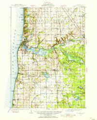 1928 Fennville1955 Print · USGSThe Lake Michigan shoreline and Kalamazoo River delta are captured here in the late 1920s during a peak era of coastal resort development and inland farming. Researchers can locate numerous one-room schoolhouses like Peach Belt Sch and trace the original Pere Marquette rail line through Fennville and New Richmond.4 unique versions available
 - 1929 Map of Holland, 1959 Print
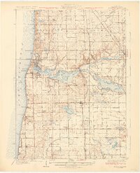
 1929 Holland1959 Print · USGSThe Lake Michigan shoreline and the city of Holland appear here as they were in the late 1920s. Local researchers can trace the historic lakefront developments and rural landmarks including Getz Lakewood Farm, the Waukantanka Lodge, and the Pere Marquette rail lines.2 unique versions available
 - 1931 Map of Fennville
 1931 Fennville1931 Print · USGSCoastal Allegan County was a thriving hub of lakefront tourism and rail-based agriculture in the years before the Great Depression. Genealogists and historians can trace family-named schools like Reid Sch and Loomis Sch, or find the Old Saugatuck Light Ho near the river's bend.4 unique versions available
 - 1932 Map of Holland
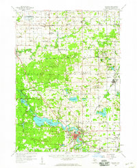
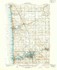 1932 Holland1932 Print · USGSThe Lake Michigan shoreline and the growing city of Holland are captured here in the early 1930s. Trace the lakefront resorts and rural schoolhouses that once dotted the landscape, from Getz Lakewood Farm to the Harderwyk Sch and Noordeloos.2 unique versions available
 - 1958 Map of Allegan, 1959 Print
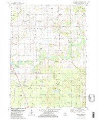
 1958 Allegan1959 Print · USGSAllegan and the surrounding Michigan countryside are captured here in the late fifties, showcasing a landscape of river-fed industry and deep-wooded preserves. Genealogists can trace family roots through dozens of local landmarks like Maple Grove Sch, the Indian Mission, and the Oversel Cem.2 unique versions available
 - 1958 Map of Grandville, 1959 Print
 1958 Grandville1959 Print · USGSOttawa and Allegan counties are captured here in the late fifties, showing a landscape of small towns and rural school districts connected by the Grand River. Researchers can trace family roots through the many local landmarks, including the Zutphen Cem, Hanley Sch, and South Blendon.2 unique versions available
 - 1958 Map of Racine, 1971 Print
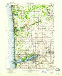
 1958 Racine1971 Print · USGSThe Lake Michigan shoreline in the late fifties was a study in contrasts between the industrial bustle of Kenosha and the quiet woods of the Allegan State Forest. Genealogists and historians can trace the urban footprint of Evanston or locate strategic sites like Fort Sheridan and the Wind Point Light.3 unique versions available
 - 1958 Map of Grand Rapids, 1973 Print
 1958 Grand Rapids1973 Print · USGSSouthern Michigan at the peak of the postwar era shows a landscape of burgeoning cities and new interstate highways. Trace family roots and regional growth in Grand Rapids, Battle Creek, and the glacial lake country around Gun Lake or Gull Lake.2 unique versions available
 - 1961 Map of Grand Rapids
 1961 Grand Rapids1961 Print · USGSSouthern Michigan at the dawn of the 1960s reveals a region shaped by major river systems and a robust rail network. Trace mid-century industrial growth and land use from Grand Rapids to the Fort Custer Military Reservation and Gun Lake.
 - 1962 Map of Grand Rapids
 1962 Grand Rapids1962 Print · USGSMid-century Southern Michigan is mapped here at a time of massive growth, showing the expanding urban footprints of Grand Rapids and Lansing. Researchers can trace the legacy of the Grand Trunk Western RR, find historic boundaries of the Fort Custer Military Reservation, or locate sporting camps around Gun Lake.2 unique versions available
 - 1962 Map of Racine
 1962 Racine1962 Print · USGSThe Lake Michigan shoreline in the early sixties reveals a fascinating contrast between the dense industrial rail hubs of RACINE and CHICAGO and the forested dunes of Michigan. Local historians can trace military installations like Fort Sheridan or explore the numerous inland retreats around Paw Paw Lake and Sister Lakes.
 - 1972 Map of Holland East, 1975 Print
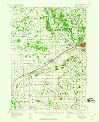
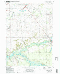
 1972 Holland East1975 Print · USGSOttawa County communities are captured here in the early seventies, showing the established neighborhoods of Holland and Zeeland. Genealogists and historians can trace institutional roots at Hope College or locate family plots in Pilgrim Home Cemetery and Noordeloos Cem.2 unique versions available
 - 1980 Map of Hudsonville West
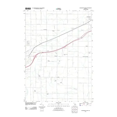
 1980 Hudsonville West1980 Print · USGSThe Ottawa County farming country south of the Grand River was transitioning between its rural roots and suburban growth in the 1970s. Genealogists can trace family names through landmarks like Beaverdam Cem and the small rail stop at Forest Grove Station.
 - 1981 Map of Hamilton East
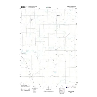
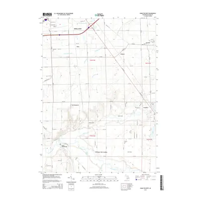
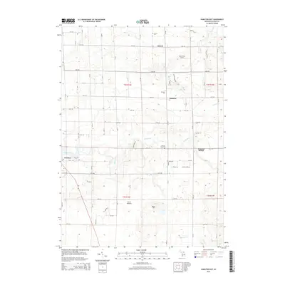
 1981 Hamilton East1981 Print · USGSAllegan County in the late 1970s shows a rural landscape where farming, oil extraction, and conservation coexist. Researchers can trace family history at Oakland Cem and Diamond Springs Cem or locate old school sites like Sandy View Sch.2 unique versions available
 - 1981 Map of Hamilton West, 1982 Print
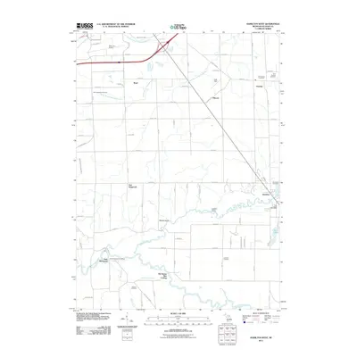
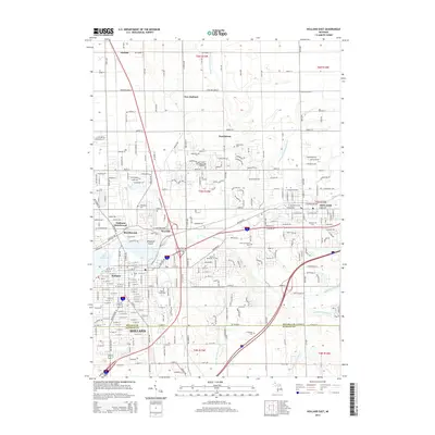
 1981 Hamilton West1982 Print · USGSAllegan County's agricultural heartland and the Kalamazoo River valley are captured here in the early eighties. Genealogists can trace family footprints through numerous rural burial grounds like Old Overisel Cem and Manlius Cem or follow the Chesapeake and Ohio rail stops.2 unique versions available
 - 1982 Map of Holland
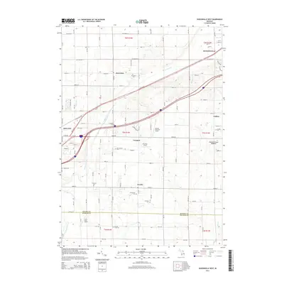
 1982 Holland1982 Print · USGSThe Lake Michigan coast in the early eighties shows a refined network of Dutch-influenced settlements and lakeside retreats. Trace the rail lines of the Chesapeake and Ohio or find family landmarks near Noordeloos and New Richmond.
 - 1984 Map of Grand Rapids
 1984 Grand Rapids1984 Print · USGSWest Michigan in the mid-eighties shows a thriving metropolitan core surrounded by expansive state recreation areas and river valleys. Genealogists and local historians can trace developments around Grand Rapids, institutional landmarks like Grand Rapids Bible College, and the quiet reaches of Jordan Lake.
 - 2011 Map of Holland East, 2011 Print
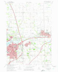
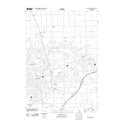 2011 Holland East2011 Print · USGSCovers Overisel Township, including Holland, Zeeland, and other nearby areas
 - 2011 Map of Hamilton West, 2011 Print
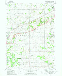
 2011 Hamilton West2011 Print · USGSCovers Overisel Township, including Holland, Overisel, and other nearby areas
 - 2011 Map of Hudsonville West, 2011 Print
 2011 Hudsonville West2011 Print · USGSCovers Overisel Township, including Hudsonville, Zeeland, and other nearby areas
 - 2011 Map of Hamilton East, 2011 Print
 2011 Hamilton East2011 Print · USGSCovers Overisel Township, including Bentheim, Diamond Springs, and other nearby areas
 - 2014 Map of Hudsonville West, 2014 Print
 2014 Hudsonville West2014 Print · USGSCovers Overisel Township, including Hudsonville, Zeeland, and other nearby areas
 - 2014 Map of Hamilton West, 2014 Print
 2014 Hamilton West2014 Print · USGSCovers Overisel Township, including Holland, Overisel, and other nearby areas
 - 2014 Map of Holland East, 2014 Print
 2014 Holland East2014 Print · USGSCovers Overisel Township, including Holland, Zeeland, and other nearby areas
 - 2014 Map of Hamilton East, 2014 Print
 2014 Hamilton East2014 Print · USGSCovers Overisel Township, including Bentheim, Diamond Springs, and other nearby areas
Showing maps 1-25 of 37
Top cities near Overisel Township
- Grand Rapids historical maps
- Wyoming historical maps
- Holland historical maps
- Byron Township historical maps
- Walker historical maps
- Grandville historical maps
See more
Top neighborhoods of Overisel Township
Frequently asked questions
- What are the different types of historical maps available for Overisel Township?
- What is the oldest map of Overisel Township?
- Where can I purchase historical maps of Overisel Township for my home or office?
- Where can I download high-res historical maps of Overisel Township?
- Are there historical topographic maps available for Overisel Township?
- Is there historical aerial imagery available for Overisel Township?
- Where are historical maps of Overisel Township sourced from?