Old Maps of Arenac County, Michigan for Academic Research
Study the evolution of Arenac County with 122 high-resolution historic maps. Whether you're teaching, researching, or modeling changes in land use, these maps provide essential visual documentation of urban, environmental, and geographic change.
- Analyze long-term change: Track patterns in development, transportation, and natural features.
- Ideal for environmental or urban studies: Support academic projects with primary historical map data.
- Use in the classroom or lab: Educators and researchers rely on these maps to bring historical context to life.
These maps are a powerful tool for teaching, research, and visualizing how Arenac County has changed over the decades.
Arenac County, MI maps
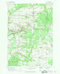
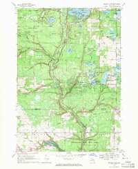
(122)- 1954 Map of Traverse City, 1965 Print
 1954 Traverse City1965 Print · USGSNorthern Michigan’s vast lakeshores and timberlands are captured here in the mid-fifties, showing the region before the modern interstate era. Genealogists and researchers can trace rail connections like the Detroit and Mackinac RR or find old communities such as Suttons Bay, Elk Rapids, and Prudenville.4 unique versions available
 - 1954 Map of Midland, 1967 Print
 1954 Midland1967 Print · USGSMid-Michigan at the peak of the post-war era shows a landscape balancing industrial growth in Midland with the deep timberlands of the Manistee National Forest. Researchers can trace the legacy of the timber and rail era along the Pennsylvania RR or find family roots in river towns like Chesaning and Big Rapids.4 unique versions available
 - 1954 Map of Flint, 1968 Print
 1954 Flint1968 Print · USGSThe industrial corridor and fertile Thumb region of Michigan come alive in this mid-century survey. Genealogists and historians can trace the rail networks of the Grand Trunk, locate established settlements like Bad Axe and Sandusky, or explore the 1950s shoreline along Saginaw Bay.4 unique versions available
 - 1954 Map of Tawas City, 1968 Print
 1954 Tawas City1968 Print · USGSCoastal life along Lake Huron was defined by a mix of military aviation and hydroelectric power in the mid-fifties. Researchers can trace the river dams like Cooke Dam, the layout of Wurtsmith AFB, and the coastal mining operations at Alabaster.4 unique versions available
 - 1958 Map of Traverse City
 1958 Traverse City1958 Print · USGSNorthern Lower Michigan was a landscape of vast state forests and burgeoning lakeside retreats in the late fifties. Genealogists and historians can trace the rail corridors of the Ann Arbor RR and find established settlements from Elk Rapids to Houghton Lake.2 unique versions available
 - 1958 Map of Flint
 1958 Flint1958 Print · USGSThe Michigan Thumb and the Saginaw Valley are captured here during the height of the post-war industrial era. Researchers can trace the complex rail networks of the Grand Trunk Western or locate mid-century landmarks like Lakeport State Park and the port at Bay City.2 unique versions available
 - 1958 Map of Tawas City
 1958 Tawas City1958 Print · USGSThe Lake Huron shoreline and northern Michigan timberlands come into focus in the late fifties, during the expansion of the Cold War. Genealogists and historians can trace rail lines like the Detroit and Mackinac, find regional landmarks like the Lumbermans Memorial Monument, and locate coastal facilities including Wurtsmith AFB.2 unique versions available
 - 1958 Map of Midland
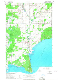
 1958 Midland1958 Print · USGSCentral Michigan in the late fifties is captured here during a period of transition for its university towns and industrial hubs. Genealogists and researchers can trace family lines through old rail-stop towns like Breckenridge and Chesaning or locate property near the Muskegon River and Prairie Farm.
 - 1959 Map of Midland
 1959 Midland1959 Print · USGSMid-century Michigan comes alive in this survey of the central Lower Peninsula, from the streets of Grand Rapids to the Houghton Lake timberlands. Genealogists and rail fans can trace the Ann Arbor RR and Chesapeake and Ohio RR through towns like Big Rapids and Mount Pleasant.
 - 1966 Map of Midland
 1966 Midland1966 Print · USGSCentral Michigan in the mid-1960s shows a landscape of growing manufacturing hubs and active resource extraction. Genealogists and historians can trace the rail corridors of the Grand Trunk Western or locate family-named landmarks near Oil wells and the Muskegon River.
 - 1966 Map of Point Lookout, 1968 Print
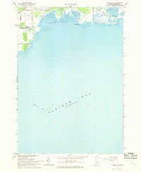
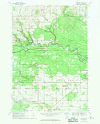
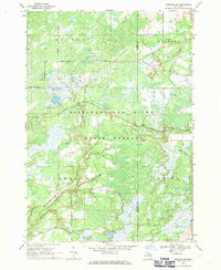
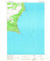 1966 Point Lookout1968 Print · USGSThe Arenac County shoreline reaches into Saginaw Bay during the mid-1960s, showing a landscape of coastal retreats and rural farms. Trace family history at Whitney Farms Cem or explore lakefront tracts like Birchwood Shores and Whitestone Point.2 unique versions available
 - 1966 Map of Au Gres, 1968 Print
 1966 Au Gres1968 Print · USGSSaginaw Bay’s western shoreline comes into focus during the mid-1960s, showing the riverside town of Au Gres and the surrounding woodlands. Genealogists and local historians can trace family-named sites such as Linwood Cem, Delano Ch, and the small settlement of Santiago.2 unique versions available
 - 1966 Map of Alabaster, 1968 Print
 1966 Alabaster1968 Print · USGSCoastal Michigan in the late sixties reveals a landscape of industrial quarries and growing bayside communities along Saginaw Bay. Genealogists and historians can trace the lakeside residential rows from Huron Oaks to Harmon City Heights and locate local landmarks like Township Cem and the railroad at Alabaster Junction.2 unique versions available
 - 1966 Map of National City, 1968 Print
 1966 National City1968 Print · USGSIosco County in the mid-1960s reveals a landscape shaped by timber, rail, and an intricate drainage network. Trace the Detroit and Mackinac RR through McIvor, locate Quarries near the county line, and find the Sherman Sch.2 unique versions available
 - 1967 Map of Mount Forest, 1969 Print
 1967 Mount Forest1969 Print · USGSBay and Arenac counties appear here in the late sixties, showing a landscape defined by drainage canals and the regional oil industry. Genealogists can trace family roots through settlements like Johnsfield and landmarks such as the Bethlehem Ch and Mount Forest.2 unique versions available
 - 1967 Map of Standish NE, 1969 Print
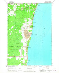
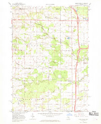
 1967 Standish NE1969 Print · USGSArenac County’s shoreline on the edge of Saginaw Bay is captured in the late sixties, showing the rural roads and river mouths of Standish and Au Gres. Local historians can trace the paths of Arenac State Road and Palmer Road near the banks of the Rifle River and Wigwam Bay.
 - 1967 Map of Standish, 1969 Print
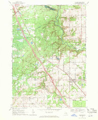
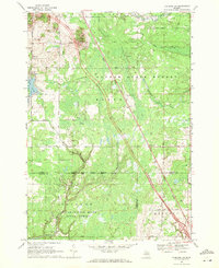
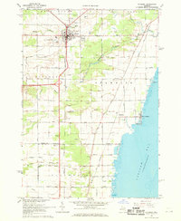 1967 Standish1969 Print · USGSStandish at the close of the 1960s serves as a busy crossroads for the Detroit and Mackinac and Penn Central railroads. Genealogists can locate family names at Woodmere Cem and St Johns Cem, or trace the shoreline from Whites Beach to Saganing.3 unique versions available
 - 1968 Map of Prescott, 1971 Print
 1968 Prescott1971 Print · USGSNorthern Michigan in the late sixties reveals a landscape of rural villages and energy extraction. Trace local family history at Richland Cem or follow the Old Railroad Grade past Prescott and the Oil Wells near Maple Ridge.
 - 1968 Map of Whittemore, 1971 Print
 1968 Whittemore1971 Print · USGSWhittemore and Turner are captured in the late sixties as the surrounding landscapes were still heavily defined by state forestry and old rail corridors. Researchers can find historical burial sites like Cedar Valley Cemetery and follow the paths of the Au Gres River and the Old Railroad Grade.
 - 1968 Map of Omer SW, 1971 Print
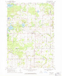
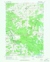
 1968 Omer SW1971 Print · USGSArenac County lands are captured here in the late sixties as agricultural grids meet the woods of the Tittabawassee River State Forest. Researchers can locate family landmarks like Knights Mill, the Evergreen Cem, and the Penn Central railroad corridor.2 unique versions available
 - 1968 Map of Sterling, 1971 Print
 1968 Sterling1971 Print · USGSArenac County as it appeared in the late sixties reveals a landscape of working oil fields and small railway towns. Genealogists can trace family footprints near Alger and Sterling, locating landmarks like the Alger Cem and the Penn Central tracks.2 unique versions available
 - 1968 Map of Omer, 1971 Print
 1968 Omer1971 Print · USGSArenac County in the late sixties reveals a landscape of dense river forests and small railroad towns along the Detroit and Mackinac line. Researchers can trace the development of Twining and Omer, find Evergreen Cem, or locate mid-century Quarries.
 - 1968 Map of Skidway Lake, 1971 Print
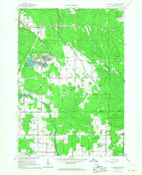
 1968 Skidway Lake1971 Print · USGSIn the late sixties, the Ogemaw County lakes region was a burgeoning center for recreation and industry. Researchers can trace the Old Railroad Grade near Alger, locate the Clayton Oil and Gas Field, and find local landmarks like St Stephens Ch.
 - 1968 Map of Sterling SW, 1971 Print
 1968 Sterling SW1971 Print · USGSThe Gladwin County backcountry in the late sixties reveals a landscape of managed wetlands and forestry trails. Genealogists and outdoorsmen can locate specific landmarks like Bowmanville, the Lame Duck Truck Trail, and the curiously named Hard Luck.
 - 1968 Map of Sterling NW, 1971 Print
 1968 Sterling NW1971 Print · USGSNorthern Michigan's forested interior is captured in the late sixties, showing the intersection of Ogemaw, Gladwin, and Arenac counties. Genealogists and historians can trace the Bourret Cem or locate the Gustafson Airport and the Penn Central rail line.
Showing maps 1-25 of 122
Top cities of Arenac County
Frequently asked questions
- What are the different types of historical maps available for Arenac County?
- What is the oldest map of Arenac County?
- Where can I purchase historical maps of Arenac County for my home or office?
- Where can I download high-res historical maps of Arenac County?
- Are there historical topographic maps available for Arenac County?
- Is there historical aerial imagery available for Arenac County?
- Where are historical maps of Arenac County sourced from?