2020s Maps of Whitney Township, Michigan
Explore 5 historic maps of Whitney Township from the 2020s. These maps offer a rare glimpse into what life looked like during the 2020s — showing old roads, neighborhoods, homes, and landmarks that have changed or disappeared over time.
Whether you're researching your family's past, planning a metal detecting trip, or studying how Whitney Township's landscape evolved across the 2020s, these high-resolution maps are a powerful tool for exploring the history of this region.
- Focus on a specific era: All maps on this page are from the 2020s, giving you a focused view of this time period.
- See what’s changed: Compare century-old streets, trails, and buildings to today's modern landscape using overlays and satellite layers.
- Research with precision: Use these maps for genealogy, historical research, land use analysis, or educational projects.
- View, download, or print: Maps are fully viewable online in high resolution, and can be downloaded or printed for your own records.
Start exploring Whitney Township's history through authentic maps from the 2020s. This is your window into the past.
Whitney Township, MI maps
(5)- 2023 Map of National City, 2023 Print
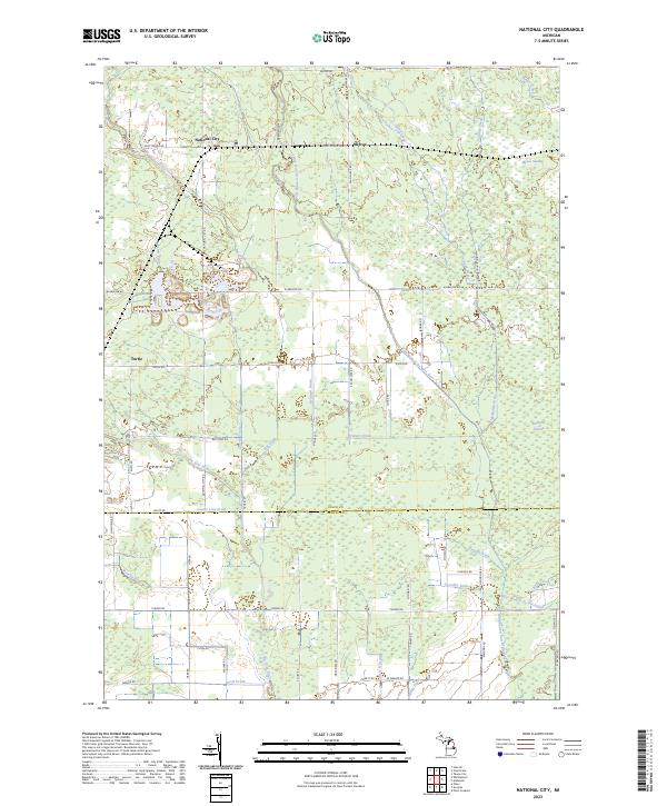 2023 National City2023 Print · USGSSettled at the intersection of Iosco and Arenac counties, this area remains defined by its complex drainage and river networks. Researchers can trace rural landmarks like McIvor, Turtle, and the expansive Alabaster Swamp.
 - 2023 Map of Au Gres, 2023 Print
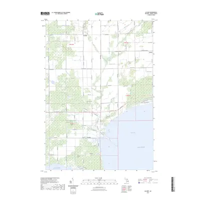 2023 Au Gres2023 Print · USGSCoastal Arenac County meets the waters of Saginaw Bay in this recent survey of the riverfront and marshlands. Researchers can locate family landmarks like Linwood Cem, the Indian Burial Ground, and the small settlements of Santiago and Delano.
 - 2023 Map of Alabaster, 2023 Print
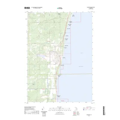 2023 Alabaster2023 Print · USGSCoastal Iosco County at the edge of Lake Huron reveals a landscape of lakeside communities and extensive marshlands. Researchers can trace family history at the Alabaster Township Cemetery or explore the drainage of Kendall Marsh and Crowell Swamp.
 - 2023 Map of Point Lookout, 2023 Print
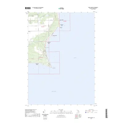 2023 Point Lookout2023 Print · USGSArenac County's shoreline reaches into Saginaw Bay during the early twenty-first century, showing a landscape of coastal resorts and drainage networks. Genealogists can locate Sims - Whitney Cem and trace developments like Birchwood Shores and Whitestone Point.
 - 2023 Map of Charity Island, 2023 Print
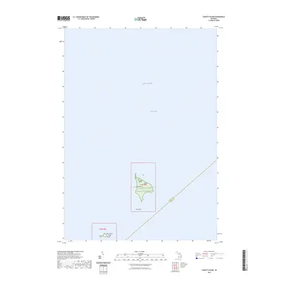 2023 Charity Island2023 Print · USGSIsolated in Saginaw Bay, these islands represent a protected sanctuary in the waters of Lake Huron as mapped in 2023. Researchers can trace the boundaries of the Michigan Islands National Wildlife Refuge across Charity Island and Little Charity Island.
End of results
Showing maps 1-5 of 5
Top cities near Whitney Township
- East Tawas historical maps
- Tawas City historical maps
- Au Gres historical maps
- Alabaster historical maps
- Turner historical maps
Top neighborhoods of Whitney Township
- Hammell Beach historical maps
- Wagner Beach historical maps
- Whitestone Point historical maps
- Delano historical maps
- Pine Wood Park historical maps
- Huron Heights historical maps
See more
Frequently asked questions
- What are the different types of historical maps available for Whitney Township?
- What is the oldest map of Whitney Township?
- Where can I purchase historical maps of Whitney Township for my home or office?
- Where can I download high-res historical maps of Whitney Township?
- Are there historical topographic maps available for Whitney Township?
- Is there historical aerial imagery available for Whitney Township?
- Where are historical maps of Whitney Township sourced from?