2020s Maps of L'Anse Township, Michigan
Explore 14 historic maps of L'Anse Township from the 2020s. These maps offer a rare glimpse into what life looked like during the 2020s — showing old roads, neighborhoods, homes, and landmarks that have changed or disappeared over time.
Whether you're researching your family's past, planning a metal detecting trip, or studying how L'Anse Township's landscape evolved across the 2020s, these high-resolution maps are a powerful tool for exploring the history of this region.
- Focus on a specific era: All maps on this page are from the 2020s, giving you a focused view of this time period.
- See what’s changed: Compare century-old streets, trails, and buildings to today's modern landscape using overlays and satellite layers.
- Research with precision: Use these maps for genealogy, historical research, land use analysis, or educational projects.
- View, download, or print: Maps are fully viewable online in high resolution, and can be downloaded or printed for your own records.
Start exploring L'Anse Township's history through authentic maps from the 2020s. This is your window into the past.
L'Anse Township, MI maps
(14)- 2023 Map of Vermilac, 2023 Print
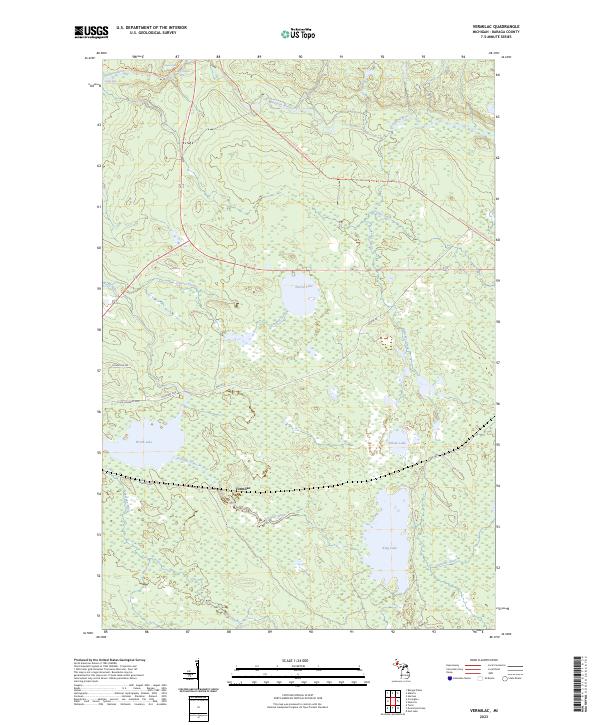 2023 Vermilac2023 Print · USGSBaraga County's interior and the Vermilac area are shown here during the early twenty-first century. Outdoor enthusiasts and local historians can trace the North Country National Scenic Trl past landmarks like Canyon Falls and King Lake.
 - 2023 Map of Keweenaw Bay NE, 2023 Print
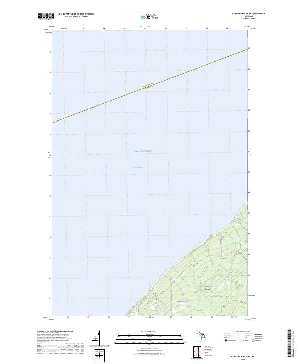 2023 Keweenaw Bay NE2023 Print · USGSCoastal Baraga County is defined by the reaching arm of the Abbaye Peninsula as it extends into the waters of Lake Superior. Researchers can trace remote shoreline access and local landmarks along Point-Abbaye Rd, Whiskey Rd, and Reeds Pointers.
 - 2023 Map of Herman, 2023 Print
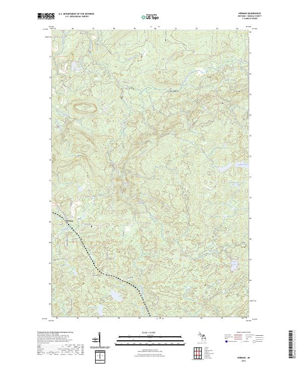 2023 Herman2023 Print · USGSThe community of Herman sits amidst the dense forests and cascading waters of Baraga County in the 2020s. Researchers can locate family sites near Herman Cem or trace the winding paths of the Silver River past Harley Falls and Upper Silver River Falls.
 - 2023 Map of Mount Curwood, 2023 Print
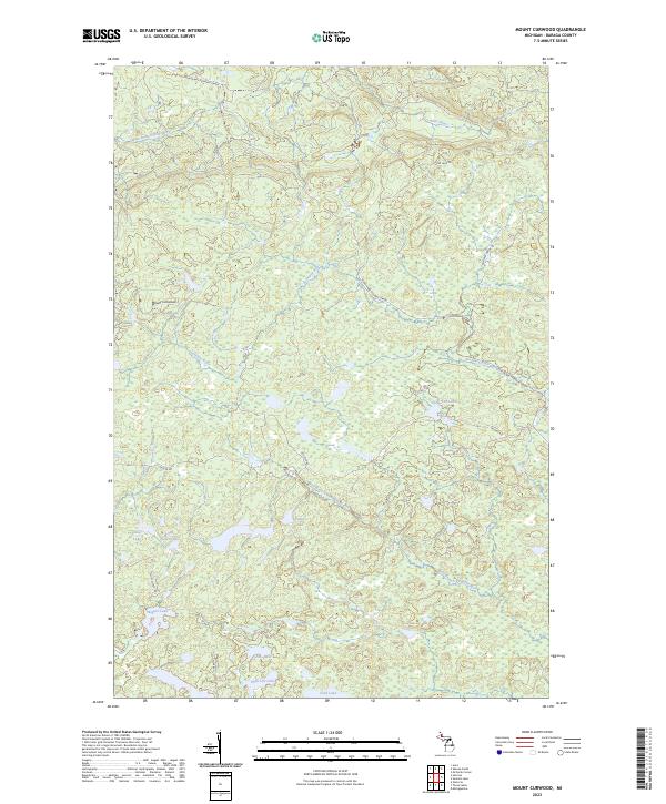 2023 Mount Curwood2023 Print · USGSUpper Peninsula timber and transit history converge in the Michigamme Highlands during the early twenty-first century. Researchers can trace the legacy of the Huron Bay-Peshekee Grade near Mount Curwood and explore the remote shores of Camp Ten Lake.
 - 2023 Map of L'Anse, 2023 Print
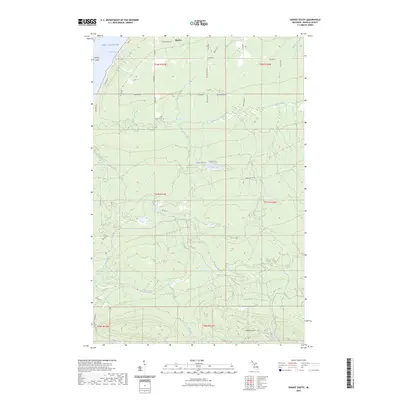
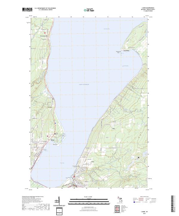 2023 L'Anse2023 Print · USGSThe shores of Baraga County come alive in this survey of the Keweenaw Bay area, capturing the modern layout of these historic Lake Superior settlements. Genealogists and local historians can locate several burial sites including Assinins Cem and Pinery Indian Cem, or trace the waterfront near Pequaming.
 - 2023 Map of Summit Lake, 2023 Print
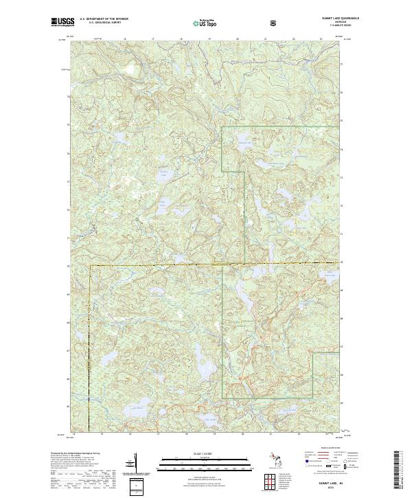 2023 Summit Lake2023 Print · USGSThe northern woods of Baraga and Marquette counties are captured here in the early twenty-first century. Genealogists and hikers can trace old logging routes like the Huron Bay Grade and explore the remote McCormick Wilderness.
 - 2023 Map of Mountain Lake, 2023 Print
 2023 Mountain Lake2023 Print · USGSThe Huron Mountains take center stage in this 2023 survey of the Michigan backcountry. You can trace the complex network of mountain summits and river systems from Mount Ida and Trout Mountain to the waters of Forty Foot Falls and Lumberman Bay.
 - 2023 Map of McComb Corner, 2023 Print
 2023 McComb Corner2023 Print · USGSThe northern wilderness along the Baraga and Marquette county line is defined by the complex river systems of the Huron Mountains. Hikers and cartography enthusiasts can trace the numerous cascades along the West Branch Huron River, including Big Ericks Falls and Letherby Falls.
 - 2023 Map of Alberta, 2023 Print
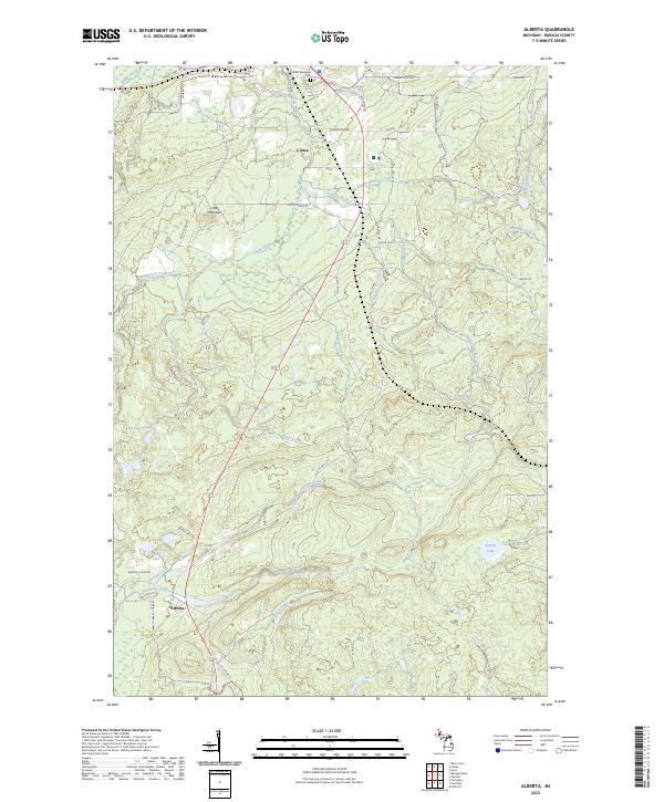 2023 Alberta2023 Print · USGSSettled along the south shore of L'Anse Bay, this area shows the rugged river systems and small settlements of the Upper Peninsula. Researchers can locate L'Anse Township Cem and trace the many cascades along the Falls River, including Power Dam Falls.
 - 2023 Map of Nestoria, 2023 Print
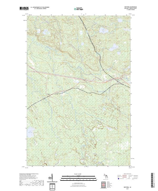 2023 Nestoria2023 Print · USGSBaraga County's timbered highlands are captured in the early 2020s, showing the intersection of Michigan's wilderness trails and river systems. You can trace the path of the North Country National Scenic Trail as it crosses through Nestoria and Tioga, passing numerous landmarks like Tioga Falls.
 - 2023 Map of Bulldog Lake, 2023 Print
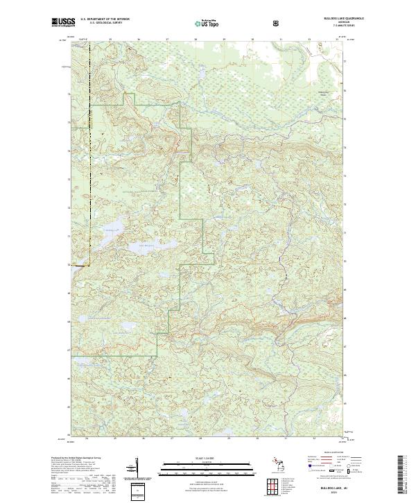 2023 Bulldog Lake2023 Print · USGSThe Upper Peninsula’s interior wilderness is documented here in the early twenty-first century, spanning the rugged border between Baraga and Marquette counties. Outdoor historians can trace the North Country National Scenic Trl past Lake Raymond and the remote Yellow Dog Falls.
 - 2023 Map of Three Lakes, 2023 Print
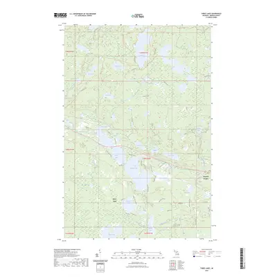 2023 Three Lakes2023 Print · USGSThe Baraga County woods and waters are captured here in the early 2020s, centered on the lakeside communities of Three Lakes and Imperial Heights. Map collectors and outdoorsmen can trace the North Country National Scenic Trail as it passes through the pristine Craig Lake State Park and past Pea Soup Lake.
 - 2023 Map of Aura, 2023 Print
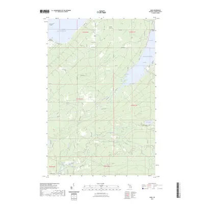 2023 Aura2023 Print · USGSCoastal Baraga County at the start of the 2020s shows a landscape defined by the Abbay Peninsula and its numerous waterfalls. Trace local family history and geographic landmarks from Aura to the Slate River Falls, Middle Silver River Falls, and Aura Cem.
 - 2023 Map of Skanee South, 2023 Print
 2023 Skanee South2023 Print · USGSThe rugged interior of Baraga County meets the Lake Superior shoreline in this recent survey. Researchers can trace the Huron Bay-Peshekee Grade rail corridor or locate landmarks like the Old Skanee Cem and Mount Arvon.
End of results
Showing maps 1-14 of 14
Top cities near L'Anse Township
Top neighborhoods of L'Anse Township
- Zeba historical maps
- Pequaming historical maps
- Bovine historical maps
- Herman historical maps
- Alberta historical maps
- Laugh's Lake historical maps
See more
Frequently asked questions
- What are the different types of historical maps available for L'Anse Township?
- What is the oldest map of L'Anse Township?
- Where can I purchase historical maps of L'Anse Township for my home or office?
- Where can I download high-res historical maps of L'Anse Township?
- Are there historical topographic maps available for L'Anse Township?
- Is there historical aerial imagery available for L'Anse Township?
- Where are historical maps of L'Anse Township sourced from?