Old Maps of Bedford Charter Township, Michigan
Explore 40 old maps of Bedford Charter Township, spanning from 1918 to today. These high-resolution historic maps reveal how streets, neighborhoods, landmarks, and natural features evolved over time — perfect for genealogy, metal detecting, research, and local history exploration.
What you can do with these maps:
- See how Bedford Charter Township changed over time: Compare historical maps to modern-day views to trace roads, homesites, rail lines & more.
- View detailed metadata: Each map includes creators, publishers, year, scale, and archive source.
- Overlay maps with satellite & LiDAR: Visualize the past alongside modern tools to explore terrain & human change.
- Trusted historical sources: Maps sourced from the USGS, Library of Congress, and other archives.
- Access maps your way: View online, download high-res files, or order prints for personal or research use.
Start exploring old maps of Bedford Charter Township to uncover forgotten places, hidden landmarks, and the deep history beneath your feet.
Bedford Charter Township, MI maps
(40)- 1918 Map of Battle Creek
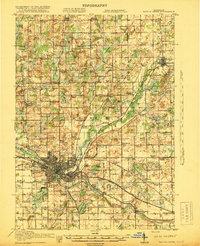 1918 Battle Creek1918 Print · USGSThe Battle Creek area thrived as a rail and industrial hub during the First World War. Genealogists can trace family footprints across rural schoolhouses like Little Brick School and settlements like Ceresco or Bellevue.4 unique versions available
 - 1918 Map of Galesburg
 1918 Galesburg1918 Print · USGSKalamazoo and Barry Counties appear during the First World War, showing a landscape defined by the massive Camp Custer military reservation. Researchers can trace rural life through a network of dozens of one-room schoolhouses, the Michigan Central rail line, and summer colonies on Gull Lake.5 unique versions available
 - 1943 Map of Battle Creek
 1943 Battle Creek1943 Print · USGSBattle Creek and the surrounding Calhoun County countryside are shown during the early years of the Second World War. Genealogists and local historians can locate dozens of country schoolhouses like Cobblestone Sch and trace the Grand Trunk Railway through Bellevue and Ceresco.
 - 1944 Map of Galesburg
 1944 Galesburg1944 Print · USGSDuring the height of World War II, this region was defined by the presence of Fort Custer and the busy Michigan Central rail corridor. Researchers can trace dozens of early rural schoolhouses like Toad Hollow Sch and Grey Sch alongside the sprawling waters of Gull Lake.
 - 1947 Map of Augusta, 1955 Print
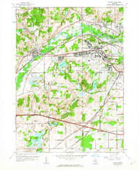
 1947 Augusta1955 Print · USGSThe Kalamazoo and Calhoun county line was a hub of military and medical activity in the late 1940s. Researchers can trace the extensive grounds of the Fort Custer Military Reservation and locate local landmarks like the Veterans Hospital and Martin Sch.
 - 1947 Map of Banfield, 1955 Print
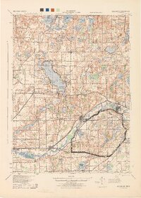
 1947 Banfield1955 Print · USGSBarry County was a landscape of quiet glacial lakes and rural schoolhouses just after the war. You can trace the development of lakeside communities like Poplar Beach or locate family roots at Banfield Cem and the King Sch.
 - 1947 Map of Bedford, 1955 Print
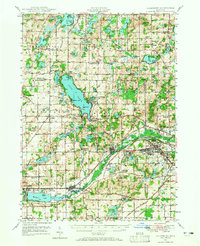
 1947 Bedford1955 Print · USGSThe border of Barry and Calhoun counties in the late 1940s shows a landscape of small lakefront settlements and rural schoolhouses. Genealogists can trace family footprints through sites like Bethel Chapel, Ellis Cem, and the unique Checkered Sch.
 - 1947 Map of Battle Creek, 1955 Print
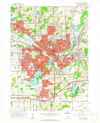
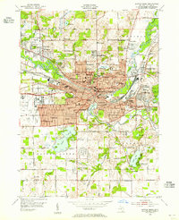 1947 Battle Creek1955 Print · USGSBattle Creek and its surrounding townships thrive in this mid-century survey as a hub of industry, medicine, and education. Genealogists can trace family footprints across dozens of local landmarks like Holy Star Cem, School No 2, and the Sanitarium.
 - 1947 Map of Galesburg, 1965 Print
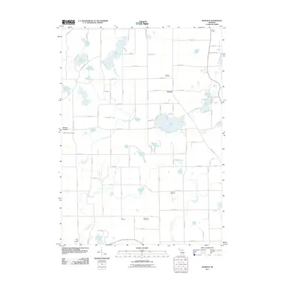
 1947 Galesburg1965 Print · USGSThe Kalamazoo and Barry County line comes alive in the late 1940s, showing a landscape of lakeside retreats and growing military installations. Genealogists can trace family names at Stony Lake Cem or Bansfield Sch while exploring the pre-interstate corridors of Augusta and Galesburg.
 - 1950 Map of Galesburg
 1950 Galesburg1950 Print · USGSSouthwestern Michigan at mid-century shows a landscape defined by the expansion of Fort Custer and the busy rail corridors of Galesburg. Researchers can trace old family schoolhouses like Hoover Sch and Toad Hollow Sch alongside the summer resorts of Gull Lake.2 unique versions available
 - 1950 Map of Battle Creek
 1950 Battle Creek1950 Print · USGSBattle Creek and its surrounding townships thrive in the early post-war years as a vital hub of Michigan industry and aviation. Genealogists and historians can trace family roots through numerous country schools like Cobblestone Sch and cemeteries such as Oak Hill Cem.3 unique versions available
 - 1958 Map of Grand Rapids, 1973 Print
 1958 Grand Rapids1973 Print · USGSSouthern Michigan at the peak of the postwar era shows a landscape of burgeoning cities and new interstate highways. Trace family roots and regional growth in Grand Rapids, Battle Creek, and the glacial lake country around Gun Lake or Gull Lake.2 unique versions available
 - 1961 Map of Grand Rapids
 1961 Grand Rapids1961 Print · USGSSouthern Michigan at the dawn of the 1960s reveals a region shaped by major river systems and a robust rail network. Trace mid-century industrial growth and land use from Grand Rapids to the Fort Custer Military Reservation and Gun Lake.
 - 1961 Map of Banfield, 1962 Print
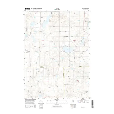
 1961 Banfield1962 Print · USGSIn the early 1960s, this area of Michigan was a landscape of small crossroads and rural schools. You can trace the lineage of local education and community life at sites like Banfield Sch, King Sch, and Stony Lake Cem near the shores of Fine Lake.3 unique versions available
 - 1961 Map of Bedford, 1962 Print
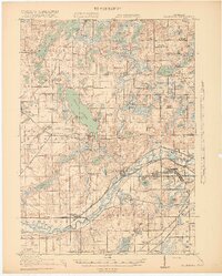
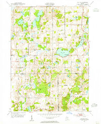
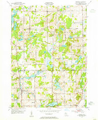
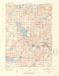
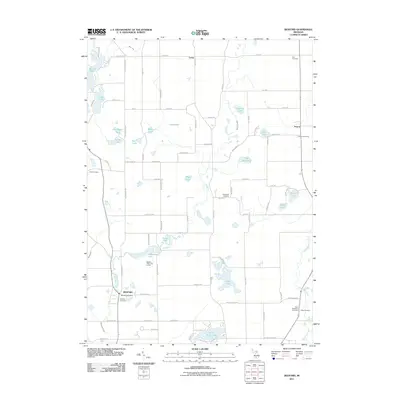
 1961 Bedford1962 Print · USGSThe Barry and Calhoun county line in the early sixties shows a rural Michigan landscape defined by its glacial lakes and one-room schoolhouses. Genealogists can trace family roots at Bedford Cemetery or locate long-standing rural institutions like Bethel Chapel and Monroe Sch.4 unique versions available
 - 1961 Map of Battle Creek, 1962 Print
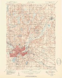
 1961 Battle Creek1962 Print · USGSBattle Creek and its burgeoning suburbs are caught in a moment of significant mid-century growth. Genealogists and researchers can trace local institutions and family-named landmarks like Oak Hill Cemetery, Kimball Sanatorium, and Beadle Lake Sch.3 unique versions available
 - 1961 Map of Augusta, 1962 Print
 1961 Augusta1962 Print · USGSThe Kalamazoo River valley in the early 1960s reveals a unique intersection of military installations and small-town Michigan life. Researchers can trace the grounds of the Fort Custer Military Reservation and locate local landmarks like the Veterans Administration Hospital and Martin Sch.5 unique versions available
 - 1962 Map of Grand Rapids
 1962 Grand Rapids1962 Print · USGSMid-century Southern Michigan is mapped here at a time of massive growth, showing the expanding urban footprints of Grand Rapids and Lansing. Researchers can trace the legacy of the Grand Trunk Western RR, find historic boundaries of the Fort Custer Military Reservation, or locate sporting camps around Gun Lake.2 unique versions available
 - 1982 Map of Kalamazoo, 1983 Print
 1982 Kalamazoo1983 Print · USGSThe Kalamazoo River valley in the early eighties shows a landscape of growing suburban centers and heavy rail infrastructure. Genealogists and researchers can trace the limits of Kalamazoo and Battle Creek or locate landmarks like Fort Custer National Cemetery and Gull Lake.
 - 1998 Map of Augusta, 1999 Print
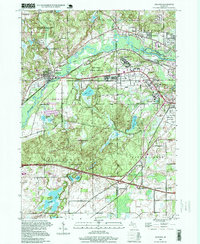 1998 Augusta1999 Print · USGSThe river valleys of the Kalamazoo and Battle Creek come alive in the late nineties, showcasing a unique mix of military legacies and conservation. Genealogists and historians can trace the grounds of Fort Custer National Cemetery or locate the historic Martin Sch and Lawler Cem.
 - 2011 Map of Battle Creek, 2011 Print
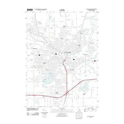 2011 Battle Creek2011 Print · USGSCovers Bedford Charter Township, including Battle Creek, Springfield, and other nearby areas
 - 2011 Map of Bedford, 2011 Print
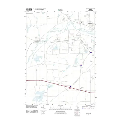
 2011 Bedford2011 Print · USGSCovers Bedford Charter Township, including Assyria, Johnstown Township, and other nearby areas
 - 2011 Map of Augusta, 2011 Print
 2011 Augusta2011 Print · USGSCovers Bedford Charter Township, including Battle Creek, Springfield, and other nearby areas
 - 2011 Map of Banfield, 2011 Print
 2011 Banfield2011 Print · USGSCovers Bedford Charter Township, including Johnstown Township, Barry Township, and other nearby areas
 - 2014 Map of Banfield, 2014 Print
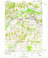
 2014 Banfield2014 Print · USGSCovers Bedford Charter Township, including Johnstown Township, Barry Township, and other nearby areas
Showing maps 1-25 of 40
Top cities near Bedford Charter Township
- Battle Creek historical maps
- Pavilion historical maps
- Springfield historical maps
- Prairieville historical maps
- Assyria historical maps
- Galesburg historical maps
See more
Top neighborhoods of Bedford Charter Township
- Oak Park historical maps
- Morgan Corners historical maps
- Level Park historical maps
- Bedford historical maps
Frequently asked questions
- What are the different types of historical maps available for Bedford Charter Township?
- What is the oldest map of Bedford Charter Township?
- Where can I purchase historical maps of Bedford Charter Township for my home or office?
- Where can I download high-res historical maps of Bedford Charter Township?
- Are there historical topographic maps available for Bedford Charter Township?
- Is there historical aerial imagery available for Bedford Charter Township?
- Where are historical maps of Bedford Charter Township sourced from?