Old Maps of Wayne Township, Michigan for Hiking & Exploration
Hike through history with 44 historic maps of Wayne Township. Explore old trails, ghost towns, and forgotten backroads — perfect for outdoor adventurers and local explorers.
- Rediscover forgotten places: Map out old mining camps, roads, and footpaths that no longer exist on modern maps.
- Layer with modern tools: Combine with LiDAR or satellite views to plan hikes through historical terrain.
- Made for exploration: Popular among hikers, overlanders, and local history lovers.
Use these maps to find adventure and explore the hidden past of Wayne Township.
Wayne Township, MI maps
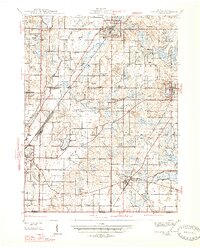
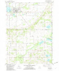
(44)- 1927 Map of Hartford, 1943 Print
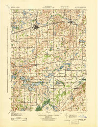 1927 Hartford1943 Print · USGSVan Buren County agriculture and lakeside leisure meet in the late 1920s as Hartford and Lawrence thrive along the Pere Marquette rail line. Researchers can locate numerous rural schoolhouses, the historic Red Mill, and early resort development at Sister Lakes and Woodland Beach.3 unique versions available
 - 1931 Map of Hartford
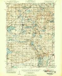
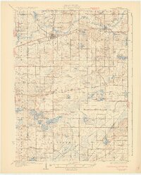 1931 Hartford1931 Print · USGSVan Buren County and the northern edge of Cass County appear here in the late twenties, defined by a dense landscape of glacial lakes and river bottomlands. Researchers can locate early country schools like Brague Sch, the Red Mill on Silver Creek, and historic crossroads including Keeler and Fritzburg.2 unique versions available
 - 1944 Map of Marcellus, 1965 Print
 1944 Marcellus1965 Print · USGSSouthwest Michigan townships in Van Buren and Cass counties are documented here during the mid-1940s as a landscape of interconnected glacial lakes and rail lines. Researchers can trace old rural schools like Durkee Sch, the Pere Marquette rail corridor, and family burial grounds such as Wildey Cem.3 unique versions available
 - 1945 Map of Cassopolis, 1967 Print
 1945 Cassopolis1967 Print · USGSSouthwestern Michigan's rural landscape is captured here in the mid-1940s, showing a dense network of country schools and family-named cemeteries. Genealogists can trace property roots near Barron Lake Cem, Crystal Springs Campground, and numerous landmarks like Morris Chapel.3 unique versions available
 - 1946 Map of Marcellus
 1946 Marcellus1946 Print · USGSThe rural landscape of Cass and Van Buren counties comes alive in the mid-1940s, showing a transition between railroad hubs and quiet farming hamlets. Genealogists can locate family-named landmarks such as Chamberlain Cem and historic schools like Porter Center Sch or Shannon Sch.2 unique versions available
 - 1947 Map of Cassopolis
 1947 Cassopolis1947 Print · USGSSouthwest Michigan's lake country is captured here just after the war, showing the busy rail-and-river hubs and rural townships. Researchers can locate dozens of neighborhood schoolhouses like Brooklyn Sch and country churches such as Smith Chapel.2 unique versions available
 - 1948 Map of Vandalia
 1948 Vandalia1948 Print · USGSCass County's lake-studded landscape is captured here in the mid-1940s, showing a vibrant network of rural schoolhouses and lakeside retreats. Genealogists and local historians can trace early school districts like Allegheny Sch, locate the Moon Cem, and see the rail economy of Vandalia along the Grand Trunk.5 unique versions available
 - 1949 Map of Vandalia
 1949 Vandalia1949 Print · USGSIn the late 1940s, this pocket of Cass County was a hub of rural life and summer lakeside recreation. Genealogists can locate family landmarks like the Shavehead Cem or Chain Lake Ch, and trace old rail stops along the Grand Trunk.2 unique versions available
 - 1953 Map of Fort Wayne, 1963 Print
 1953 Fort Wayne1963 Print · USGSNortheast Indiana and its neighboring borderlands in Michigan and Ohio appear here during a peak era of rail and road expansion. Researchers can trace the massive rail networks of the Nickel Plate Road and Wabash or locate lakeside landmarks like Lake Wawasee and Clear Lake.4 unique versions available
 - 1953 Map of Chicago, 1964 Print
 1953 Chicago1964 Print · USGSThe southern Lake Michigan shoreline was rapidly modernizing in the mid-fifties, balancing heavy industry with its famous academic centers. Researchers can trace the footprints of Notre Dame University or locate vanished sites like the Kingsbury Ordnance Plant and Meigs Field.5 unique versions available
 - 1956 Map of Fort Wayne
 1956 Fort Wayne1956 Print · USGSThe tri-state borderlands of Indiana, Michigan, and Ohio are captured here in the mid-fifties, centered on the growing industrial hub of Fort Wayne. Researchers can trace the heavy rail lines of the New York Central and Pennsylvania alongside prominent water features like Lake Wawasee and the Maumee River.2 unique versions available
 - 1957 Map of Chicago
 1957 Chicago1957 Print · USGSThe industrial heartland and southern Great Lakes shoreline are captured here during the peak of mid-century growth. Researchers can trace the massive Gary Steel Works, the grounds of the University of Notre Dame, and the early paths of the Tri-State Tollway.
 - 1958 Map of Racine, 1971 Print
 1958 Racine1971 Print · USGSThe Lake Michigan shoreline in the late fifties was a study in contrasts between the industrial bustle of Kenosha and the quiet woods of the Allegan State Forest. Genealogists and historians can trace the urban footprint of Evanston or locate strategic sites like Fort Sheridan and the Wind Point Light.3 unique versions available
 - 1958 Map of Grand Rapids, 1973 Print
 1958 Grand Rapids1973 Print · USGSSouthern Michigan at the peak of the postwar era shows a landscape of burgeoning cities and new interstate highways. Trace family roots and regional growth in Grand Rapids, Battle Creek, and the glacial lake country around Gun Lake or Gull Lake.2 unique versions available
 - 1961 Map of Grand Rapids
 1961 Grand Rapids1961 Print · USGSSouthern Michigan at the dawn of the 1960s reveals a region shaped by major river systems and a robust rail network. Trace mid-century industrial growth and land use from Grand Rapids to the Fort Custer Military Reservation and Gun Lake.
 - 1962 Map of Grand Rapids
 1962 Grand Rapids1962 Print · USGSMid-century Southern Michigan is mapped here at a time of massive growth, showing the expanding urban footprints of Grand Rapids and Lansing. Researchers can trace the legacy of the Grand Trunk Western RR, find historic boundaries of the Fort Custer Military Reservation, or locate sporting camps around Gun Lake.2 unique versions available
 - 1962 Map of Racine
 1962 Racine1962 Print · USGSThe Lake Michigan shoreline in the early sixties reveals a fascinating contrast between the dense industrial rail hubs of RACINE and CHICAGO and the forested dunes of Michigan. Local historians can trace military installations like Fort Sheridan or explore the numerous inland retreats around Paw Paw Lake and Sister Lakes.
 - 1981 Map of Dowagiac, 1982 Print
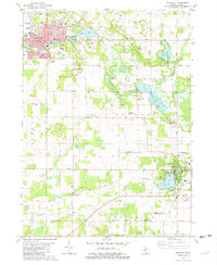 1981 Dowagiac1982 Print · USGSSouthwestern Michigan at the start of the eighties shows a landscape of established lakeside towns and rural colleges. Trace family sites near Dowagiac or Cassopolis, from the Southwestern Michigan College campus to Prospect Hill Cem.
 - 1981 Map of Twin Lakes, 1982 Print
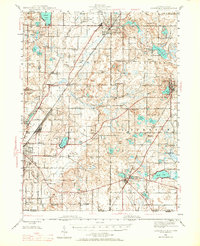
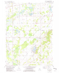 1981 Twin Lakes1982 Print · USGSSouthwestern Michigan’s lake country and the Dowagiac River valley are shown in detail during the early eighties. Researchers can locate family burial sites at North Wayne Cem and Gage Cem or trace the Amtrak line through Glenwood.
 - 1981 Map of Vandalia, 1982 Print
 1981 Vandalia1982 Print · USGSCass County prairie lands and lake shores are documented in the early eighties as rural life centered around the rail lines. Trace family sites at Moon Cem and Geneva Sch or locate the shoreline developments at Diamond Shores.
 - 1981 Map of Decatur, 1982 Print
 1981 Decatur1982 Print · USGSDecatur and the surrounding lake country of Van Buren and Cass Counties are captured here in the early eighties. Genealogists and local researchers can locate numerous country burial grounds and small settlements, including Lakeside Cem, Rose Hill Cem, and the village of Volinia.
 - 1982 Map of Kalamazoo, 1983 Print
 1982 Kalamazoo1983 Print · USGSThe Kalamazoo River valley in the early eighties shows a landscape of growing suburban centers and heavy rail infrastructure. Genealogists and researchers can trace the limits of Kalamazoo and Battle Creek or locate landmarks like Fort Custer National Cemetery and Gull Lake.
 - 1983 Map of South Bend, 1984 Print
 1983 South Bend1984 Print · USGSThe Indiana-Michigan borderlands come alive in this early 1980s overview of the Michiana region's industrial and academic hubs. Researchers can trace the rail networks of Conrail and the Grand Trunk Western alongside landmarks like the University of Notre Dame and Indiana Dunes State Park.2 unique versions available
 - 1985 Map of Elkhart
 1985 Elkhart1985 Print · USGSThe Indiana-Michigan borderlands come into focus in the mid-1980s, showcasing the industrial rail hubs and rural agricultural townships of the St. Joseph valley. Genealogists and historians can trace the growth of Elkhart, Goshen, and Three Rivers, or locate smaller communities like Middlebury and White Pigeon.2 unique versions available
 - 2011 Map of Twin Lakes, 2011 Print
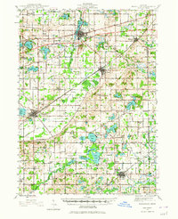
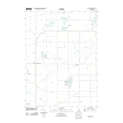 2011 Twin Lakes2011 Print · USGSCovers Wayne Township, including Glenwood, Hamilton Township, and other nearby areas
Showing maps 1-25 of 44
Top cities near Wayne Township
- Niles historical maps
- Dowagiac historical maps
- Paw Paw historical maps
- Keeler historical maps
- Hartford historical maps
- Pokagon historical maps
See more
Top neighborhoods of Wayne Township
Frequently asked questions
- What are the different types of historical maps available for Wayne Township?
- What is the oldest map of Wayne Township?
- Where can I purchase historical maps of Wayne Township for my home or office?
- Where can I download high-res historical maps of Wayne Township?
- Are there historical topographic maps available for Wayne Township?
- Is there historical aerial imagery available for Wayne Township?
- Where are historical maps of Wayne Township sourced from?