1950s Maps of Whitefish Township, Michigan
Explore 17 historic maps of Whitefish Township from the 1950s. These maps offer a rare glimpse into what life looked like during the 1950s — showing old roads, neighborhoods, homes, and landmarks that have changed or disappeared over time.
Whether you're researching your family's past, planning a metal detecting trip, or studying how Whitefish Township's landscape evolved across the 1950s, these high-resolution maps are a powerful tool for exploring the history of this region.
- Focus on a specific era: All maps on this page are from the 1950s, giving you a focused view of this time period.
- See what’s changed: Compare century-old streets, trails, and buildings to today's modern landscape using overlays and satellite layers.
- Research with precision: Use these maps for genealogy, historical research, land use analysis, or educational projects.
- View, download, or print: Maps are fully viewable online in high resolution, and can be downloaded or printed for your own records.
Start exploring Whitefish Township's history through authentic maps from the 1950s. This is your window into the past.
Whitefish Township, MI maps
(17)- 1951 Map of Vermilion SE
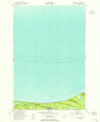 1951 Vermilion SE1951 Print · USGSThe southern shore of Lake Superior in the early 1950s reveals a wild landscape of coastal wetlands and state timberlands. Researchers can trace the intricate shorelines of Weatherhogs Lake, the Cranberry Bogs, and the Whitefish Lake Superior State Forest.2 unique versions available
 - 1951 Map of Shelldrake, 1955 Print
 1951 Shelldrake1955 Print · USGSThe Michigan shoreline of Whitefish Bay comes alive in this early 1950s record of Chippewa County's timberlands. Researchers can trace the coastal outposts of Shelldrake and Paradise or follow the intricate windings of the Betsy River through the state forest.2 unique versions available
 - 1951 Map of Vermilion, 1955 Print
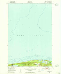 1951 Vermilion1955 Print · USGSThe Lake Superior shoreline near the Chippewa and Luce county line is captured in the early fifties, showing the isolated coastal settlement of Vermilion. Researchers can trace the wooded boundaries of the Whitefish State Forest and locate Browns Lake or the landmark Tower near the coast.2 unique versions available
 - 1951 Map of McNearney Lake, 1955 Print
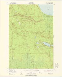
 1951 McNearney Lake1955 Print · USGSUpper Peninsula shoreline meets the deep woods in the early fifties, showing the coastal transition from bay to forest. Researchers can trace the path of Lake Shore Drive or locate landmarks like the McNearney Lake Tower and Naomikong Island.3 unique versions available
 - 1951 Map of Sheephead Lake, 1955 Print
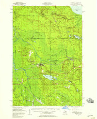
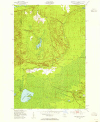 1951 Sheephead Lake1955 Print · USGSNorthern Michigan's forest and wetland interior are documented in the early fifties during a period of state-managed land use. Trace remote sites like the Prison Camp, the Porcupine Inn, and the waters of Sheephead Lake.2 unique versions available
 - 1951 Map of Emerson, 1955 Print
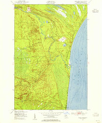
 1951 Emerson1955 Print · USGSCoastal life in Chippewa County flourished along the shores of Whitefish Bay in the early 1950s. Genealogists and historians can trace the foundations of Paradise and Emerson, finding local landmarks such as the Whitefish Sch and Hiawatha Hunt Club.2 unique versions available
 - 1951 Map of Piatt Lake, 1955 Print
 1951 Piatt Lake1955 Print · USGSUpper Peninsula timberlands and the Lake Superior coast are captured here in the early fifties. Local historians can trace the forestry network around Eckerman Lookout Tower or locate the shoreline camps near Tahquamenon Bay and Piatt Lake.3 unique versions available
 - 1951 Map of Big Beaver Creek, 1955 Print
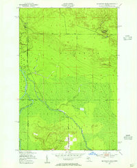 1951 Big Beaver Creek1955 Print · USGSUpper Peninsula timberlands and river systems are captured in the early fifties at the junction of three forests. Researchers can trace the logging history of the region via Cadillac Soo Camp 14, Buckhorn Lodge, and a Sawmill.3 unique versions available
 - 1951 Map of Whitefish Point, 1955 Print
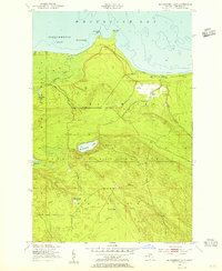
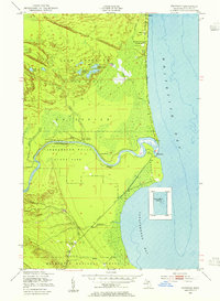
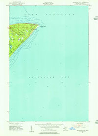 1951 Whitefish Point1955 Print · USGSWhitefish Point at the start of the 1950s remained a critical outpost for Great Lakes mariners. Researchers can trace the coastal layout of the USCG Radio Sta and Fog Warning Sta and the early path of Whitefish Road through the Lake Superior State Forest.2 unique versions available
 - 1951 Map of Timberlost, 1955 Print
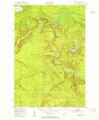 1951 Timberlost1955 Print · USGSThe Upper Peninsula wilderness of the early fifties is defined here by the winding river and the early boundaries of Tahquamenon Falls State Park. Genealogists and local historians can trace isolated settlements and riverside outposts like Timberlost, Whitehorse Landing, and Bowers Lodge.4 unique versions available
 - 1951 Map of Strongs, 1958 Print
 1951 Strongs1958 Print · USGSCoastal Chippewa County is captured here in the early fifties, showing the interplay between Lake Superior's Whitefish Bay and the wooded interior. Genealogists and hikers can locate the Strong Sch, the Demond Hill Lookout Tower, and old camps like Mt. Misery Lodge.
 - 1951 Map of Eckerman, 1958 Print
 1951 Eckerman1958 Print · USGSIn the early 1950s, this portion of Chippewa County remained a landscape of remote sporting camps and timber interests tied to the rail line. Researchers can locate family landmarks like the Hulbert Cem, Eckerman Corner, and the Cadillac Soo Camp 14.2 unique versions available
 - 1951 Map of Shelldrake, 1958 Print
 1951 Shelldrake1958 Print · USGSThe Upper Peninsula coastline is captured in the early fifties, showing the isolated hunting clubs and small fishing outposts of the Whitefish Point area. Genealogists and researchers can trace old settlements like Shelldrake, Emerson, and the Chippewa Hunt Post.
 - 1954 Map of Sault Sainte Marie, 1979 Print
 1954 Sault Sainte Marie1979 Print · USGSThe Eastern Upper Peninsula and Ontario borderlands are captured here at the height of the mid-century era. Family historians can trace settlements like Grand Marais and Stalwart, while mapping the strategic grounds of Kincheloe AFB.3 unique versions available
 - 1956 Map of Sault Sainte Marie, 1964 Print
 1956 Sault Sainte Marie1964 Print · USGSThe Eastern Upper Peninsula and the Canadian border meet in this mid-sixties survey of the bustling Soo Locks region. Genealogists and historians can trace the paths of the Soo Line and locate lakeside communities from Grand Marais to Shelldrake.2 unique versions available
 - 1957 Map of Sault Sainte Marie
 1957 Sault Sainte Marie1957 Print · USGSThe Upper Peninsula and Ontario border come alive in this mid-century portrait of the eastern Lake Superior shoreline and the vital St. Marys River corridor. Genealogists and historians can trace rail-era settlements from Newberry to Detour, while locating military landmarks like Kinross Air Force Base.
 - 1958 Map of Sault Sainte Marie
 1958 Sault Sainte Marie1958 Print · USGSThe eastern Upper Peninsula and the Canadian borderland appear here during the late fifties, a time of military growth and forest management. Researchers can locate vanished rail stops along the Soo Line, early sites like the Fiborn Quarry, and the sprawling Kinross Air Force Base.
End of results
Showing maps 1-17 of 17
Top neighborhoods of Whitefish Township
- Paradise historical maps
- Timberlost historical maps
- Emerson historical maps
- Vermilion historical maps
- Whitehouse Landing historical maps
- Snug Harbor historical maps
See more
Frequently asked questions
- What are the different types of historical maps available for Whitefish Township?
- What is the oldest map of Whitefish Township?
- Where can I purchase historical maps of Whitefish Township for my home or office?
- Where can I download high-res historical maps of Whitefish Township?
- Are there historical topographic maps available for Whitefish Township?
- Is there historical aerial imagery available for Whitefish Township?
- Where are historical maps of Whitefish Township sourced from?