Old Maps of Delta County, Michigan
Explore 318 old maps of Delta County, spanning from 1931 to today. These high-resolution historic maps reveal how streets, neighborhoods, landmarks, and natural features evolved over time — perfect for genealogy, metal detecting, research, and local history exploration.
What you can do with these maps:
- See how Delta County changed over time: Compare historical maps to modern-day views to trace roads, homesites, rail lines & more.
- View detailed metadata: Each map includes creators, publishers, year, scale, and archive source.
- Overlay maps with satellite & LiDAR: Visualize the past alongside modern tools to explore terrain & human change.
- Trusted historical sources: Maps sourced from the USGS, Library of Congress, and other archives.
- Access maps your way: View online, download high-res files, or order prints for personal or research use.
Start exploring old maps of Delta County to uncover forgotten places, hidden landmarks, and the deep history beneath your feet.
Delta County, MI maps
(318)- 1931 Map of Steuben SW
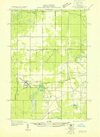
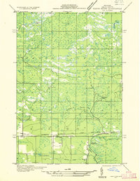
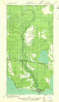
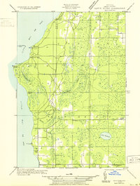
 1931 Steuben SW1931 Print · USGSThe Upper Peninsula wilderness in the early 1930s is documented here through a dense network of glacial lakes and river systems. Historians and outdoor researchers can trace the old water routes of the Indian River and locate landmarks like Thunder Lake and Frankes Lake.
 - 1931 Map of Cooks NW
 1931 Cooks NW1931 Print · USGSThe Upper Peninsula wilderness around the Delta and Schoolcraft county line comes into focus in the early 1930s. Genealogists and local historians can trace rural life through the Cooks Sch, the Seventh Day Adventist Sch, and the rail stops of Cooks and Elkhorn.
 - 1931 Map of Steuben NW
 1931 Steuben NW1931 Print · USGSThe Upper Peninsula wilderness in the early 1930s is defined here by its intricate network of lakes and the essential Manistique and Lake Superior railroad. You can trace the development of the Steuben settlement or locate historic camps like Jack Pine Lodge and the Woods Club along the Indian River.
 - 1931 Map of Skeels Lake NE
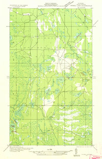
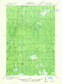
 1931 Skeels Lake NE1931 Print · USGSThe Upper Peninsula wilderness of the early thirties is captured here as a labyrinth of glacial waters. Researchers can trace the winding Indian River and locate remote landmarks like Hill Tower, Skeels Lake, and Straits Lake.
 - 1932 Map of Burnt Bluff SW
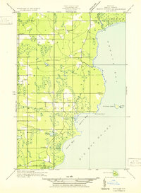
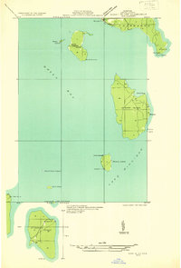 1932 Burnt Bluff SW1932 Print · USGSThe islands of northern Green Bay are captured here in the early thirties, showing a critical maritime landscape of lighthouses and isolated outposts. Trace historic navigation markers and coastal settlements like Fairport, ST MARTIN LH, and Summer Island.
 - 1932 Map of Gladstone NE
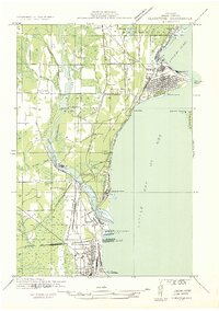
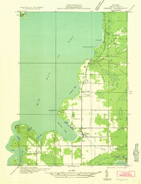
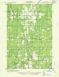 1932 Gladstone NE1932 Print · USGSThe Delta County timberlands and rail corridors are captured here in the early 1930s. Genealogists and researchers can trace the locations of family-named landmarks like Youngs School, Chaison School, and the St Josephs Cem near Perkins.2 unique versions available
 - 1932 Map of Rock SW
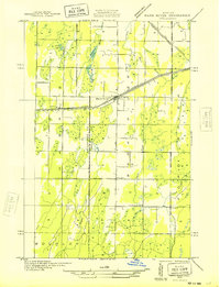
 1932 Rock SW1932 Print · USGSUpper Peninsula timber and transit define this 1930s landscape near the Marquette and Delta county line. You can trace the rural school system from North Finn Sch down to St Nicholas Sch or locate family plots at ROCK CEM near the village of Rock.
 - 1932 Map of Rapid River NE
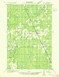
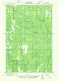
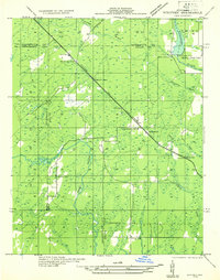
 1932 Rapid River NE1932 Print · USGSDelta County's central timber and transit corridors are captured here in the early thirties as the Soo Line railroad connected rural townships. Researchers can pinpoint Ensign, find the Ogontz Cem, and trace the winding Ogontz River past the Seven Mile Dam.
 - 1932 Map of Burnt Bluff NE
 1932 Burnt Bluff NE1932 Print · USGSThe Delta County coast comes into focus in the early 1930s as aerial photography begins to modernize Great Lakes mapping. Researchers can trace the rural landscape around Devils Corner and the marshy shores of Portage Bay and Sucker Lake.
 - 1932 Map of Trenary SW
 1932 Trenary SW1932 Print · USGSDelta County timber and transit are captured here in the early thirties as logging camps dotted the Upper Peninsula forest. Genealogists and historians can trace the locations of Dave Woods Camp, Mills Sch, and the unique Dutch Mill along the Rapid River.
 - 1932 Map of Burnt Bluff NW
 1932 Burnt Bluff NW1932 Print · USGSThe Garden Peninsula’s coastline is captured here in the early thirties as a landscape of isolated harbors and rural schoolhouses. Researchers can locate vanished landmarks like the Burnt Bluff Sch, St Josephs Ch, and the coastal settlement at Sac Bay.
 - 1932 Map of Garden NW and SW
 1932 Garden NW and SW1932 Print · USGSThe Delta County coast and Sturgeon River valley come alive in the 1930s, documenting a landscape shaped by the timber industry. Researchers can trace the layout of Nahma, find family-named sites like Larson Sch, and locate remote logging outposts like Jobbers Camp.
 - 1932 Map of Rock NE
 1932 Rock NE1932 Print · USGSThe timber-heavy border between Alger and Delta Counties comes to life in the early thirties. Trace the legacy of old logging camps and homesteads like Suomi Camp, Gould Homestead, and the Osier Sch along the Chicago and Northwestern rail line.
 - 1932 Map of Skeels Lake SE
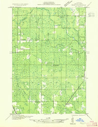
 1932 Skeels Lake SE1932 Print · USGSDelta County's backcountry is captured here during the early years of the National Forest system, showing a landscape defined by timber camps and glacial lakes. Local historians can trace the logging-era heritage through sites like Camp No 41 Lake and the winding course of the Northeast Branch Fishdam River.
 - 1932 Map of Gladstone SE
 1932 Gladstone SE1932 Print · USGSThe industrial shoreline of Delta County is captured here in the early thirties as the timber and ore trade shaped the coast. Genealogists can locate family landmarks like Fernwood Cem or Soo Hill Sch while tracing the massive C & NW Docks and rail lines.2 unique versions available
 - 1932 Map of Bark River NE
 1932 Bark River NE1932 Print · USGSUpper Peninsula life in the early 1930s centered on the rail-and-highway corridor through Harris and Bark River. Local historians can trace the early townships of Gourley and Harris, locating rural landmarks like Sunnyside Sch and Riverside Sch.2 unique versions available
 - 1932 Map of Garden SE
 1932 Garden SE1932 Print · USGSThe eastern shores of Big Bay de Noc appear in the early thirties, showing a coastal landscape of timber and small harbors. Genealogists can trace family footprints at Kates Bay Sch, Vans Harbor, and the Kates Bay Cem.
 - 1932 Map of Rapid River NW
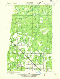
 1932 Rapid River NW1932 Print · USGSUpper Peninsula life in the early thirties centers on the confluence of rivers and rails at the head of Little Bay De Noc. Genealogists can trace family footprints at Bethany Ch, Rapid River Cem, and local schools like Fuhirman Sch.2 unique versions available
 - 1932 Map of Trenary SE
 1932 Trenary SE1932 Print · USGSDelta County was a hub of Northwoods logging during the early thirties, where timber camps and rail spurs threaded through the forest. Genealogists and historians can trace the locations of Mc Donald Camp, Schultz Camp, and the Nahma & Northern railroad.
 - 1932 Map of Rock SE
 1932 Rock SE1932 Print · USGSThe timber and rail landscapes of Delta County come alive in this early 1930s survey of the Rapid River country. Genealogists and historians can trace family sites like Coty Homestead or locate industrial landmarks such as Clearman Mill and Osier Sch.
 - 1932 Map of Rapid River SE
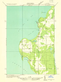
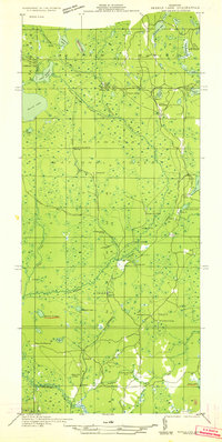
 1932 Rapid River SE1932 Print · USGSThe northern shores of Big Bay de Noc appear in the early 1930s as a quiet landscape of coastal marshes and timberlands. Local researchers can trace family roots at Grange Hall, visit the Silver Dale Sch, or locate old camps like Camp Ruh and Indian Town Lake.
 - 1932 Map of Whitney NE
 1932 Whitney NE1932 Print · USGSThe Upper Peninsula interior during the early 1930s was a landscape of timber-hauling railroads and remote hydro projects. Researchers can locate small communities like Woodlawn and Hendricks or trace the schools and dams along the Escanaba River.
 - 1932 Map of Whitney SE
 1932 Whitney SE1932 Print · USGSLower Peninsula timber country comes to life in this early 1930s survey of the Menominee and Delta county line. Genealogists can trace family roots at Schaffer Cem or locate the old Tenmile Sch and Eustis Sta along the historic rail lines.
 - 1932 Map of Skeels Lake NW and SW
 1932 Skeels Lake NW and SW1932 Print · USGSUpper Peninsula timberlands and early recreational camps appear in this early 1930s survey of the Alger and Delta county line. Genealogists and historians can trace the Nahma and Northern railroad to isolated outposts like Allens Homestead and Buckhorn Lodge.
 - 1932 Map of Rapid River SW
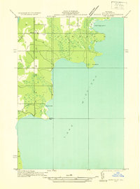
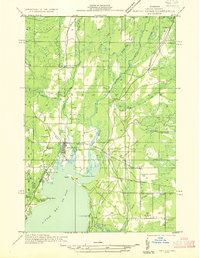
 1932 Rapid River SW1932 Print · USGSThe Delta County coast at the start of the 1930s shows a quiet maritime and rural landscape along the northern reaches of Lake Michigan. Researchers can locate coastal landmarks like Squaw Point LH alongside inland community sites like Grange Hall and the Lakewood Cem.
Showing maps 1-25 of 318
Top cities of Delta County
Frequently asked questions
- What are the different types of historical maps available for Delta County?
- What is the oldest map of Delta County?
- Where can I purchase historical maps of Delta County for my home or office?
- Where can I download high-res historical maps of Delta County?
- Are there historical topographic maps available for Delta County?
- Is there historical aerial imagery available for Delta County?
- Where are historical maps of Delta County sourced from?