2020s Maps of Delta County, Michigan
Explore 45 historic maps of Delta County from the 2020s. These maps offer a rare glimpse into what life looked like during the 2020s — showing old roads, neighborhoods, homes, and landmarks that have changed or disappeared over time.
Whether you're researching your family's past, planning a metal detecting trip, or studying how Delta County's landscape evolved across the 2020s, these high-resolution maps are a powerful tool for exploring the history of this region.
- Focus on a specific era: All maps on this page are from the 2020s, giving you a focused view of this time period.
- See what’s changed: Compare century-old streets, trails, and buildings to today's modern landscape using overlays and satellite layers.
- Research with precision: Use these maps for genealogy, historical research, land use analysis, or educational projects.
- View, download, or print: Maps are fully viewable online in high resolution, and can be downloaded or printed for your own records.
Start exploring Delta County's history through authentic maps from the 2020s. This is your window into the past.
Delta County, MI maps
(45)- 2022 Map of Washington Island NE, 2022 Print
 2022 Washington Island NE2022 Print · USGSThe islands and passages of the Door County archipelago are documented here in the early twenty-first century. Researchers can trace land tracts near Jackson Harbor or locate the historic Saint Martin Island Cem on the northern islands.
 - 2023 Map of Henderson Lakes, 2023 Print
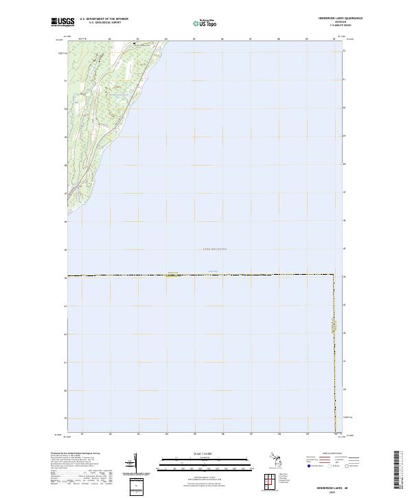 2023 Henderson Lakes2023 Print · USGSThe Lake Michigan shoreline and the bay waters of Delta County are captured here in the early 2020s. Researchers can locate the South Ford River Cem or trace the Bark River as it winds near the Henderson Lakes along the Menominee County line.
 - 2023 Map of Fairport, 2023 Print
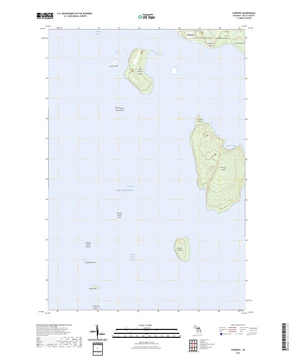 2023 Fairport2023 Print · USGSThe southern tip of the Garden Peninsula meets the island chains of Lake Michigan in this contemporary survey. Maritime researchers can trace the shorelines of Summer Island, locate the remote Poverty Island, and identify the small fishing settlement at Fairport.
 - 2023 Map of Washington Island NE OE N, 2023 Print
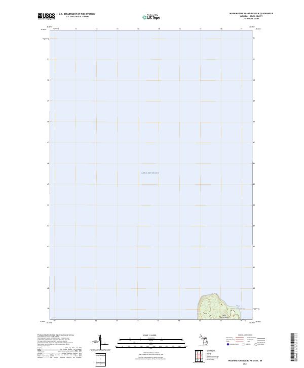 2023 Washington Island NE OE N2023 Print · USGSDelta County's maritime boundary comes into focus in this recent survey of the northern Green Bay waters. Researchers can trace the shoreline and elevation of Saint Martin Island and the navigable depths of the Saint Martin Island Passage.
 - 2023 Map of Seagull Point, 2023 Print
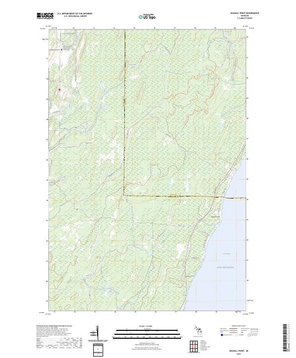 2023 Seagull Point2023 Print · USGSThe Menominee County shoreline meets the waters of Green Bay in this recent survey of the Michigan coast. Genealogists and local historians can locate the Wilson Seventh Day Adventist Church Cem or trace the path of the Cedar River and Sevenmile Marsh.
 - 2023 Map of Nahma, 2023 Print
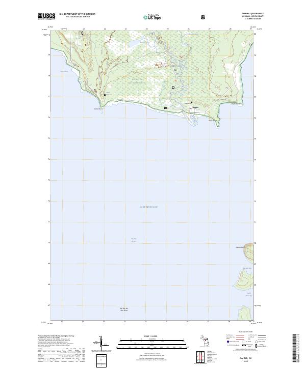 2023 Nahma2023 Print · USGSNahma and the Sturgeon River mouth are captured in this modern survey of the Big Bay de Noc shoreline. Researchers can trace the coastal geography of the Hiawatha National Forest and locate historical sites like Indian Point Cem and Nahma Cem.
 - 2023 Map of Maywood, 2023 Print
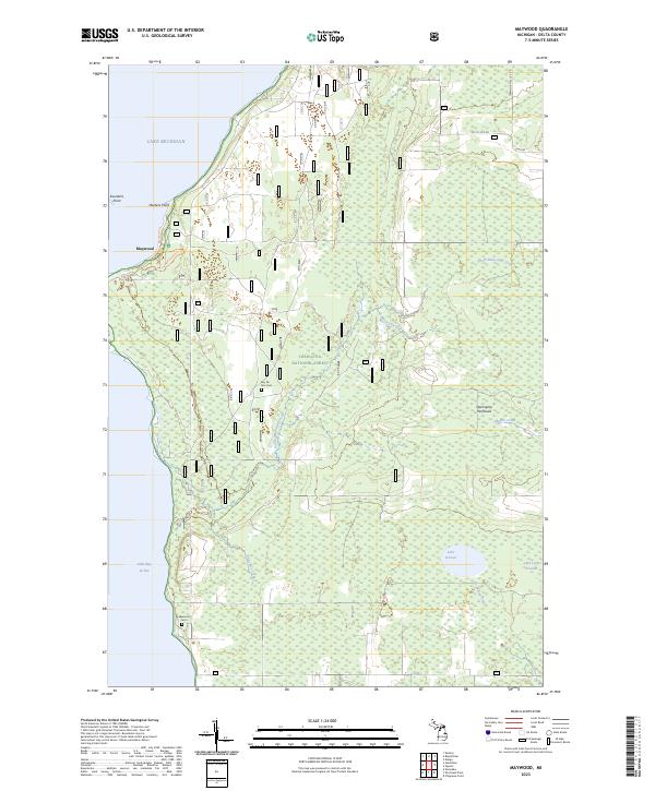 2023 Maywood2023 Print · USGSThe Stonington Peninsula waterfront and the Hiawatha National Forest are documented here in recent years. Researchers can trace local history at Bay De Noc Cem or explore the coast near Maywood and Saunders Point.
 - 2023 Map of Chippewa Point, 2023 Print
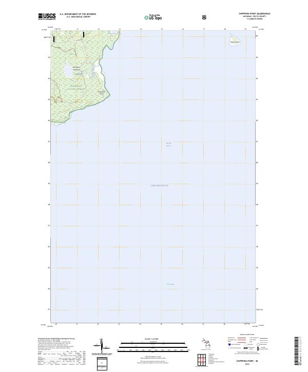 2023 Chippewa Point2023 Print · USGSDelta County's eastern shoreline is documented in this recent survey of the Stonington Peninsula and its surrounding bays. Local historians can trace the bounds of the Hiawatha National Forest near Chippewa Point and Indian Town Lake.
 - 2023 Map of Chandler, 2023 Print
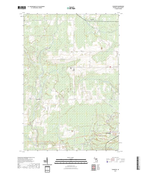 2023 Chandler2023 Print · USGSDelta County's rural interior is captured in this recent survey, showing the forested reaches north of the regional hub of Escanaba. Researchers can trace old section lines and property boundaries near the Flat Rock Cem or follow the Felch Grade Route Trail.
 - 2023 Map of Garden, 2023 Print
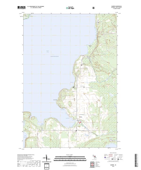 2023 Garden2023 Print · USGSThe Garden Peninsula comes to life in this modern survey of Delta County, showing the intersection of coastal life and the northern forest. Researchers can trace family history through numerous burial sites like Kates Bay Cem and New Garden Cem near Garden Bay.
 - 2023 Map of Ensign, 2023 Print
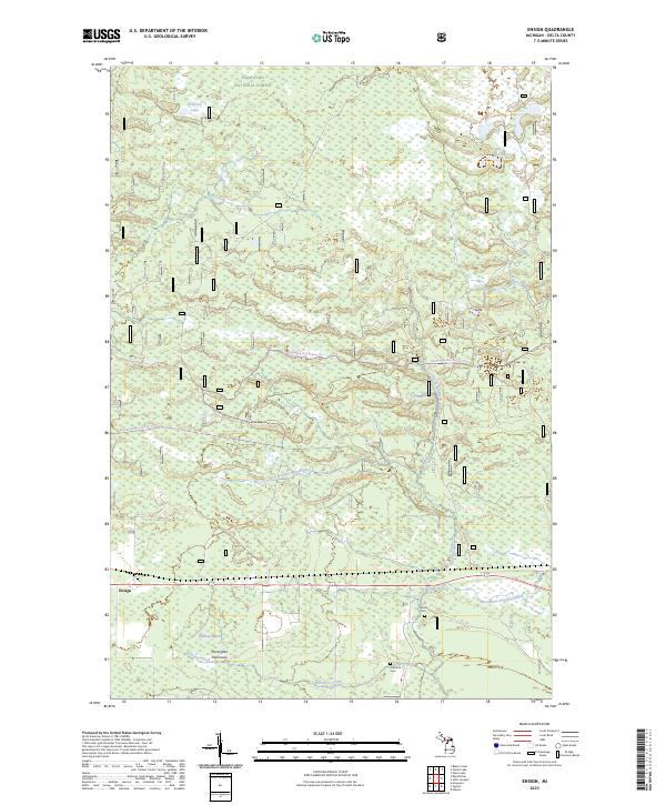 2023 Ensign2023 Print · USGSThe northern Stonington Peninsula comes into focus during this contemporary survey of Delta County's forested wetlands. Researchers can locate family landmarks such as the Johnston Cem, trace the headwaters of the Ogontz River, and explore the rural layout around Ensign.
 - 2023 Map of Bark River, 2023 Print
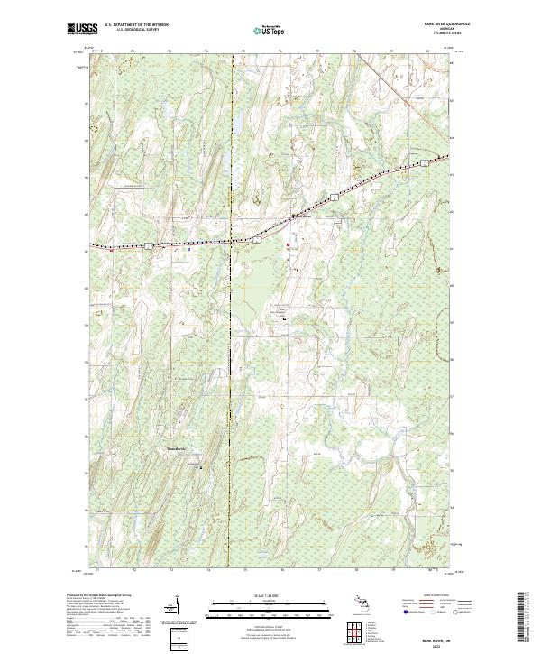 2023 Bark River2023 Print · USGSUpper Peninsula life in Delta and Menominee counties is centered on the settlements of Bark River and Hannahville in the 2020s. Genealogists and historians can trace local family markers at the Bark River Township Cem and follow the old rail alignment of the Felch Grade Route Trl.
 - 2023 Map of Garden Corners, 2023 Print
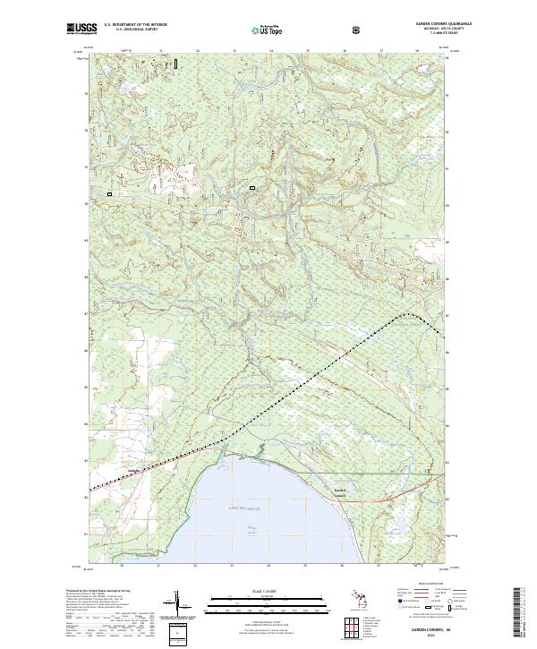 2023 Garden Corners2023 Print · USGSThe northern reaches of Big Bay de Noc in Delta County come into sharp focus in this recent survey. Researchers can trace the drainage of the Fishdam River and locate the small communities of Isabella and Garden Corners along the Lake Michigan shoreline.
 - 2023 Map of Escanaba, 2023 Print
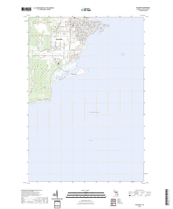 2023 Escanaba2023 Print · USGSEscanaba sits at the edge of Little Bay de Noc in this recent survey of Delta County's urban and coastal landscape. Researchers can trace the city's detailed street grid, locate the Delta County Courthouse, and find local landmarks like Lakeview Cem and Sand Point.
 - 2023 Map of Peninsula Point, 2023 Print
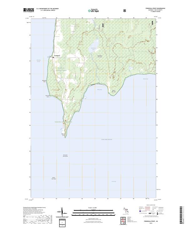 2023 Peninsula Point2023 Print · USGSThe Stonington Peninsula reaches into Lake Michigan during the 2020s, a landscape defined by forest and shore. Genealogists and hikers can trace the Lakeview Cem, the trails of Hiawatha National Forest, and the remote Peninsula Point.
 - 2023 Map of Devils Corner, 2023 Print
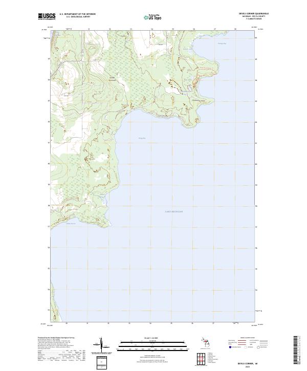 2023 Devils Corner2023 Print · USGSThe Delta County coast at the Garden Peninsula is revealed in this modern survey of the Lake Michigan shoreline. Researchers can trace the winding Ninga Aki Pathway Trl and identify coastal landmarks like Charboneau Point and the quiet waters of Gillnet Haven.
 - 2023 Map of Schaffer, 2023 Print
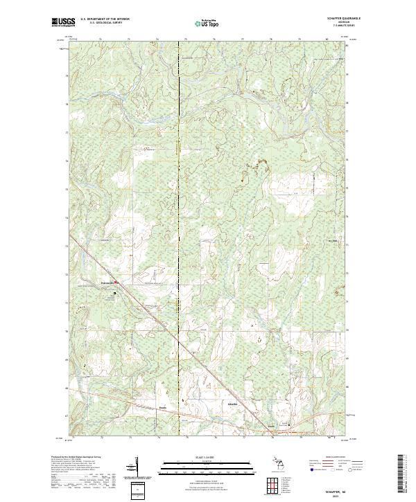 2023 Schaffer2023 Print · USGSThe rural landscapes of Delta and Menominee Counties are showcased in this recent survey of the Michigan Upper Peninsula. Researchers can trace the heritage of small settlements like Perronville and Schaffer or locate burial sites at Sacred Heart Cem.
 - 2023 Map of Ford River, 2023 Print
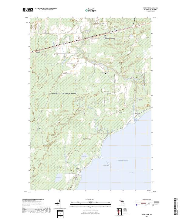 2023 Ford River2023 Print · USGSThe Delta County shoreline and the lower reaches of the Ford River are captured here in the early 2020s. Researchers can trace the modern paths of the Felch Grade Route-Trl or locate the West Ford River Cem and the settlement at Narenta.
 - 2023 Map of Saint Jacques, 2023 Print
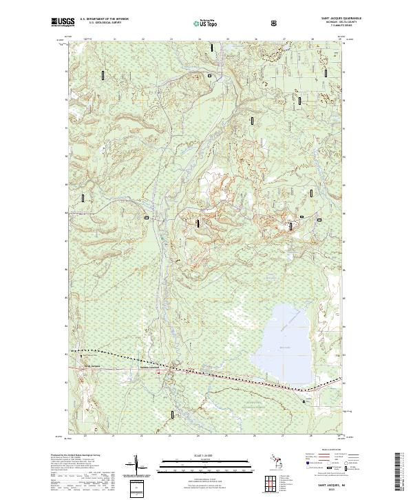 2023 Saint Jacques2023 Print · USGSThe Sturgeon River corridor and the settlement of Saint Jacques are shown in detail on this modern survey of the Hiawatha National Forest. Researchers can find Saint Jacques Cem, Isabella Cem, and the old Nahma Junction rail crossing.
 - 2023 Map of Point Detour, 2023 Print
 2023 Point Detour2023 Print · USGSThe southern tip of the Garden Peninsula meets the open waters of Lake Michigan in this coastal survey. Genealogists and maritime historians can trace the shoreline at Point Detour and the isolated geography of Summer Island.
 - 2023 Map of Rapid River, 2023 Print
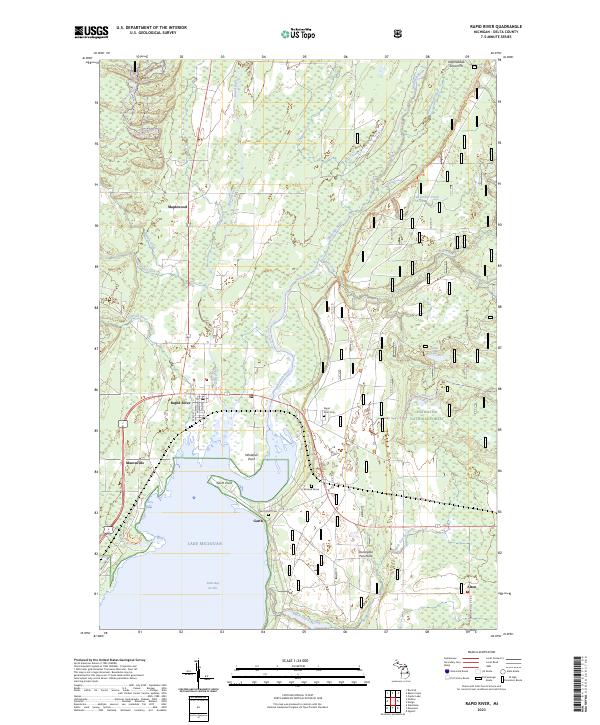 2023 Rapid River2023 Print · USGSThe northern reaches of Little Bay de Noc are captured here in the early twenty-first century, showing the confluence of the Rapid River and Whitefish River. Genealogists and local historians can locate the Rapid River Cem, the isolated McLeod Grave, and old settlement sites like Garth and Masonville.
 - 2023 Map of Waco Lake, 2023 Print
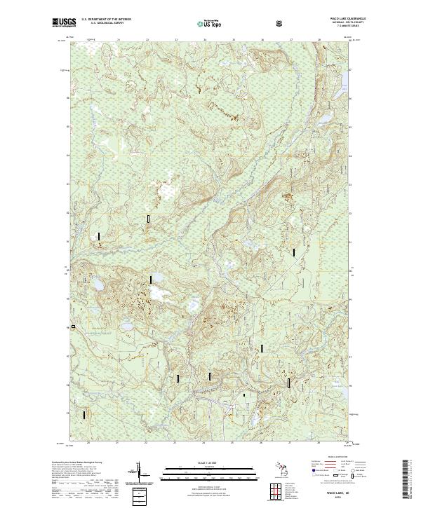 2023 Waco Lake2023 Print · USGSDelta County's forested interior is captured here in the early twenty-first century, showcasing a preserved wilderness of wetlands and glacial lakes. You can trace the path of the Nahma Grade Sno-mo Tr or locate remote water bodies like Waco Lake and Billy Good Lake.
 - 2023 Map of Thunder Lake, 2023 Print
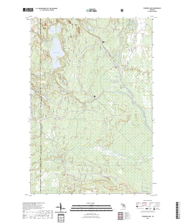 2023 Thunder Lake2023 Print · USGSThe northern Michigan wilderness at the Delta and Schoolcraft county line is revealed in this contemporary survey of the Hiawatha National Forest. Outdoor enthusiasts and historians can trace an intricate network of waterways and trails, from the Indian Wild and Scenic River to the Big Spring-baldy Lake Snomo Trl.
 - 2023 Map of McFarland, 2023 Print
 2023 McFarland2023 Print · USGSThis Upper Peninsula landscape near the Marquette and Delta County line showcases the small settlements of McFarland and Lathrop in the early 2020s. Researchers can locate Hillview Cem and Lathrop Cem or trace the old Stack Grade through the wetlands.
 - 2023 Map of Baker Creek, 2023 Print
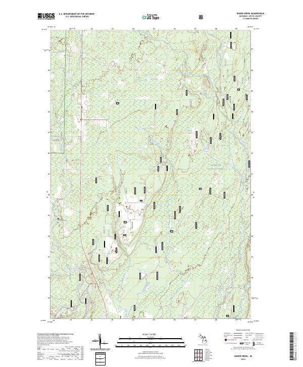 2023 Baker Creek2023 Print · USGSThe Delta County timberlands of the Upper Peninsula are documented here in a contemporary era of conservation and recreation. Researchers can locate the Dutch Mill Cem and trace the paths of the Whitefish Wild and Scenic River and Rapid River Falls.
Showing maps 1-25 of 45
Top cities of Delta County
Frequently asked questions
- What are the different types of historical maps available for Delta County?
- What is the oldest map of Delta County?
- Where can I purchase historical maps of Delta County for my home or office?
- Where can I download high-res historical maps of Delta County?
- Are there historical topographic maps available for Delta County?
- Is there historical aerial imagery available for Delta County?
- Where are historical maps of Delta County sourced from?