Old Maps of Dickinson County, Michigan for Genealogy
Trace your family roots with 162 historic maps of Dickinson County. These high-res maps reveal old neighborhoods, homesites, landmarks, and streets — helping you uncover where your ancestors lived and how the area evolved over time.
- Explore historic neighborhoods: Identify where your relatives may have lived in the 1800s or 1900s.
- Compare maps over time: Trace the changes in streets, buildings, and landmarks for multi-generational research.
- Perfect for genealogy & ancestry research: Used by family historians and researchers to map out lineage and migration.
These maps are an incredible resource for exploring your personal connection to Dickinson County's past.
Dickinson County, MI maps
(162)- 1899 Map of Sagola
 1899 Sagola1899 Print · USGSIron and Dickinson counties were defined by the expansion of the rail-and-river economy in the late nineteenth century. Genealogists and historians can trace the early layouts of Channing, Sagola, and Mansfield alongside the winding Michigamme River.3 unique versions available
 - 1939 Map of Pembine, 1941 Print
 1939 Pembine1941 Print · USGSThe Menominee River borderlands in the late thirties showcase a landscape of granite quarries, rail junctions, and river falls. Trace early settlements and infrastructure including Pembine, the Chalk Hill Dam, and the St Anthony Cem.2 unique versions available
 - 1939 Map of Iron Mountain, 1963 Print
 1939 Iron Mountain1963 Print · USGSThe Menominee River borderlands at the end of the 1930s show a landscape of hydroelectric power and deep-woods settlements. Genealogists and historians can trace rural school districts like Golden Rule Sch and early industrial sites such as the Henry Ford Dam.
 - 1941 Map of Iron Mountain
 1941 Iron Mountain1941 Print · USGSThe Menominee River borderlands thrive with hydroelectric power and iron mining during the late thirties. Genealogists can trace family footprints at Woodlawn Cem or find early rural schoolhouses like Golden Rule Sch and Hauserman Sch.
 - 1947 Map of Pembine
 1947 Pembine1947 Print · USGSMarinette County was a landscape of stone quarries and timber-line railroads just after World War II. Researchers can trace rural life through sites like Dixon Sch, the Reformatory Quarry, and the Mission Chapel near Kremlin.
 - 1947 Map of Iron Mountain
 1947 Iron Mountain1947 Print · USGSAs the post-war industrial era took hold, this borderland map reveals a landscape of hydroelectric dams and iron-town settlements along the Menominee River. Genealogists and local historians can locate several rural schoolhouses, including Golden Rule Sch and Roach Sch, and trace the path of the Chicago and Northwestern Railroad.
 - 1954 Map of Iron Mountain, 1964 Print
 1954 Iron Mountain1964 Print · USGSUpper Michigan and Northeastern Wisconsin are shown in detail during the mid-fifties, when the logging and mining economies still moved by rail. Trace the rail lines of the Soo Line to remote stops like Koepenick Station or explore the Iron Range near Iron Mountain.2 unique versions available
 - 1954 Map of Escanaba, 1967 Print
 1954 Escanaba1967 Print · USGSThe Upper Peninsula and Door County shorelines meet here in the mid-fifties, showing the vital maritime and timber networks of the Great Lakes. Researchers can trace historic rail lines, old fire lookouts like the Stonington Fire Tower, and island settlements such as Washington Island.2 unique versions available
 - 1955 Map of Ralph NW, 1956 Print
 1955 Ralph NW1956 Print · USGSUpper Peninsula timberlands and river valleys are captured here in the mid-fifties at the Marquette and Dickinson county line. Trace the route of the Escanaba and Lake Superior railroad through the Sturgeon River State Forest and along the Ford River.3 unique versions available
 - 1955 Map of Ralph NE, 1956 Print
 1955 Ralph NE1956 Print · USGSThe Dickinson and Marquette county line appears here in the mid-1950s, showing a remote landscape shaped by state forestry and river systems. Researchers can locate the Willit Run Landing Field and the Escanaba River Lookout Tower among the winding bends of the North Branch Ford River.3 unique versions available
 - 1955 Map of Norway, 1957 Print
 1955 Norway1957 Print · USGSMid-century Dickinson County was a landscape defined by its iron-mining heritage and the powerful Menominee River. Genealogists and industrial historians can trace inactive sites like Aragon Mine or find ancestors at St Anthony Cem and Norway Cemetery.3 unique versions available
 - 1955 Map of Vulcan, 1957 Print
 1955 Vulcan1957 Print · USGSMid-century Dickinson County was a hub of Menominee Range iron mining and heavy rail activity. Genealogists and industrial historians can trace the foundations of Vulcan and Loretto, or locate the specific footprints of the Loretta Mine and Appleton Mine.2 unique versions available
 - 1955 Map of Norway, 1957 Print
 1955 Norway1957 Print · USGSUpper Peninsula mining towns and state forests thrive in the mid-fifties as the rail-and-river economy transitions. Researchers can trace the industrial footprint of the Aragon Mine, find the Norway Sch, and locate the St Anthony Cem.3 unique versions available
 - 1955 Map of Randville, 1957 Print
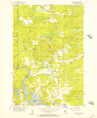 1955 Randville1957 Print · USGSThe Michigan-Wisconsin borderlands come alive in the mid-1950s as the rail-and-timber economy defines the landscape. Trace the Milwaukee Road through settlements like Randville and Merriman or locate early lakeside landmarks near Badwater Lake.3 unique versions available
 - 1955 Map of Ralph, 1957 Print
 1955 Ralph1957 Print · USGSUpper Peninsula timber and rail life come into focus in the mid-1950s around the Dickinson and Marquette county line. Researchers can trace the Escanaba and Lake Superior line to local hubs like Ralph and Stafford, or locate the Ralph Cem.3 unique versions available
 - 1955 Map of Iron Mountain, 1957 Print
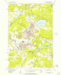 1955 Iron Mountain1957 Print · USGSIron Mountain and Kingsford thrive as industrial hubs in the mid-fifties, shaped by deep-shaft mining and the Menominee River. Genealogists can locate family homes near the American Martyrs Sch or trace the rail sidings serving the Trader Mine and Globe Mine.3 unique versions available
 - 1955 Map of Channing, 1957 Print
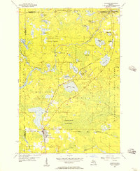 1955 Channing1957 Print · USGSUpper Peninsula timber and rail country come alive in the mid-1950s at the junction of two major rail lines. Genealogists can locate the Channing Cem and trace small settlements like Floodwood and Golden along the Michigamme River.2 unique versions available
 - 1956 Map of Sagola, 1957 Print
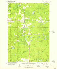 1956 Sagola1957 Print · USGSThe settlement of Sagola stands as a mid-century logging and rail crossroads in the Upper Peninsula. Trace the route of the Chicago Milwaukee St Paul and Pacific railroad through the Sturgeon River State Forest past Tobey Lake and the local Lookout Tower.
 - 1956 Map of Foster City, 1957 Print
 1956 Foster City1957 Print · USGSNorthern Menominee County is seen here during the mid-fifties, dominated by timber management and rail transit. Genealogists can trace the early community at Foster City or locate family plots at the Waucedah Township Cem.3 unique versions available
 - 1956 Map of Sagola, 1957 Print
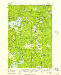 1956 Sagola1957 Print · USGSUpper Peninsula timber and rail history converge in the mid-fifties at the junction of the Chicago and North Western Railway. Trace the footprints of logging and mining settlements at Channing, Mansfield Location, and the McMillan Camp.
 - 1957 Map of Escanaba
 1957 Escanaba1957 Print · USGSThe Upper Peninsula and Door County shorelines meet in the mid-fifties, capturing a landscape of timber, iron, and maritime trade. Genealogists and local historians can trace the Chicago & North Western RR through settlements like Hermansville or locate St Vitals Church and the Potawatome Indian Reservation.
 - 1957 Map of Northland, 1958 Print
 1957 Northland1958 Print · USGSThe Upper Peninsula interior shows its mid-century character during the late 1950s, where rail lines still connected remote forest outposts. Trace the old rail stops at Northland and Alfred or locate the Alfred Lookout Tower and Education Camp near the Ford River.2 unique versions available
 - 1958 Map of Escanaba
 1958 Escanaba1958 Print · USGSNorthern Lake Michigan maritime commerce and timberlands are captured here in the mid-fifties. Genealogists and historians can trace rail networks like the Escanaba and Lake Superior or locate island settlements such as Detroit Harbor and Fish Creek.
 - 1958 Map of Marquette, 1968 Print
 1958 Marquette1968 Print · USGSThe Upper Peninsula’s central corridor is captured here in the mid-twentieth century as mining and timber industries thrived alongside new military installations. Genealogists and historians can trace the rail lines of the Soo Line Railroad through settlements like Gwinn, Turin, and Chatham.2 unique versions available
 - 1958 Map of Iron River, 1968 Print
 1958 Iron River1968 Print · USGSThe Upper Peninsula in the late fifties is captured here as a landscape of timber, iron, and rail. Genealogists and historians can trace rail stops like Mass Station or explore the coastlines of Lake Gogebic and Keweenaw Bay.3 unique versions available
Showing maps 1-25 of 162
Top cities of Dickinson County
Frequently asked questions
- What are the different types of historical maps available for Dickinson County?
- What is the oldest map of Dickinson County?
- Where can I purchase historical maps of Dickinson County for my home or office?
- Where can I download high-res historical maps of Dickinson County?
- Are there historical topographic maps available for Dickinson County?
- Is there historical aerial imagery available for Dickinson County?
- Where are historical maps of Dickinson County sourced from?