2020s Maps of Bliss Township, Michigan
Explore 5 historic maps of Bliss Township from the 2020s. These maps offer a rare glimpse into what life looked like during the 2020s — showing old roads, neighborhoods, homes, and landmarks that have changed or disappeared over time.
Whether you're researching your family's past, planning a metal detecting trip, or studying how Bliss Township's landscape evolved across the 2020s, these high-resolution maps are a powerful tool for exploring the history of this region.
- Focus on a specific era: All maps on this page are from the 2020s, giving you a focused view of this time period.
- See what’s changed: Compare century-old streets, trails, and buildings to today's modern landscape using overlays and satellite layers.
- Research with precision: Use these maps for genealogy, historical research, land use analysis, or educational projects.
- View, download, or print: Maps are fully viewable online in high resolution, and can be downloaded or printed for your own records.
Start exploring Bliss Township's history through authentic maps from the 2020s. This is your window into the past.
Bliss Township, MI maps
(5)- 2023 Map of Big Stone Bay, 2023 Print
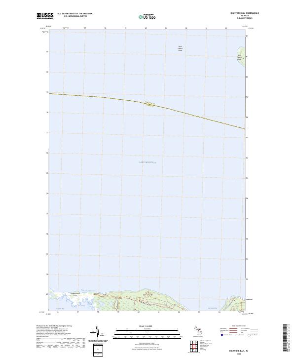 2023 Big Stone Bay2023 Print · USGSThe Straits of Mackinac shoreline comes into sharp focus in this recent survey of the Emmet County coast. Researchers can trace the protected reaches of Wilderness State Park, from Waugoshance Point to the remote Saint Helena Island.
 - 2023 Map of Levering, 2023 Print
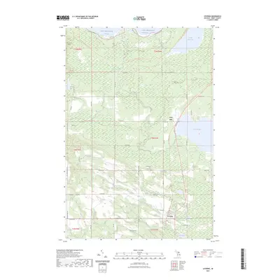 2023 Levering2023 Print · USGSNorthern Emmet County is captured here in the early twenty-first century, showing the lakefront communities between the Straits of Mackinac and the inland woods. Researchers can trace local lineage at the Levering and Carp Lake Cem or explore the routes of the North Western State Trl near Lake Paradise.
 - 2023 Map of Bliss, 2023 Print
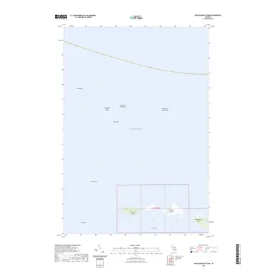
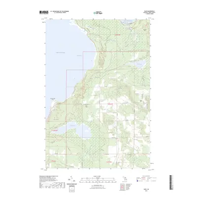 2023 Bliss2023 Print · USGSThe northwestern tip of the Lower Peninsula is captured here in the early 2020s, showing the intersection of coastal wetlands and rural crossroads. Researchers can locate the Bliss Township Cem near the town of Bliss or trace the drainage from Wycamp Lake toward Sturgeon Bay.
 - 2023 Map of McGulpin Point, 2023 Print
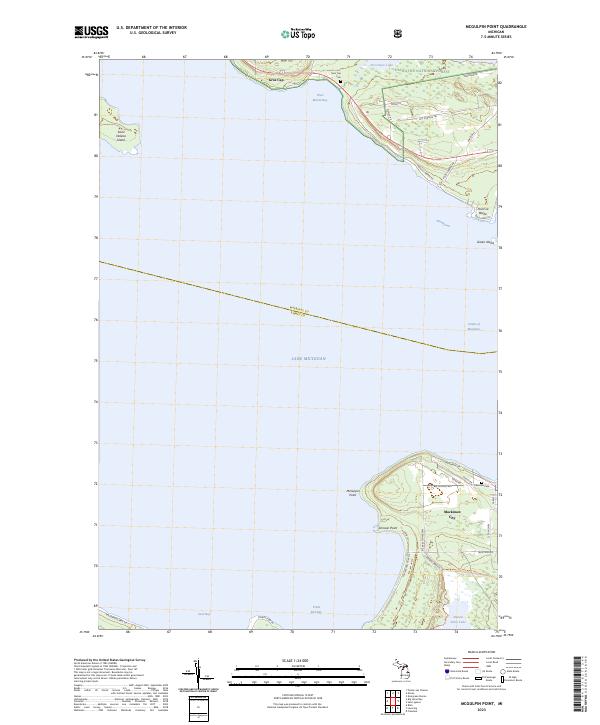 2023 McGulpin Point2023 Print · USGSThe Straits of Mackinac in the early 2020s are captured here, showing the coastal transition between Lake Michigan and Lake Huron. Trace the paths of the North Country National Scenic Trail or locate family sites at Gros Cap Cem and Lakeview Cem.
 - 2023 Map of Waugoshance Island, 2023 Print
 2023 Waugoshance Island2023 Print · USGSThe northern reaches of Lake Michigan appear here as a landscape of hidden maritime hazards and low-lying islands in the early 2020s. Trace the shoals that have challenged mariners for generations, including White Shoal and the archipelago formed by Waugoshance Island and Temperance Island.
End of results
Showing maps 1-5 of 5
Top cities near Bliss Township
- Saint Ignace historical maps
- Carp Lake historical maps
- Mackinaw City historical maps
- Pellston historical maps
- Bliss historical maps
- Cross Village historical maps
Top neighborhoods of Bliss Township
Frequently asked questions
- What are the different types of historical maps available for Bliss Township?
- What is the oldest map of Bliss Township?
- Where can I purchase historical maps of Bliss Township for my home or office?
- Where can I download high-res historical maps of Bliss Township?
- Are there historical topographic maps available for Bliss Township?
- Is there historical aerial imagery available for Bliss Township?
- Where are historical maps of Bliss Township sourced from?