Old Maps of Emmet County, Michigan for Hiking & Exploration
Hike through history with 135 historic maps of Emmet County. Explore old trails, ghost towns, and forgotten backroads — perfect for outdoor adventurers and local explorers.
- Rediscover forgotten places: Map out old mining camps, roads, and footpaths that no longer exist on modern maps.
- Layer with modern tools: Combine with LiDAR or satellite views to plan hikes through historical terrain.
- Made for exploration: Popular among hikers, overlanders, and local history lovers.
Use these maps to find adventure and explore the hidden past of Emmet County.
Emmet County, MI maps
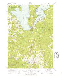
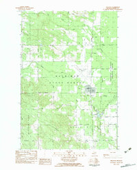
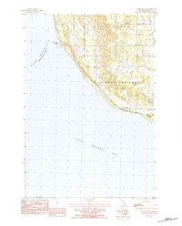
(135)- 1955 Map of Cheboygan, 1964 Print
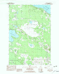
 1955 Cheboygan1964 Print · USGSNorthern Michigan in the mid-fifties is a landscape of dense timber and deep water, showing the region just as the road network began to modernize. Trace family roots in lakeside towns like St Ignace and Petoskey, or follow the historic tracks of the Pennsylvania RR and New York Central RR.5 unique versions available
 - 1957 Map of Wolverine, 1958 Print
 1957 Wolverine1958 Print · USGSNorthern Michigan's lake country is captured here during the late fifties, showing the rail-and-river geography of the Cheboygan area. Genealogists and historians can trace old community centers like Indian River, the Ohioville Sch, and the Wolverine Lookout Tower.3 unique versions available
 - 1957 Map of Mullett Lake, 1959 Print
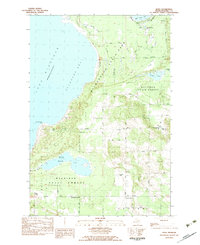
 1957 Mullett Lake1959 Print · USGSThe tip of Michigan's Lower Peninsula is defined by its massive inland waters and coastal reaches along the Straits in the late fifties. Genealogists and researchers can locate several rural schools and parish churches like Sacred Heart Ch and Hebron Cem.2 unique versions available
 - 1958 Map of Cheboygan
 1958 Cheboygan1958 Print · USGSThe tip of Michigan's Lower Peninsula and the surrounding Great Lakes islands are shown here in the late fifties, during the peak of the rail-and-ferry era. Trace the paths of the Pennsylvania RR and explore lakeside settlements like St James, Petoskey, and Indian River.2 unique versions available
 - 1958 Map of Cross Village, 1959 Print
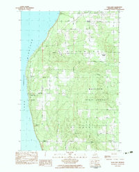
 1958 Cross Village1959 Print · USGSThe tip of Michigan's Lower Peninsula in the late fifties remains a landscape of quiet coastal hamlets and dense state forests. Genealogists can trace family names at the Holy Cross Cem or locate rural landmarks like the Sogonosh Valley Sch and Middle Village.2 unique versions available
 - 1958 Map of Pellston, 1959 Print
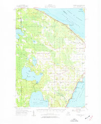
 1958 Pellston1959 Print · USGSEmmet County in the late fifties shows a landscape of timber, small farms, and rail towns before the modern highway era. Trace the Pennsylvania rail line through Pellston or locate family sites like St Nicholas Ch and Canby Sch.2 unique versions available
 - 1958 Map of Bayshore, 1959 Print
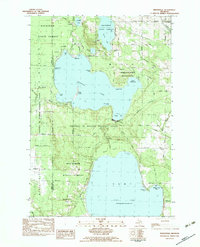
 1958 Bayshore1959 Print · USGSCoastal life in the late fifties centered on the waters of Little Traverse Bay and Lake Charlevoix. Researchers can trace old family sites at Undine Cem, visit the Greensky Ch, or locate the Drive-in Theater and Quarry near Bayshore.2 unique versions available
 - 1958 Map of Petoskey, 1959 Print
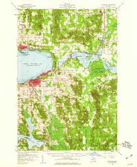 1958 Petoskey1959 Print · USGSCoastal Emmet County in the late fifties is captured here through its growing resort towns and inland forest tracts. Researchers can trace the legacy of local families through landmarks like Patons Corner, Morford Sch, and Curtis Cem.4 unique versions available
 - 1964 Map of Big Stone Bay, 1965 Print
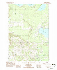
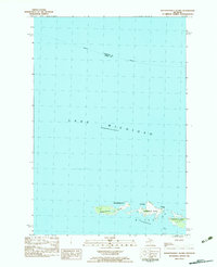
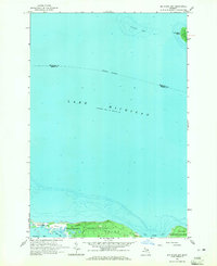 1964 Big Stone Bay1965 Print · USGSThe northern tip of Emmet County is shown in the mid-1960s, where the protected lands of Wilderness State Park meet the lake. Researchers can trace the shoreline from Waugoshance Point up to the isolated St Helena Island.2 unique versions available
 - 1964 Map of St. Ignace, 1966 Print
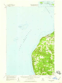
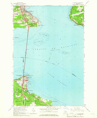 1964 St. Ignace1966 Print · USGSThe Straits of Mackinac were in a period of transition in the mid-sixties, linked by the recently completed Mackinac Bridge. Genealogists and historians can trace the rail terminals of the Pennsylvania and waterfront sites like Old Mackinac Point and Edgewater Beach.2 unique versions available
 - 1964 Map of McGulpin Point, 1966 Print
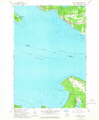 1964 McGulpin Point1966 Print · USGSThe tip of Michigan's Lower Peninsula and the Upper Peninsula shore meet at the straits in the mid-1960s. Researchers can trace the layout of Mackinaw City, locate Gros Cap Cem, or study the shoreline around Mc Gulpin Point.2 unique versions available
 - 1975 Map of Petoskey NW, 1976 Print
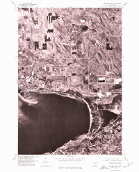 1975 Petoskey NW1976 Print · USGSLittle Traverse Bay and its coastal settlements are captured from the air in the mid-1970s, showing the intersection of resort life and rural land use. Trace the established shorelines of Harbor Springs, Petoskey, and the storied grounds of Bay View.
 - 1975 Map of Petoskey SW, 1976 Print
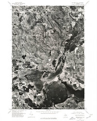
 1975 Petoskey SW1976 Print · USGSNorthern Michigan's coastline and interior lakes are captured in high detail during the mid-seventies. Trace the 1975 development of Petoskey along Little Traverse Bay and the shoreline of Walloon Lake.
 - 1975 Map of Petoskey NE, 1976 Print
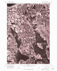
 1975 Petoskey NE1976 Print · USGSEmmet County's lake country is seen through aerial photography in the mid-seventies, showing the transition from woodland to waterfront settlement. Researchers can trace the exact footprint of shoreline communities like Alanson, Oden, and Conway along Crooked Lake.
 - 1982 Map of Petoskey
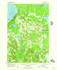
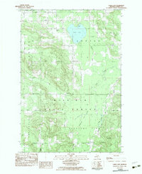
 1982 Petoskey1982 Print · USGSNorthern Michigan in the early eighties shows a landscape of deep timber and vast inland lakes. Genealogists and historians can trace the rail corridors of the Michigan Central and Detroit and Mackinac between Petoskey, Gaylord, and Wolverine.
 - 1982 Map of Levering, 1983 Print
 1982 Levering1983 Print · USGSNorthern Michigan’s timberlands and lakefronts are frozen in time during the early eighties, showing the transition between state-managed forests and local settlements. Genealogists and historians can trace family locations near Levering, the Church of God, and the Levering and Carp Lake Cem.
 - 1982 Map of Pellston, 1983 Print
 1982 Pellston1983 Print · USGSPellston and the surrounding Emmet County forests are documented here in the early eighties, showcasing a mix of academic research and aviation hubs. Genealogists can trace family roots at Ayr Cem or locate community centers like Zion United Ch and the University of Michigan Biological Station.
 - 1982 Map of Bliss, 1983 Print
 1982 Bliss1983 Print · USGSEmmet County's northern forests and Lake Michigan shoreline are captured here in the late 1970s. Genealogists and local historians can trace family locations near crossroads like Wesbters Corners or find markers at Township Cem and Pioneer Memorial Ch.
 - 1982 Map of Good Hart, 1983 Print
 1982 Good Hart1983 Print · USGSThe Emmet County shoreline comes alive in this early 1980s survey, showing the rural character of the lakeside bluffs. Trace family connections at Island View Cem and find local landmarks like Good Hart and the Good Hart Middle Ch.
 - 1982 Map of Indianville, 1983 Print
 1982 Indianville1983 Print · USGSCheboygan County in the early eighties was defined by the massive presence of the University of Michigan Biological Station and protected forest lands. Researchers and genealogists can trace property lines near Indianville, locate the Munro Cem, or study the shoreline development of Douglas Lake and Burt Lake.
 - 1982 Map of Freedom, 1983 Print
 1982 Freedom1983 Print · USGSThe Straits of Mackinac shoreline and the northern reaches of the Lower Peninsula are captured here in the early eighties. Genealogists and local historians can locate Hebron Cem, the Hebron Town Hall, and the village of Carp Lake along the shore of Lake Paradise.
 - 1982 Map of Waugoshance Island, 1983 Print
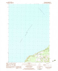
 1982 Waugoshance Island1983 Print · USGSThe tip of Michigan's Lower Peninsula is captured here in the early eighties, showing the remote landforms of Wilderness State Park. Researchers can locate the Abandoned Light House and the shorelines of Temperance Island and Waugoshance Island.
 - 1982 Map of Larks Lake, 1983 Print
 1982 Larks Lake1983 Print · USGSEmmet County’s northern woods and wetlands are captured here in the early eighties, showing the intersection of state forest lands and rural townships. Genealogists and local historians can locate several family burial sites like Starr Cem and Greenwood Cem, alongside landmarks like Camp Ralston and the Townhall in Pleasant View.
 - 1982 Map of Cross Village, 1983 Print
 1982 Cross Village1983 Print · USGSCross Village and the Emmet County shoreline are captured in the late seventies, showing the historic settlement overlooking Lake Michigan. Genealogists can locate family sites near Holy Cross Ch, Indian Cem, and the wooded trails of Mackinaw State Forest.
 - 1983 Map of Forest Beach, 1984 Print
 1983 Forest Beach1984 Print · USGSThe Emmet County shoreline comes into focus during the early eighties, showing the transition from rural townships to lakeside communities. Genealogists and local historians can trace family lands along Hughston Road, locate Lakeview Cem, and explore the settled coast at Forest Beach.2 unique versions available
Showing maps 1-25 of 135
Top cities of Emmet County
Frequently asked questions
- What are the different types of historical maps available for Emmet County?
- What is the oldest map of Emmet County?
- Where can I purchase historical maps of Emmet County for my home or office?
- Where can I download high-res historical maps of Emmet County?
- Are there historical topographic maps available for Emmet County?
- Is there historical aerial imagery available for Emmet County?
- Where are historical maps of Emmet County sourced from?