1960s Maps of Gladwin County, Michigan
Explore 17 historic maps of Gladwin County from the 1960s. These maps offer a rare glimpse into what life looked like during the 1960s — showing old roads, neighborhoods, homes, and landmarks that have changed or disappeared over time.
Whether you're researching your family's past, planning a metal detecting trip, or studying how Gladwin County's landscape evolved across the 1960s, these high-resolution maps are a powerful tool for exploring the history of this region.
- Focus on a specific era: All maps on this page are from the 1960s, giving you a focused view of this time period.
- See what’s changed: Compare century-old streets, trails, and buildings to today's modern landscape using overlays and satellite layers.
- Research with precision: Use these maps for genealogy, historical research, land use analysis, or educational projects.
- View, download, or print: Maps are fully viewable online in high resolution, and can be downloaded or printed for your own records.
Start exploring Gladwin County's history through authentic maps from the 1960s. This is your window into the past.
Gladwin County, MI maps
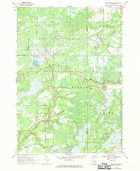
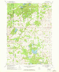
(17)- 1966 Map of Midland
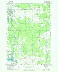
 1966 Midland1966 Print · USGSCentral Michigan in the mid-1960s shows a landscape of growing manufacturing hubs and active resource extraction. Genealogists and historians can trace the rail corridors of the Grand Trunk Western or locate family-named landmarks near Oil wells and the Muskegon River.
 - 1968 Map of Sterling SW, 1971 Print
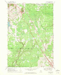
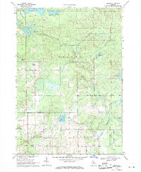
 1968 Sterling SW1971 Print · USGSThe Gladwin County backcountry in the late sixties reveals a landscape of managed wetlands and forestry trails. Genealogists and outdoorsmen can locate specific landmarks like Bowmanville, the Lame Duck Truck Trail, and the curiously named Hard Luck.
 - 1968 Map of Sterling NW, 1971 Print
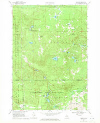
 1968 Sterling NW1971 Print · USGSNorthern Michigan's forested interior is captured in the late sixties, showing the intersection of Ogemaw, Gladwin, and Arenac counties. Genealogists and historians can trace the Bourret Cem or locate the Gustafson Airport and the Penn Central rail line.
 - 1969 Map of Meredith, 1971 Print
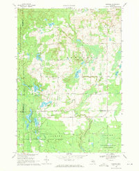
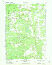
 1969 Meredith1971 Print · USGSThe woodlands around Meredith were a nexus of state forest lands and glacial lakes in the late 1960s. Researchers can trace early roads and local landmarks like the Meredith Drive-in Theater, Hoister Lake, and the winding Sugar River.2 unique versions available
 - 1969 Map of Edwards, 1971 Print
 1969 Edwards1971 Print · USGSCentral Michigan's lake-studded woodlands are captured here in the late sixties at the intersection of Ogemaw, Roscommon, and Gladwin counties. Genealogists and local historians can trace family-named routes and community landmarks like Edwards Cem, Oak Grove Ch, and the settlement of Edwards.
 - 1969 Map of Butman, 1971 Print
 1969 Butman1971 Print · USGSThe northern Michigan woods at the turn of the 1970s reveal a landscape of timber, water, and early oil exploration. Genealogists and historians can trace the rural community of Butman, locate the Butman Cem, and follow the banks of the Sugar River.
 - 1969 Map of Wagarville, 1971 Print
 1969 Wagarville1971 Print · USGSGladwin County during the late sixties shows a landscape of river-fed townships and tight-knit rural settlements. Genealogists can trace family roots through the McClure Cem and Ridge Cem, or locate local landmarks like the Miracle Mission and Sugar Rapids.
 - 1969 Map of Gladwin, 1971 Print
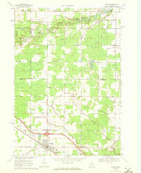
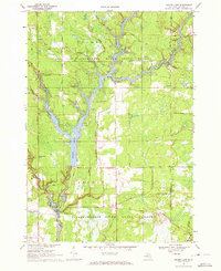
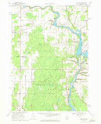
 1969 Gladwin1971 Print · USGSGladwin and Beaverton are shown during the late 1960s, a period defined by the local oil industry and river-fed landscape. Researchers can trace the Old Railroad Grade, locate the Arbutus Cem, or explore the Buckeye Oil Field and Gladwin State Park.
 - 1969 Map of Coleman, 1972 Print
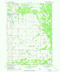
 1969 Coleman1972 Print · USGSMidland and Isabella counties show a landscape of energy and agriculture during the late sixties. Trace the old industrial footprints of the West Beaverton Oil Field and the Chesapeake and Ohio rail lines near Coleman.2 unique versions available
 - 1969 Map of Skeels, 1972 Print
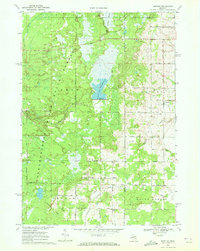
 1969 Skeels1972 Print · USGSGladwin County, Michigan, is shown here in the late sixties as a landscape of state forests and quiet lakeside settlements. Local historians can trace the rural layout of Skeels, Podunk, and Oberlin, or find landmarks like Chappel Dam and Pratt Lake.
 - 1969 Map of Hope, 1972 Print
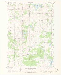
 1969 Hope1972 Print · USGSMidland County shoreline communities and inland farmsteads are documented here in the late sixties as lakeside development expanded. Researchers can trace family roots at New Hope Cem, locate the Hillside Sch, or follow the Old Railroad Grade through the woods.
 - 1969 Map of Secord Lake, 1972 Print
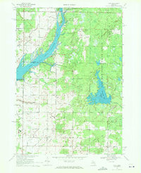
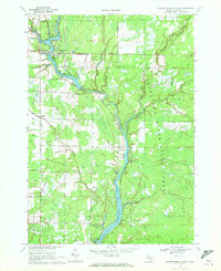
 1969 Secord Lake1972 Print · USGSGladwin County's river-fed landscapes are frozen in time here during the late sixties, showcasing the vast reservoir systems of the northern Tittabawassee. Researchers can trace the development of Secord and Bowmanville, or locate specific landmarks like the Secord Ch and the historic Secord Dam.2 unique versions available
 - 1969 Map of Bentley, 1972 Print
 1969 Bentley1972 Print · USGSGladwin County's timberlands and river valleys are captured here in the late sixties as the local economy balanced forestry and oil. Genealogists can locate family sites near Bentley, Rhodes, and the New Rhodes Cem, or trace the Old Railroad Grade through the forest.
 - 1969 Map of Edenville, 1972 Print
 1969 Edenville1972 Print · USGSMid-Michigan lake country is defined by the convergence of two major rivers in the late 1960s. Researchers can trace the development of Edenville, find local landmarks like Robinson Airfield, and locate family sites near St Anne Ch.2 unique versions available
 - 1969 Map of Wooden Shoe Village, 1972 Print
 1969 Wooden Shoe Village1972 Print · USGSGladwin County's river-driven landscape comes into focus during the late 1960s as these timber and oil territories transitioned into forest and recreational lands. Genealogists and historians can trace industrial sites like Buckeye Oil Field and small settlements like Wooden Shoe Village and Highwood.
 - 1969 Map of Coleman NE, 1972 Print
 1969 Coleman NE1972 Print · USGSGladwin County during the late sixties shows a landscape of glacial lakes and river branches before extensive modern development. Genealogists and historians can trace family locations near Grout Cem, West Grout Ch, or the scattered Oil Wells along the Tobacco River.3 unique versions available
 - 1969 Map of Estey, 1972 Print
 1969 Estey1972 Print · USGSThe Michigan backcountry at the junction of Gladwin and Midland counties comes alive in this late-sixties survey. Genealogists and local historians can trace family-named roads and landmarks like Mills Sch, Bethel Ch, and an Old Railroad Grade.
End of results
Showing maps 1-17 of 17
Top cities of Gladwin County
Frequently asked questions
- What are the different types of historical maps available for Gladwin County?
- What is the oldest map of Gladwin County?
- Where can I purchase historical maps of Gladwin County for my home or office?
- Where can I download high-res historical maps of Gladwin County?
- Are there historical topographic maps available for Gladwin County?
- Is there historical aerial imagery available for Gladwin County?
- Where are historical maps of Gladwin County sourced from?