1960s Maps of Bentley Township, Michigan
Explore 5 historic maps of Bentley Township from the 1960s. These maps offer a rare glimpse into what life looked like during the 1960s — showing old roads, neighborhoods, homes, and landmarks that have changed or disappeared over time.
Whether you're researching your family's past, planning a metal detecting trip, or studying how Bentley Township's landscape evolved across the 1960s, these high-resolution maps are a powerful tool for exploring the history of this region.
- Focus on a specific era: All maps on this page are from the 1960s, giving you a focused view of this time period.
- See what’s changed: Compare century-old streets, trails, and buildings to today's modern landscape using overlays and satellite layers.
- Research with precision: Use these maps for genealogy, historical research, land use analysis, or educational projects.
- View, download, or print: Maps are fully viewable online in high resolution, and can be downloaded or printed for your own records.
Start exploring Bentley Township's history through authentic maps from the 1960s. This is your window into the past.
Bentley Township, MI maps
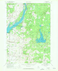
(5)- 1966 Map of Midland
 1966 Midland1966 Print · USGSCentral Michigan in the mid-1960s shows a landscape of growing manufacturing hubs and active resource extraction. Genealogists and historians can trace the rail corridors of the Grand Trunk Western or locate family-named landmarks near Oil wells and the Muskegon River.
 - 1969 Map of Hope, 1972 Print
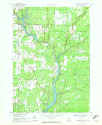
 1969 Hope1972 Print · USGSMidland County shoreline communities and inland farmsteads are documented here in the late sixties as lakeside development expanded. Researchers can trace family roots at New Hope Cem, locate the Hillside Sch, or follow the Old Railroad Grade through the woods.
 - 1969 Map of Bentley, 1972 Print
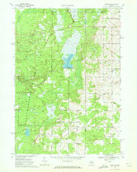 1969 Bentley1972 Print · USGSGladwin County's timberlands and river valleys are captured here in the late sixties as the local economy balanced forestry and oil. Genealogists can locate family sites near Bentley, Rhodes, and the New Rhodes Cem, or trace the Old Railroad Grade through the forest.
 - 1969 Map of Wooden Shoe Village, 1972 Print
 1969 Wooden Shoe Village1972 Print · USGSGladwin County's river-driven landscape comes into focus during the late 1960s as these timber and oil territories transitioned into forest and recreational lands. Genealogists and historians can trace industrial sites like Buckeye Oil Field and small settlements like Wooden Shoe Village and Highwood.
 - 1969 Map of Estey, 1972 Print
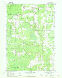 1969 Estey1972 Print · USGSThe Michigan backcountry at the junction of Gladwin and Midland counties comes alive in this late-sixties survey. Genealogists and local historians can trace family-named roads and landmarks like Mills Sch, Bethel Ch, and an Old Railroad Grade.
End of results
Showing maps 1-5 of 5
Top cities near Bentley Township
- Midland historical maps
- Billings historical maps
- Beaver historical maps
- Edenville historical maps
- Mount Forest historical maps
- Hope historical maps
See more
Top neighborhoods of Bentley Township
Frequently asked questions
- What are the different types of historical maps available for Bentley Township?
- What is the oldest map of Bentley Township?
- Where can I purchase historical maps of Bentley Township for my home or office?
- Where can I download high-res historical maps of Bentley Township?
- Are there historical topographic maps available for Bentley Township?
- Is there historical aerial imagery available for Bentley Township?
- Where are historical maps of Bentley Township sourced from?