Old Maps of Auvinen Corner, Ironwood Township
Explore 10 old maps of Auvinen Corner, spanning from 1953 to today. These high-resolution historic maps reveal how streets, neighborhoods, landmarks, and natural features evolved over time — perfect for genealogy, metal detecting, research, and local history exploration.
What you can do with these maps:
- See how Auvinen Corner changed over time: Compare historical maps to modern-day views to trace roads, homesites, rail lines & more.
- View detailed metadata: Each map includes creators, publishers, year, scale, and archive source.
- Overlay maps with satellite & LiDAR: Visualize the past alongside modern tools to explore terrain & human change.
- Trusted historical sources: Maps sourced from the USGS, Library of Congress, and other archives.
- Access maps your way: View online, download high-res files, or order prints for personal or research use.
Start exploring old maps of Auvinen Corner to uncover forgotten places, hidden landmarks, and the deep history beneath your feet.
Auvinen Corner, Ironwood Township maps
(10)- 1953 Map of Ashland, 1964 Print
 1953 Ashland1964 Print · USGSNorthern Wisconsin's lakefront and timberlands are seen here in the mid-1950s, showing the intersection of industrial rail lines and vast wilderness. Genealogists and historians can trace the Soo Line through rail towns like Mellen or locate family roots in the Apostle Islands and Bad River Indian Reservation.3 unique versions available
 - 1956 Map of North Ironwood, 1957 Print
 1956 North Ironwood1957 Print · USGSThe Lake Superior shoreline and the waterfall-rich Black River define this mid-century Gogebic County landscape. Researchers can trace rural life through sites like Roosevelt Sch, the Gogebic County Airport, and the Hautala Corner crossroads.3 unique versions available
 - 1958 Map of Ashland
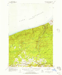
 1958 Ashland1958 Print · USGSCoastal Wisconsin and the Michigan borderlands meet here in the late fifties, dominated by the timbered expanses and iron-rich ranges. Genealogists can trace family footprints in settlements like Odanah and Montreal, or locate landmarks such as the Coast Guard Station and Agricultural Experiment Station.
 - 1989 Map of Ashland
 1989 Ashland1989 Print · USGSCoastal Wisconsin and Michigan at the end of the 1980s show a landscape of deep-water bays, island preserves, and industrial timber towns. Researchers can trace the rail lines of the Soo Line and identify landmarks from Big Bay State Park to the Bad River Indian Reservation.
 - 1999 Map of Copper Peak, 2004 Print
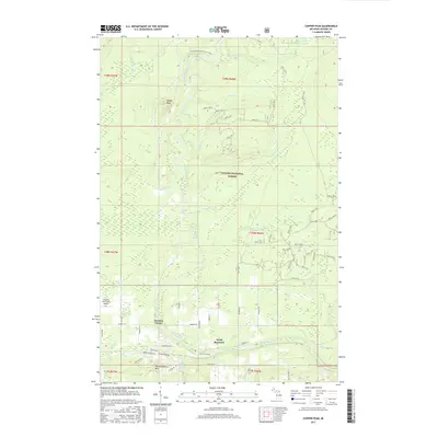
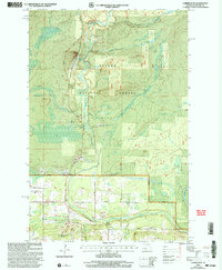 1999 Copper Peak2004 Print · USGSGogebic County at the close of the millennium showcases a landscape where the rugged Ottawa National Forest meets modern recreation. Researchers can trace the development of the Big Powderhorn Ski Area, the Gogebic County Airport, and the settlement of North Bessemer.
 - 2011 Map of Copper Peak, 2011 Print
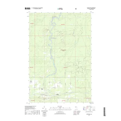
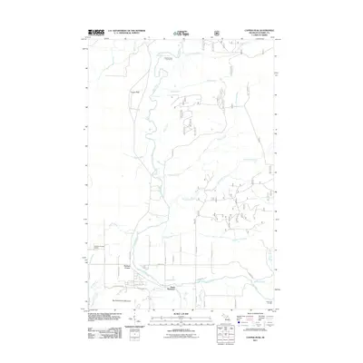 2011 Copper Peak2011 Print · USGSCovers Auvinen Corner, including Ironwood Township, North Bessemer, and other nearby areas
 - 2014 Map of Copper Peak, 2014 Print
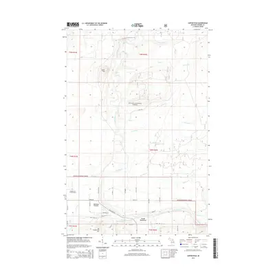 2014 Copper Peak2014 Print · USGSCovers Auvinen Corner, including Ironwood Township, North Bessemer, and other nearby areas
 - 2017 Map of Copper Peak, 2017 Print
 2017 Copper Peak2017 Print · USGSCovers Auvinen Corner, including Ironwood Township, North Bessemer, and other nearby areas
 - 2019 Map of Copper Peak, 2019 Print
 2019 Copper Peak2019 Print · USGSCovers Auvinen Corner, including Ironwood Township, North Bessemer, and other nearby areas
 - 2023 Map of Copper Peak, 2023 Print
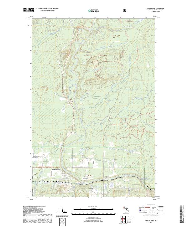 2023 Copper Peak2023 Print · USGSGogebic County's high-relief terrain comes into focus in this recent survey of the area around North Bessemer. Researchers can trace the wild course of the Black Wild and Scenic River and locate landmarks like Copper Peak, Algonquin Falls, and Auvinen Corner.
End of results
Showing maps 1-10 of 10
Top cities near Auvinen Corner
- Ironwood historical maps
- Wakefield historical maps
- Bessemer historical maps
- Hurley historical maps
- Montreal historical maps
- Kimball historical maps
See more
Frequently asked questions
- What are the different types of historical maps available for Auvinen Corner?
- What is the oldest map of Auvinen Corner?
- Where can I purchase historical maps of Auvinen Corner for my home or office?
- Where can I download high-res historical maps of Auvinen Corner?
- Are there historical topographic maps available for Auvinen Corner?
- Is there historical aerial imagery available for Auvinen Corner?
- Where are historical maps of Auvinen Corner sourced from?