
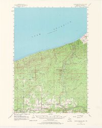
1956 Map of North Ironwood
USGS Topo · Published 1957About this map
Lake Superior defines the northern edge of this Upper Peninsula landscape, where the rugged descent of the Black River creates a sequence of notable cascades including Potawatomi Falls, Rainbow Falls, and Great Conglomerate Falls. These natural features are preserved within the Black River County Park and the broader reaches of the Ottawa National Forest. The map captures a mid-century transitional period where rural crossroads like Hautala Corner and Auvinen Corner serve as local landmarks alongside emerging infrastructure like the Gogebic County Airport. In the southern portion of the sheet, the industrial and transportation corridor is marked by the Duluth South Shore and Atlantic rail line. This network connects small community hubs such as North Ironwood and Junet, providing a detailed record of settlement patterns and education sites like Roosevelt Sch before the consolidation of many rural school districts.
Find a feature on this map
50 named features on this map. Tap any name to fly to it.
Don’t see what you’re looking for? This feature index may not catch every label — zoom into the map to look around manually.
Map Details
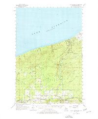
Editions of this 1956 North Ironwood Map
3 editions found
Other maps of this area

1940 · Upson
USGS Topo · 1:48,000

1943 · Little Girls Point
USGS Topo · 1:24,000

1943 · Upson
USGS Topo · 1:48,000

1943 · Ironwood
USGS Topo · 1:48,000

1943 · Little Girl Point
USGS Topo · 1:48,000

1953 · Ashland
USGS Topo · 1:250,000

1955 · Ironwood
USGS Topo · 1:24,000

1955 · Bessemer
USGS Topo · 1:24,000

1955 · Wakefield
USGS Topo · 1:24,000

1955 · Wakefield
USGS Topo · 1:62,500