
1943 Map of Upson
USGS Topo · Published 1943About this map
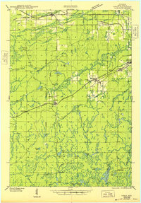
Iron Belt and Upson serve as central nodes in this 1940s landscape, where the iron-rich terrain of Iron County meets an extensive network of waterways and early industrial transport. The map reveals a transition from the established settlements along the Sault Ste Marie and Minneapolis Highway to the deep timber and mining camps further south. Genealogy researchers will find significant detail in the placement of Hillside Cem, Greenwood Cem, and Calvary Cem, as well as named residential and industrial outposts like LeClair Camp and Kerstein Camp. The dominance of the Lumber Railroad and the Chicago and Northwestern tracks highlights the era's reliance on rail to move raw materials through the dense forests and across the Potato River. Landmarks like the Upson Fire Tower stand as sentinels over a landscape defined by names like Blueberry Marsh and the Montreal River.
Find a feature on this map
65 named features on this map. Tap any name to fly to it.
Don’t see what you’re looking for? This feature index may not catch every label — zoom into the map to look around manually.
Map Details
Editions of this 1943 Upson Map
2 editions found
Other maps of this area

1940 · Mercer
USGS Topo · 1:48,000

1940 · Butternut
USGS Topo · 1:48,000

1940 · Upson
USGS Topo · 1:48,000

1942 · Glidden
USGS Topo · 1:48,000

1942 · Mellen
USGS Topo · 1:48,000

1943 · Little Girls Point
USGS Topo · 1:24,000

1943 · Ironwood
USGS Topo · 1:48,000

1943 · Little Girl Point
USGS Topo · 1:48,000

1943 · Odanah
USGS Topo · 1:48,000

1945 · Odanah
USGS Topo · 1:48,000