
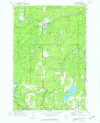
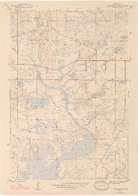
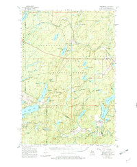
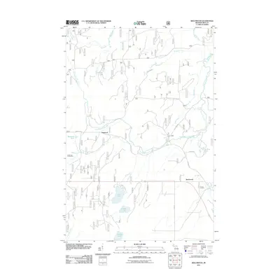
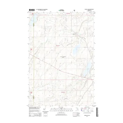
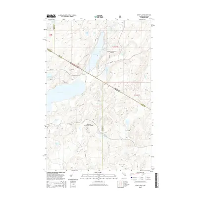
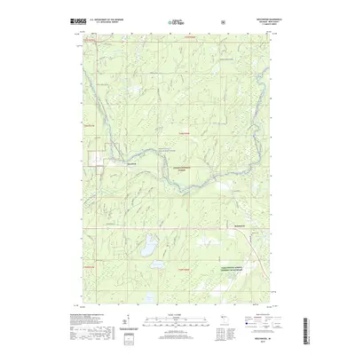
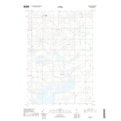
1943 Map of Little Girl Point
USGS Topo · Published 1943About this map
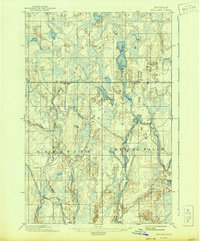
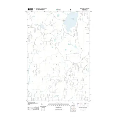
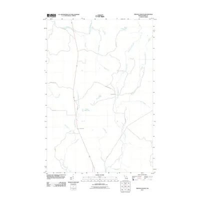
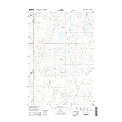
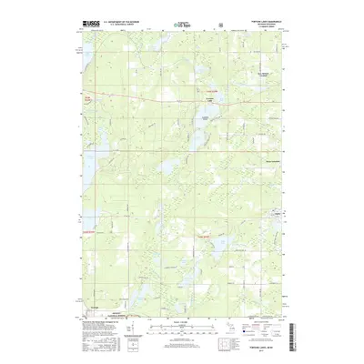
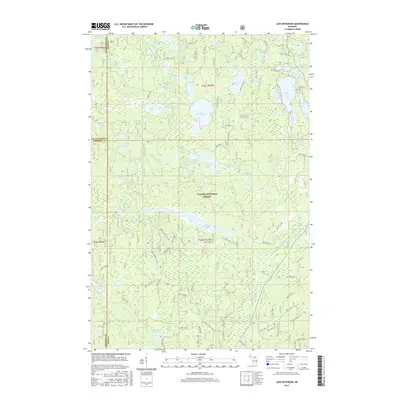
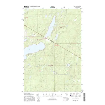
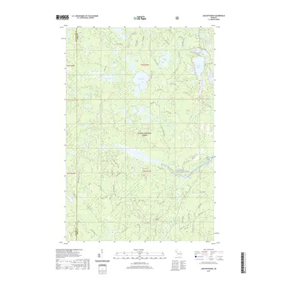
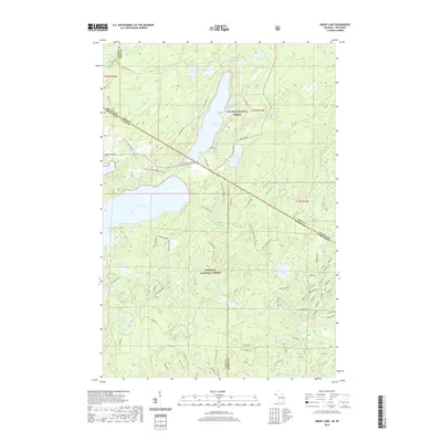
The La Pointe Indian Reservation meets the shoreline of Lake Superior in this early 1940s survey of the borderlands between Wisconsin and Michigan. The landscape is defined by the drainage of several northern-flowing waterways, including Sturgeon Creek, Oronto Creek, and Parker Creek, which feed into Oronto Bay. Near the coast, Saxon Harbor and its adjacent Saxon Harbor Park represent the primary recreational and maritime hub of the area, while a Dam and Power Plant along the Montreal River indicate the era's hydroelectric infrastructure. Further south, the Duluth South Shore and Atlantic railroad and Highway No-2 provide the regional transport backbone, passing near the Lake View Cem. This map shows the transition from surveyed lands to the north's vast Unsurveyed Area, marked by the intersection of the Fourth Principal Meridian.
Find a feature on this map
25 named features on this map. Tap any name to fly to it.
Don’t see what you’re looking for? This feature index may not catch every label — zoom into the map to look around manually.
Map Details
Editions of this 1943 Little Girl Point Map
This is the sole edition of this map. No revisions or reprints were ever made.
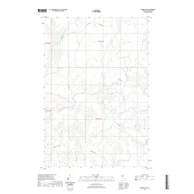
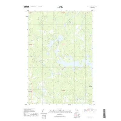
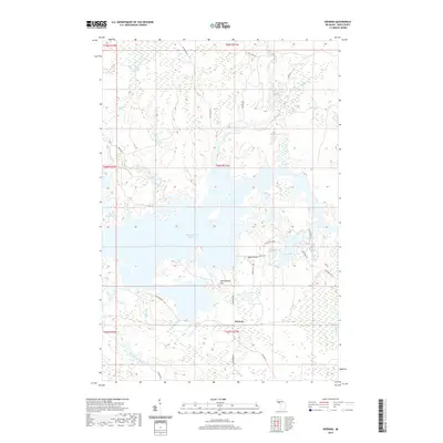
Historical Maps of Kimball Through Time
133 maps found
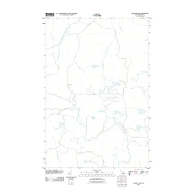
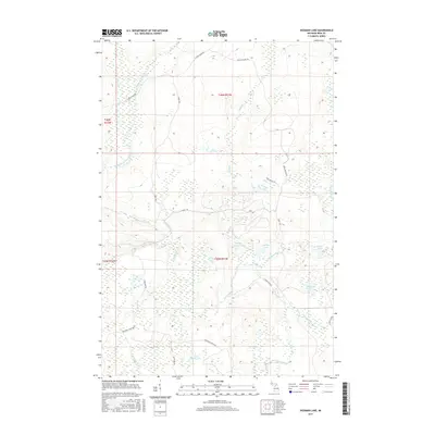
1895 Ned Lake
Iron County, MI
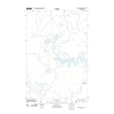
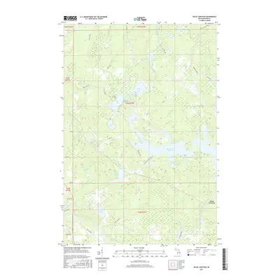
1895 Perch Lake
Iron County, MI
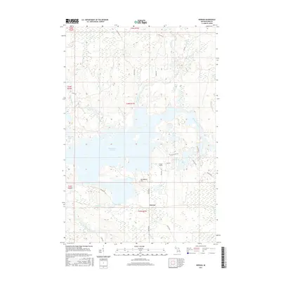
1899 Sagola
Iron County, MI
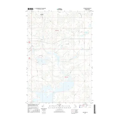
1943 Little Girl Point
Iron County, MI
1944 Fortune Lakes
Iron County, MI
1945 Gibbs City
Iron County, MI

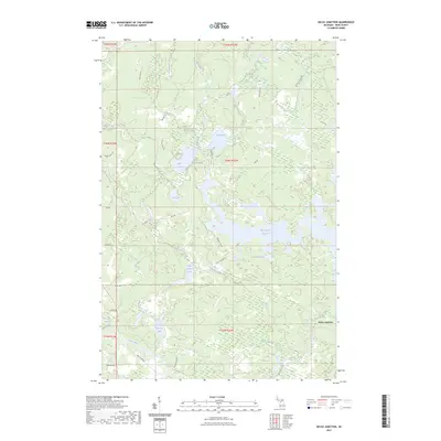
1945 Kelso Junction
Iron County, MI

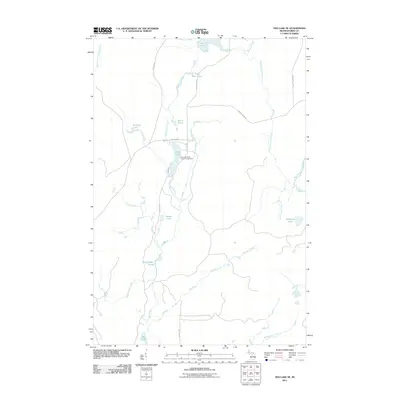
1945 Sunset Lake
Iron County, MI

1946 Fortune Lakes
Iron County, MI
1946 Gibbs City
Iron County, MI
1946 Sunset Lake
Iron County, MI

1947 Kelso Junction
Iron County, MI
1947 Kiernan
Iron County, MI
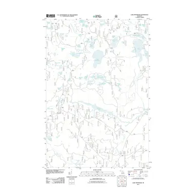
1947 Lake Mary
Iron County, MI
1954 Kenton
Iron County, MI
1954 Perch Lake
Iron County, MI
1955 Ned Lake
Iron County, MI
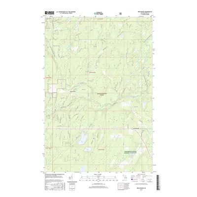
1956 Beechwood
Iron County, MI
1956 Kiernan
Iron County, MI
1956 Lake Mary
Iron County, MI

1956 Sagola
Iron County, MI

1962 Naults
Iron County, MI

1981 Beechwood
Iron County, MI

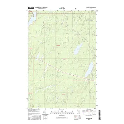
1981 Golden Lake
Iron County, MI

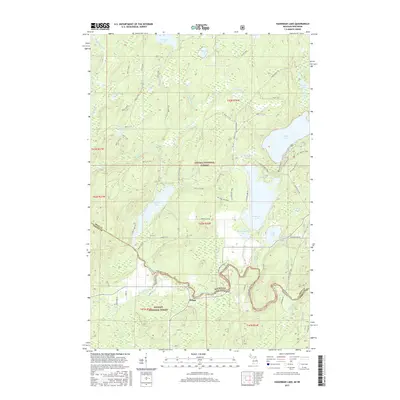
1981 Hagerman Lake
Iron County, MI
1981 Smoky Lake
Iron County, MI

1982 Lake Mitigwaki
Iron County, MI

1982 Winslow Lake
Iron County, MI

1985 Hickman Lake
Iron County, MI

1985 Ned Lake SE
Iron County, MI

1985 Perch Lake
Iron County, MI

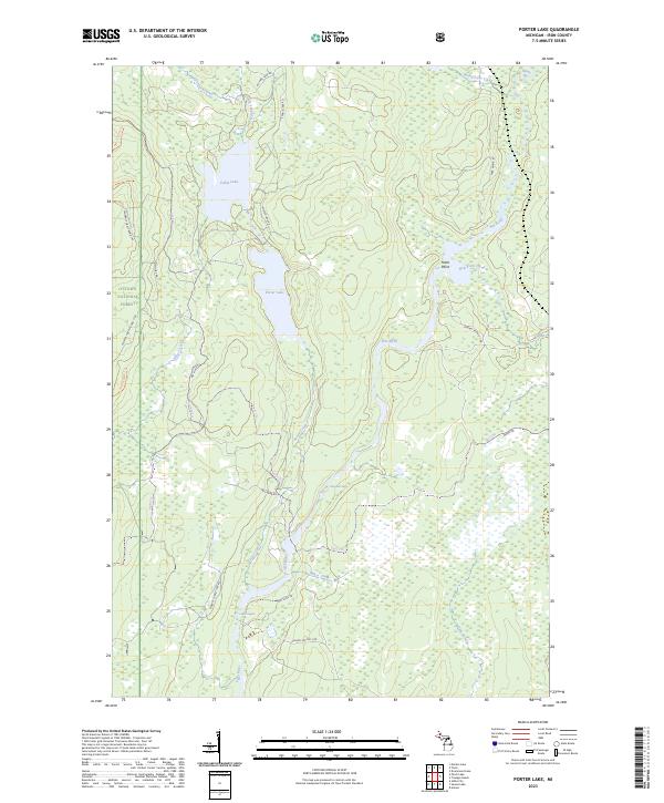
1985 Porter Lake
Iron County, MI

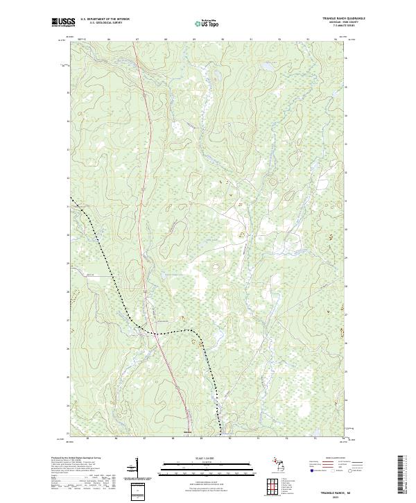
1985 Triangle Ranch
Iron County, MI

1999 Beechwood
Iron County, MI

1999 Gibbs City
Iron County, MI

1999 Golden Lake
Iron County, MI

1999 Hagerman Lake
Iron County, MI

1999 Lake Mitigwaki
Iron County, MI

1999 Perch Lake
Iron County, MI

1999 Smoky Lake
Iron County, MI

1999 Sunset Lake
Iron County, MI

1999 Winslow Lake
Iron County, MI
2011 Beechwood
Iron County, MI
2011 Fortune Lakes
Iron County, MI

2011 Gibbs City
Iron County, MI
2011 Golden Lake
Iron County, MI
2011 Hagerman Lake
Iron County, MI
2011 Hickman Lake
Iron County, MI
2011 Kelso Junction
Iron County, MI

2011 Kiernan
Iron County, MI

2011 Lake Mary
Iron County, MI
2011 Lake Mitigwaki
Iron County, MI

2011 Naults
Iron County, MI
2011 Ned Lake SE
Iron County, MI
2011 Perch Lake
Iron County, MI
2011 Porter Lake
Iron County, MI
2011 Smoky Lake
Iron County, MI
2011 Sunset Lake
Iron County, MI
2011 Triangle Ranch
Iron County, MI
2011 Winslow Lake
Iron County, MI

2013 Naults
Iron County, MI
2014 Beechwood
Iron County, MI
2014 Fortune Lakes
Iron County, MI

2014 Gibbs City
Iron County, MI
2014 Golden Lake
Iron County, MI
2014 Hagerman Lake
Iron County, MI
2014 Hickman Lake
Iron County, MI
2014 Kelso Junction
Iron County, MI

2014 Kiernan
Iron County, MI

2014 Lake Mary
Iron County, MI
2014 Lake Mitigwaki
Iron County, MI

2014 Naults
Iron County, MI
2014 Ned Lake SE
Iron County, MI
2014 Perch Lake
Iron County, MI
2014 Porter Lake
Iron County, MI
2014 Smoky Lake
Iron County, MI
2014 Sunset Lake
Iron County, MI
2014 Triangle Ranch
Iron County, MI
2014 Winslow Lake
Iron County, MI
2017 Beechwood
Iron County, MI
2017 Fortune Lakes
Iron County, MI

2017 Gibbs City
Iron County, MI
2017 Golden Lake
Iron County, MI
2017 Hagerman Lake
Iron County, MI
2017 Hickman Lake
Iron County, MI
2017 Kelso Junction
Iron County, MI
2017 Kiernan
Iron County, MI
2017 Lake Mary
Iron County, MI
2017 Lake Mitigwaki
Iron County, MI

2017 Naults
Iron County, MI
2017 Ned Lake SE
Iron County, MI
2017 Perch Lake
Iron County, MI
2017 Porter Lake
Iron County, MI
2017 Smoky Lake
Iron County, MI
2017 Sunset Lake
Iron County, MI
2017 Triangle Ranch
Iron County, MI
2017 Winslow Lake
Iron County, MI
2019 Beechwood
Iron County, MI
2019 Fortune Lakes
Iron County, MI

2019 Gibbs City
Iron County, MI
2019 Golden Lake
Iron County, MI
2019 Hagerman Lake
Iron County, MI
2019 Hickman Lake
Iron County, MI
2019 Kelso Junction
Iron County, MI
2019 Kiernan
Iron County, MI
2019 Lake Mary
Iron County, MI
2019 Lake Mitigwaki
Iron County, MI

2019 Naults
Iron County, MI
2019 Ned Lake SE
Iron County, MI
2019 Perch Lake
Iron County, MI
2019 Porter Lake
Iron County, MI
2019 Smoky Lake
Iron County, MI
2019 Sunset Lake
Iron County, MI
2019 Triangle Ranch
Iron County, MI
2019 Winslow Lake
Iron County, MI

2023 Beechwood
Iron County, MI

2023 Fortune Lakes
Iron County, MI

2023 Gibbs City
Iron County, MI

2023 Golden Lake
Iron County, MI

2023 Hagerman Lake
Iron County, MI

2023 Hickman Lake
Iron County, MI
2023 Kelso Junction
Iron County, MI

2023 Kiernan
Iron County, MI

2023 Lake Mary
Iron County, MI

2023 Lake Mitigwaki
Iron County, MI

2023 Naults
Iron County, MI

2023 Ned Lake SE
Iron County, MI

2023 Perch Lake
Iron County, MI
2023 Porter Lake
Iron County, MI

2023 Smoky Lake
Iron County, MI

2023 Sunset Lake
Iron County, MI
2023 Triangle Ranch
Iron County, MI

2023 Winslow Lake
Iron County, MI