
1955 Map of Bessemer
USGS Topo · Published 1957About this map
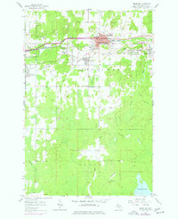
Mining operations and industrial infrastructure dominate the northern half of this Gogebic County landscape, centered on the city of BesseMER and the surrounding settlements of Anvil, Ramsay, and Yale. The era's iron ore extraction is clearly marked by extensive mine dumps and significant sites like the Old Tilden Mine, Anvil Mine, and Geneva Mine. Two major railroads, the Chicago and North Western and the Minneapolis St Paul and Sault Ste Marie, provide the transit backbone for the region's heavy industry. South of the city, the terrain transitions into the protected woods of the Ottawa National Forest. This section reveals a complex network of waterways, including Powder Mill Creek and the Black River, which flow through the forested interior toward McDonald Lake. The map also captures local civic life through the placement of Washington Sch, Hillcrest Cemetery, and Grandview Hospital.
Find a feature on this map
38 named features on this map. Tap any name to fly to it.
Don’t see what you’re looking for? This feature index may not catch every label — zoom into the map to look around manually.
Map Details
Editions of this 1955 Bessemer Map
2 editions found
Other maps of this area

1943 · Ironwood
USGS Topo · 1:48,000

1953 · Ashland
USGS Topo · 1:250,000

1955 · Ironwood
USGS Topo · 1:24,000

1955 · Wakefield
USGS Topo · 1:24,000

1955 · Wakefield
USGS Topo · 1:62,500

1955 · Ironwood
USGS Topo · 1:62,500

1956 · North Ironwood
USGS Topo · 1:62,500

1956 · Thomaston
USGS Topo · 1:62,500

1958 · Ashland
USGS Topo · 1:250,000

1958 · Iron River
USGS Topo · 1:250,000