2020s Maps of Lafayette Township, Michigan
Explore 4 historic maps of Lafayette Township from the 2020s. These maps offer a rare glimpse into what life looked like during the 2020s — showing old roads, neighborhoods, homes, and landmarks that have changed or disappeared over time.
Whether you're researching your family's past, planning a metal detecting trip, or studying how Lafayette Township's landscape evolved across the 2020s, these high-resolution maps are a powerful tool for exploring the history of this region.
- Focus on a specific era: All maps on this page are from the 2020s, giving you a focused view of this time period.
- See what’s changed: Compare century-old streets, trails, and buildings to today's modern landscape using overlays and satellite layers.
- Research with precision: Use these maps for genealogy, historical research, land use analysis, or educational projects.
- View, download, or print: Maps are fully viewable online in high resolution, and can be downloaded or printed for your own records.
Start exploring Lafayette Township's history through authentic maps from the 2020s. This is your window into the past.
Lafayette Township, MI maps
(4)- 2023 Map of Breckenridge, 2023 Print
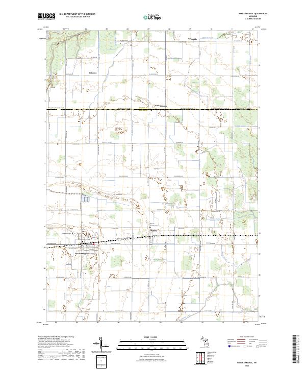 2023 Breckenridge2023 Print · USGSGratiot County's agricultural heartland is mapped here in the early twenty-first century, showing the enduring grid of farm roads and drainage systems. Genealogists and local historians can locate specific burial sites at Ridgelawn Cem or trace the early settlement footprints of Wheeler and Redstone.
 - 2023 Map of Rathbone, 2023 Print
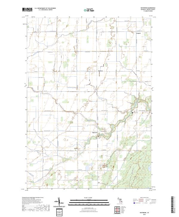 2023 Rathbone2023 Print · USGSGratiot County, Michigan, remains a landscape defined by its agricultural heritage and river networks in this modern survey. Genealogists and local historians can trace family land and rural origins near Edgewood, Sickles, and the Lafayette Cem.
 - 2023 Map of Lakefield, 2023 Print
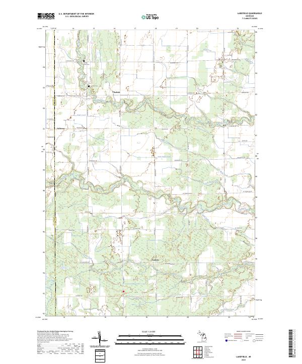 2023 Lakefield2023 Print · USGSSaginaw County's rural townships are shown here in the early twenty-first century as a landscape of structured farmland and meandering waterways. Genealogists can locate family landmarks such as Sacred Heart Cem and the small settlements of Lakefield and Fordney.
 - 2023 Map of Merrill, 2023 Print
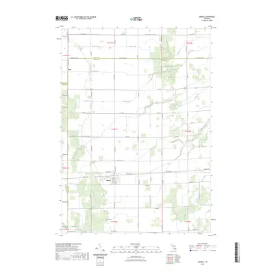 2023 Merrill2023 Print · USGSMerrill and its surrounding farmsteads are documented here at the convergence of Saginaw, Midland, and Gratiot counties. Genealogists and local historians can trace family land along Handy Creek or locate the rural crossroads of Ryan and Iva.
End of results
Showing maps 1-4 of 4
Top cities near Lafayette Township
- Alma historical maps
- Saint Louis historical maps
- Ithaca historical maps
- Wheeler historical maps
- Coe historical maps
- Brant historical maps
See more
Top neighborhoods of Lafayette Township
Frequently asked questions
- What are the different types of historical maps available for Lafayette Township?
- What is the oldest map of Lafayette Township?
- Where can I purchase historical maps of Lafayette Township for my home or office?
- Where can I download high-res historical maps of Lafayette Township?
- Are there historical topographic maps available for Lafayette Township?
- Is there historical aerial imagery available for Lafayette Township?
- Where are historical maps of Lafayette Township sourced from?