2020s Maps of Sherman Township, Michigan
Explore 6 historic maps of Sherman Township from the 2020s. These maps offer a rare glimpse into what life looked like during the 2020s — showing old roads, neighborhoods, homes, and landmarks that have changed or disappeared over time.
Whether you're researching your family's past, planning a metal detecting trip, or studying how Sherman Township's landscape evolved across the 2020s, these high-resolution maps are a powerful tool for exploring the history of this region.
- Focus on a specific era: All maps on this page are from the 2020s, giving you a focused view of this time period.
- See what’s changed: Compare century-old streets, trails, and buildings to today's modern landscape using overlays and satellite layers.
- Research with precision: Use these maps for genealogy, historical research, land use analysis, or educational projects.
- View, download, or print: Maps are fully viewable online in high resolution, and can be downloaded or printed for your own records.
Start exploring Sherman Township's history through authentic maps from the 2020s. This is your window into the past.
Sherman Township, MI maps
(6)- 2023 Map of Bad Axe SE, 2023 Print
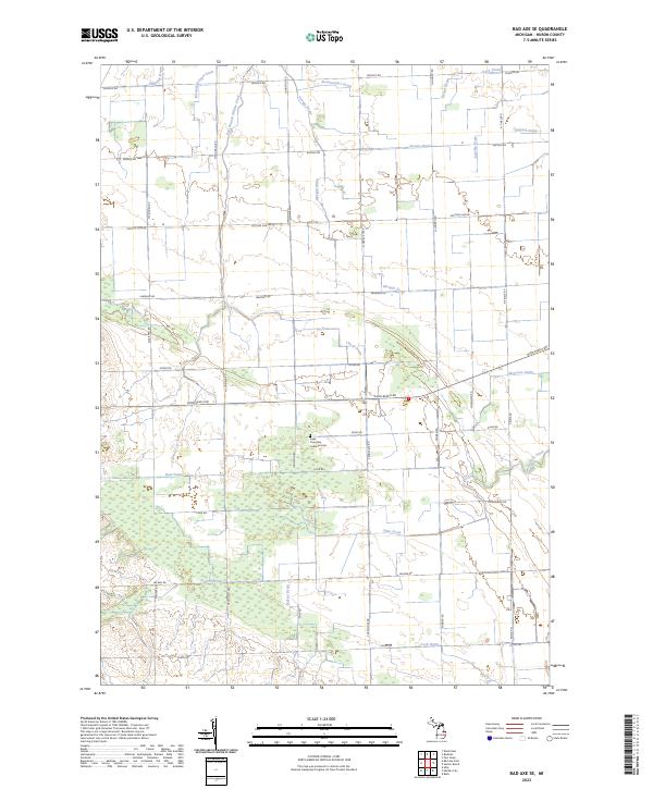 2023 Bad Axe SE2023 Print · USGSHuron County's agricultural heartland is documented here in the early 2020s, showing the intersection of historic family farmsteads and complex water systems. Genealogists can locate the Sigel Township Lutheran Cem and trace the paths of East Branch Willow Creek or Mazure Drain.
 - 2023 Map of Minden City, 2023 Print
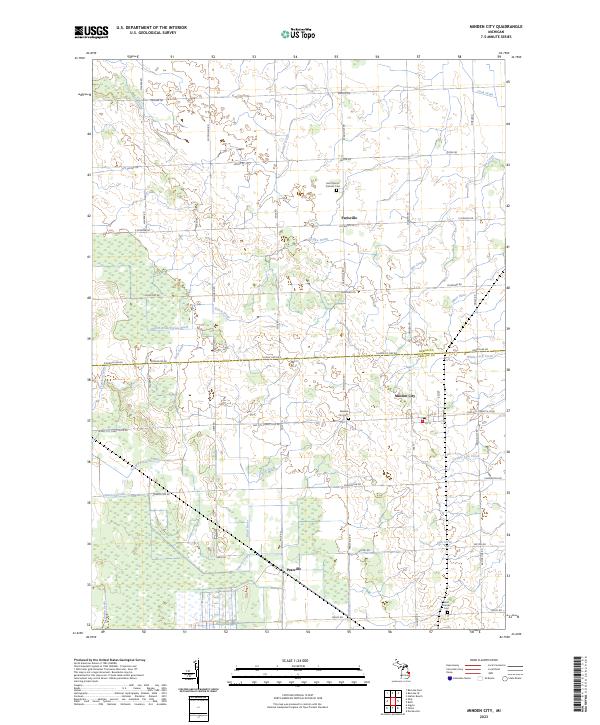 2023 Minden City2023 Print · USGSMinden City and its surrounding farmsteads are shown in this 2023 survey of the Sanilac and Huron county line. Genealogists can locate family landmarks like Saint Mary's Catholic Cem and the small settlements of Parisville and Peatville.
 - 2023 Map of Ruth, 2023 Print
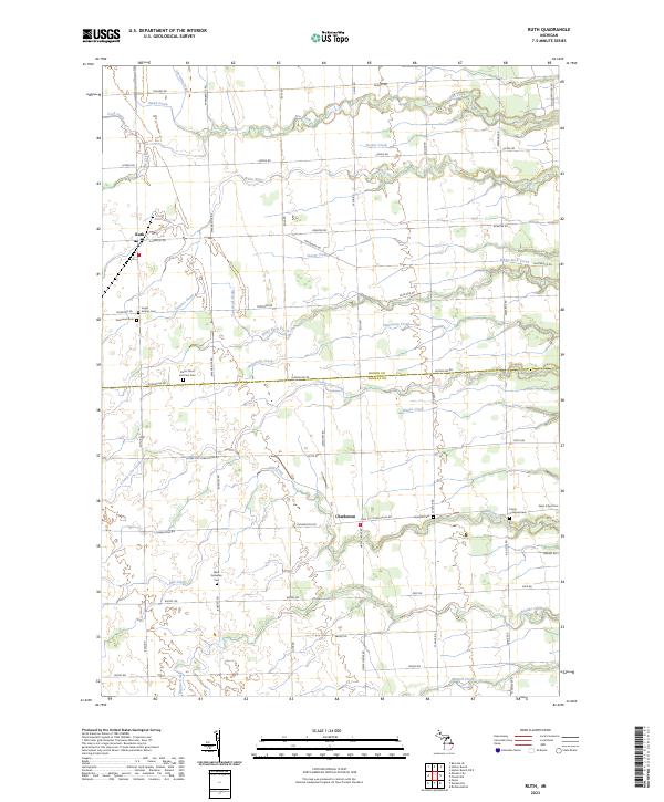 2023 Ruth2023 Print · USGSThe Michigan Thumb region comes into focus during this contemporary survey of the rural landscape bordering Sanilac and Huron counties. Genealogists can trace family footprints across numerous sites like Saints Peter and Paul Cem and Charleston.
 - 2023 Map of Forestville, 2023 Print
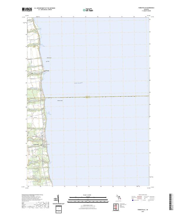 2023 Forestville2023 Print · USGSThe Lake Huron shoreline in eastern Michigan appears here in recent detail, showing the coastal villages and rural backroads of Sanilac and Huron Counties. Researchers can locate family landmarks like Saint Johns Cem and trace the paths of White River and Mill Creek through Forestville.
 - 2023 Map of Harbor Beach, 2023 Print
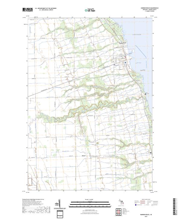 2023 Harbor Beach2023 Print · USGSHarbor Beach's Lake Huron shoreline and the surrounding Huron County farmlands are captured here in the early twenty-first century. Researchers can trace family sites near Rock Falls Cem or follow the paths of Rock Falls Creek and Buckley Creek through the rural landscape.
 - 2023 Map of Harbor Beach OE E, 2023 Print
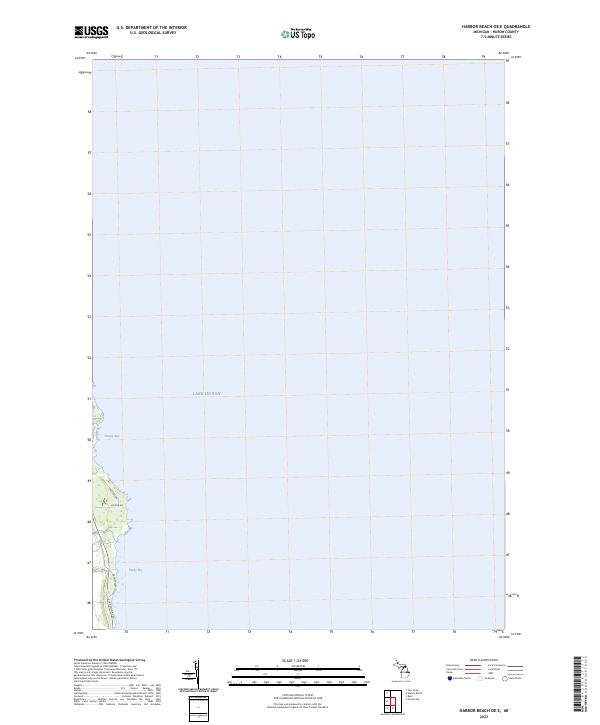 2023 Harbor Beach OE E2023 Print · USGSCoastal Huron County is mapped here in the early 2020s, showing the modern shoreline and residential corridors along the lake. Genealogists and local researchers can trace family properties along Lakeside Dr and Helena Rd near the waters of Sharpe Bay.
End of results
Showing maps 1-6 of 6
Top cities near Sherman Township
- Harbor Beach historical maps
- Verona historical maps
- Deckerville historical maps
- Port Hope historical maps
- Minden City historical maps
- Forestville historical maps
Top neighborhoods of Sherman Township
Frequently asked questions
- What are the different types of historical maps available for Sherman Township?
- What is the oldest map of Sherman Township?
- Where can I purchase historical maps of Sherman Township for my home or office?
- Where can I download high-res historical maps of Sherman Township?
- Are there historical topographic maps available for Sherman Township?
- Is there historical aerial imagery available for Sherman Township?
- Where are historical maps of Sherman Township sourced from?