Old Maps of Boston Township, Michigan for Genealogy
Trace your family roots with 17 historic maps of Boston Township. These high-res maps reveal old neighborhoods, homesites, landmarks, and streets — helping you uncover where your ancestors lived and how the area evolved over time.
- Explore historic neighborhoods: Identify where your relatives may have lived in the 1800s or 1900s.
- Compare maps over time: Trace the changes in streets, buildings, and landmarks for multi-generational research.
- Perfect for genealogy & ancestry research: Used by family historians and researchers to map out lineage and migration.
These maps are an incredible resource for exploring your personal connection to Boston Township's past.
Boston Township, MI maps
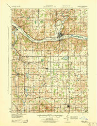
(17)- 1916 Map of Ionia, 1958 Print
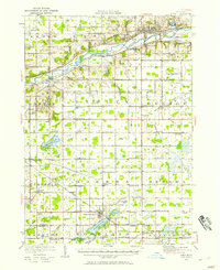 1916 Ionia1958 Print · USGSCovers Boston Township, including Ionia, Lake Odessa, and other nearby areas2 unique versions available
 - 1918 Map of Ionia
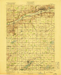 1918 Ionia1918 Print · USGSCovers Boston Township, including Ionia, Lake Odessa, and other nearby areas2 unique versions available
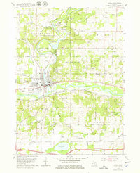
 - 1918 Map of Lowell
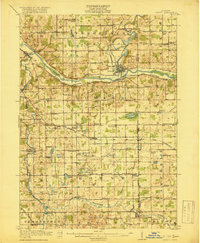 1918 Lowell1918 Print · USGSCovers Boston Township, including Cascade Charter Township, Ada Township, and other nearby areas4 unique versions available
 - 1943 Map of Ionia, 1944 Print
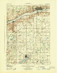 1943 Ionia1944 Print · USGSCovers Boston Township, including Ionia, Lake Odessa, and other nearby areas
 - 1943 Map of Lowell, 1944 Print
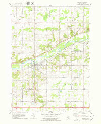
 1943 Lowell1944 Print · USGSCovers Boston Township, including Cascade Charter Township, Ada Township, and other nearby areas
 - 1958 Map of Grand Rapids, 1973 Print
 1958 Grand Rapids1973 Print · USGSCovers Boston Township, including Grand Rapids, Lansing, and other nearby areas2 unique versions available
 - 1961 Map of Grand Rapids
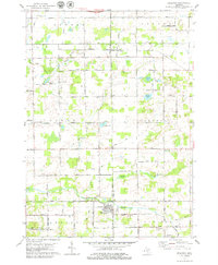
 1961 Grand Rapids1961 Print · USGSCovers Boston Township, including Grand Rapids, Lansing, and other nearby areas
 - 1962 Map of Grand Rapids
 1962 Grand Rapids1962 Print · USGSCovers Boston Township, including Grand Rapids, Lansing, and other nearby areas2 unique versions available
 - 1978 Map of Freeport, 1979 Print
 1978 Freeport1979 Print · USGSCovers Boston Township, including Lowell Charter Township, Freeport, and other nearby areas
 - 1978 Map of Lowell, 1979 Print
 1978 Lowell1979 Print · USGSCovers Boston Township, including Lowell Charter Township, Vergennes Township, and other nearby areas
 - 1978 Map of Saranac, 1979 Print
 1978 Saranac1979 Print · USGSCovers Boston Township, including Saranac, Berlin Township, and other nearby areas
 - 1978 Map of Lake Odessa, 1979 Print
 1978 Lake Odessa1979 Print · USGSCovers Boston Township, including Lake Odessa, Clarksville, and other nearby areas
 - 1984 Map of Grand Rapids
 1984 Grand Rapids1984 Print · USGSCovers Boston Township, including Grand Rapids, Wyoming, and other nearby areas
 - 2023 Map of Saranac, 2023 Print
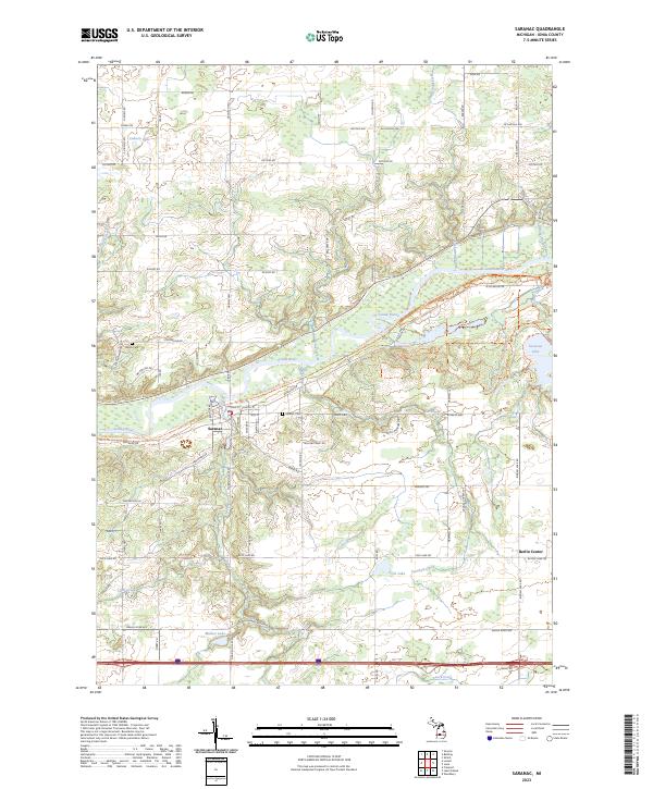 2023 Saranac2023 Print · USGSCovers Boston Township, including Saranac, Easton Township, and other nearby areas
 - 2023 Map of Lake Odessa, 2023 Print
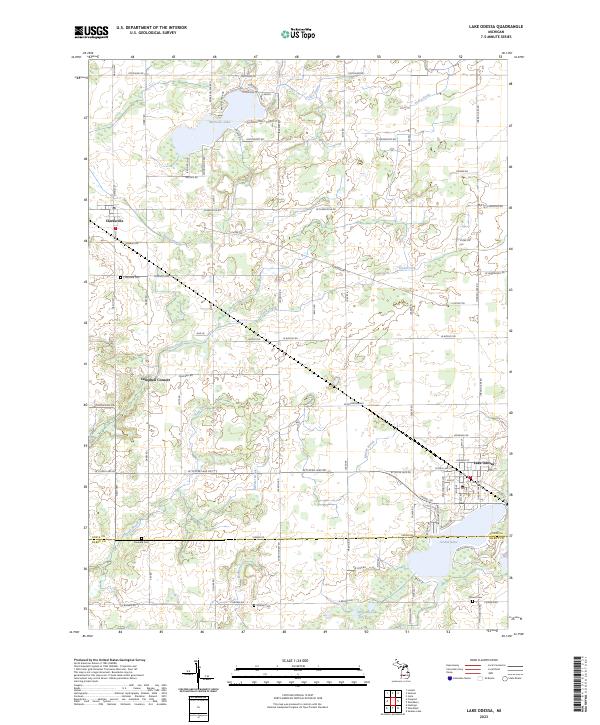 2023 Lake Odessa2023 Print · USGSCovers Boston Township, including Lake Odessa, Clarksville, and other nearby areas
 - 2023 Map of Lowell, 2023 Print
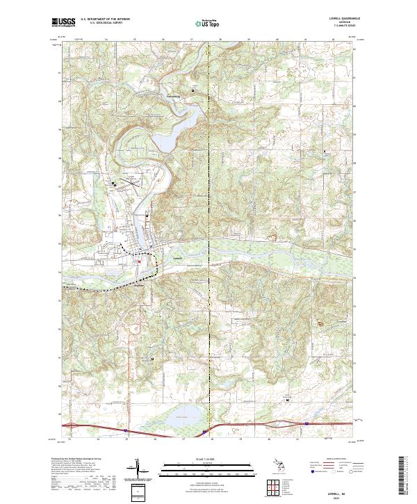 2023 Lowell2023 Print · USGSCovers Boston Township, including Lowell Charter Township, Vergennes Township, and other nearby areas
 - 2023 Map of Freeport, 2023 Print
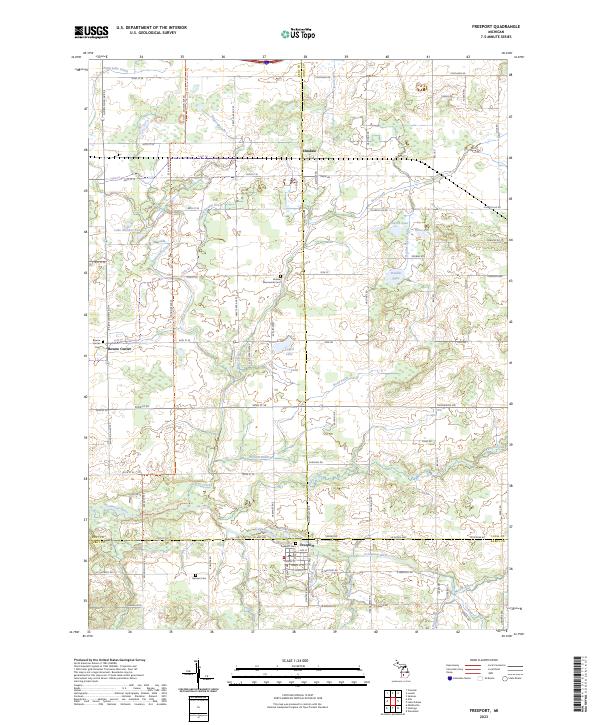 2023 Freeport2023 Print · USGSCovers Boston Township, including Lowell Charter Township, Freeport, and other nearby areas
End of results
Showing maps 1-17 of 17
Top cities near Boston Township
- Cascade Charter Township historical maps
- Ada Township historical maps
- Cannon Township historical maps
- Ionia historical maps
- Lowell Charter Township historical maps
- Belding historical maps
See more
Top neighborhoods of Boston Township
Frequently asked questions
- What are the different types of historical maps available for Boston Township?
- What is the oldest map of Boston Township?
- Where can I purchase historical maps of Boston Township for my home or office?
- Where can I download high-res historical maps of Boston Township?
- Are there historical topographic maps available for Boston Township?
- Is there historical aerial imagery available for Boston Township?
- Where are historical maps of Boston Township sourced from?