1940s Maps of Bete Grise, Grant Township
Explore 3 historic maps of Bete Grise from the 1940s. These maps offer a rare glimpse into what life looked like during the 1940s — showing old roads, neighborhoods, homes, and landmarks that have changed or disappeared over time.
Whether you're researching your family's past, planning a metal detecting trip, or studying how Bete Grise's landscape evolved across the 1940s, these high-resolution maps are a powerful tool for exploring the history of this region.
- Focus on a specific era: All maps on this page are from the 1940s, giving you a focused view of this time period.
- See what’s changed: Compare century-old streets, trails, and buildings to today's modern landscape using overlays and satellite layers.
- Research with precision: Use these maps for genealogy, historical research, land use analysis, or educational projects.
- View, download, or print: Maps are fully viewable online in high resolution, and can be downloaded or printed for your own records.
Start exploring Bete Grise's history through authentic maps from the 1940s. This is your window into the past.
Bete Grise, Grant Township maps
(3)- 1940 Map of Lake Medora
 1940 Lake Medora1940 Print · USGSKeweenaw's rugged northern tip is captured in the 1940s as a landscape of mining history and new tourism. Trace the early routes of Brockway Mountain Drive and find the site of Aetna near Lake Manganese.
 - 1948 Map of Lake Medora, 1964 Print
 1948 Lake Medora1964 Print · USGSThe Keweenaw Peninsula's northern coast appears here in the late 1940s, balancing its mining history with emerging tourism. Researchers can trace the winding Brockway Mountain Drive and find landmarks like Ft Wilkins State Park and Mount Houghton.3 unique versions available
 - 1949 Map of Lake Medora
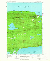
 1949 Lake Medora1949 Print · USGSThe tip of Michigan's Keweenaw Peninsula comes alive in this late 1940s survey of the northern copper country. Trace the historic grounds of Ft Wilkins State Park, the heights of Mount Houghton, and the remote coastal settlement at Bete Grise.
End of results
Showing maps 1-3 of 3
Top cities near Bete Grise
Frequently asked questions
- What are the different types of historical maps available for Bete Grise?
- What is the oldest map of Bete Grise?
- Where can I purchase historical maps of Bete Grise for my home or office?
- Where can I download high-res historical maps of Bete Grise?
- Are there historical topographic maps available for Bete Grise?
- Is there historical aerial imagery available for Bete Grise?
- Where are historical maps of Bete Grise sourced from?