Old Maps of Volney, Beaver Township for Genealogy
Trace your family roots with 8 historic maps of Volney. These high-res maps reveal old neighborhoods, homesites, landmarks, and streets — helping you uncover where your ancestors lived and how the area evolved over time.
- Explore historic neighborhoods: Identify where your relatives may have lived in the 1800s or 1900s.
- Compare maps over time: Trace the changes in streets, buildings, and landmarks for multi-generational research.
- Perfect for genealogy & ancestry research: Used by family historians and researchers to map out lineage and migration.
These maps are an incredible resource for exploring your personal connection to Volney's past.
Volney, Beaver Township maps
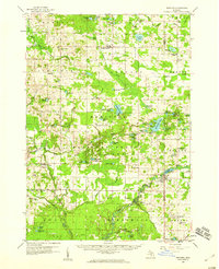
(8)- 1931 Map of Walkerville NE
 1931 Walkerville NE1931 Print · USGSCovers Volney, including Colfax, Troy, and other nearby areas
 - 1954 Map of Milwaukee, 1967 Print
 1954 Milwaukee1967 Print · USGSCovers Volney, including Milwaukee, West Allis, and other nearby areas3 unique versions available
 - 1958 Map of Milwaukee
 1958 Milwaukee1958 Print · USGSCovers Volney, including Milwaukee, West Allis, and other nearby areas
 - 1958 Map of Hesperia, 1959 Print
 1958 Hesperia1959 Print · USGSCovers Volney, including Ferry, Elbridge, and other nearby areas3 unique versions available
 - 1976 Map of Hersperia NE
 1976 Hersperia NE1976 Print · USGSCovers Volney, including Colfax, Troy, and other nearby areas
 - 1983 Map of Ludington, 1984 Print
 1983 Ludington1984 Print · USGSCovers Volney, including Ludington, Amber, and other nearby areas
 - 1985 Map of Walkerville East
 1985 Walkerville East1985 Print · USGSCovers Volney, including Colfax, Troy, and other nearby areas
 - 2023 Map of Walkerville East, 2023 Print
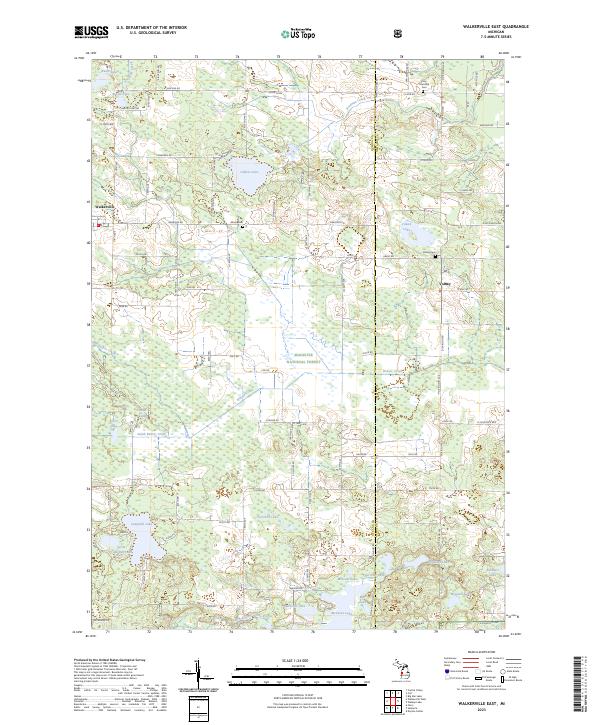 2023 Walkerville East2023 Print · USGSCovers Volney, including Colfax, Troy, and other nearby areas
End of results
Showing maps 1-8 of 8
Top cities near Volney
- Fremont historical maps
- Ferry historical maps
- Baldwin historical maps
- Elbridge historical maps
- Hesperia historical maps
- Lilley historical maps
See more
Frequently asked questions
- What are the different types of historical maps available for Volney?
- What is the oldest map of Volney?
- Where can I purchase historical maps of Volney for my home or office?
- Where can I download high-res historical maps of Volney?
- Are there historical topographic maps available for Volney?
- Is there historical aerial imagery available for Volney?
- Where are historical maps of Volney sourced from?