1900s (20th Century) Maps of Denver Township, Michigan
Explore 21 historic maps of Denver Township from the 1900s (20th Century). These maps offer a rare glimpse into what life looked like during the 1900s — showing old roads, neighborhoods, homes, and landmarks that have changed or disappeared over time.
Whether you're researching your family's past, planning a metal detecting trip, or studying how Denver Township's landscape evolved across the 1900s, these high-resolution maps are a powerful tool for exploring the history of this region.
- Focus on a specific era: All maps on this page are from the 1900s, giving you a focused view of this time period.
- See what’s changed: Compare century-old streets, trails, and buildings to today's modern landscape using overlays and satellite layers.
- Research with precision: Use these maps for genealogy, historical research, land use analysis, or educational projects.
- View, download, or print: Maps are fully viewable online in high resolution, and can be downloaded or printed for your own records.
Start exploring Denver Township's history through authentic maps from the 1900s. This is your window into the past.
Denver Township, MI maps
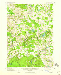
(21)- 1931 Map of Walkerville NE
 1931 Walkerville NE1931 Print · USGSCovers Denver Township, including Colfax, Troy, and other nearby areas
 - 1931 Map of Walkerville SE
 1931 Walkerville SE1931 Print · USGSCovers Denver Township, including Hesperia, Greenwood Township, and other nearby areas
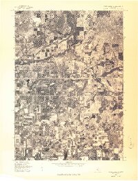
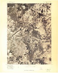
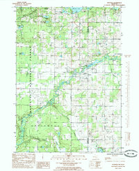
 - 1954 Map of Milwaukee, 1967 Print
 1954 Milwaukee1967 Print · USGSCovers Denver Township, including Milwaukee, West Allis, and other nearby areas3 unique versions available
 - 1954 Map of Midland, 1967 Print
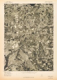
 1954 Midland1967 Print · USGSCovers Denver Township, including Grand Rapids, Midland, and other nearby areas4 unique versions available
 - 1958 Map of Midland
 1958 Midland1958 Print · USGSCovers Denver Township, including Grand Rapids, Midland, and other nearby areas
 - 1958 Map of Milwaukee
 1958 Milwaukee1958 Print · USGSCovers Denver Township, including Milwaukee, West Allis, and other nearby areas
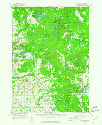
 - 1958 Map of Hesperia, 1959 Print
 1958 Hesperia1959 Print · USGSCovers Denver Township, including Ferry, Elbridge, and other nearby areas3 unique versions available
 - 1959 Map of Midland
 1959 Midland1959 Print · USGSCovers Denver Township, including Grand Rapids, Midland, and other nearby areas
 - 1959 Map of White Cloud, 1960 Print
 1959 White Cloud1960 Print · USGSCovers Denver Township, including White Cloud, Monroe Township, and other nearby areas3 unique versions available
 - 1966 Map of Midland
 1966 Midland1966 Print · USGSCovers Denver Township, including Grand Rapids, Midland, and other nearby areas
 - 1976 Map of White Cloud SW
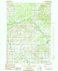
 1976 White Cloud SW1976 Print · USGSCovers Denver Township, including Aetna, Sherman Township, and other nearby areas
 - 1976 Map of Hersperia SE
 1976 Hersperia SE1976 Print · USGSCovers Denver Township, including Hesperia, Greenwood Township, and other nearby areas
 - 1976 Map of Hersperia NE
 1976 Hersperia NE1976 Print · USGSCovers Denver Township, including Colfax, Troy, and other nearby areas
 - 1976 Map of White Cloud NW
 1976 White Cloud NW1976 Print · USGSCovers Denver Township, including Walgamor Corners, Beaver Township, and other nearby areas
 - 1983 Map of Ludington, 1984 Print
 1983 Ludington1984 Print · USGSCovers Denver Township, including Ludington, Amber, and other nearby areas
 - 1984 Map of Big Rapids
 1984 Big Rapids1984 Print · USGSCovers Denver Township, including Big Rapids, Big Prairie, and other nearby areas
 - 1985 Map of Walkup Lake
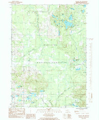 1985 Walkup Lake1985 Print · USGSCovers Denver Township, including Walgamor Corners, Beaver Township, and other nearby areas
 - 1985 Map of Dayton Center
 1985 Dayton Center1985 Print · USGSCovers Denver Township, including Aetna, Sherman Township, and other nearby areas
 - 1985 Map of Hesperia
 1985 Hesperia1985 Print · USGSCovers Denver Township, including Hesperia, Greenwood Township, and other nearby areas
 - 1985 Map of Walkerville East
 1985 Walkerville East1985 Print · USGSCovers Denver Township, including Colfax, Troy, and other nearby areas
 - 1991 Map of Big Rapids
 1991 Big Rapids1991 Print · USGSCovers Denver Township, including Big Rapids, Big Prairie, and other nearby areas
End of results
Showing maps 1-21 of 21
Top cities near Denver Township
- Fremont historical maps
- Holton historical maps
- Newaygo historical maps
- White Cloud historical maps
- Hesperia historical maps
- Lilley historical maps
See more
Top neighborhoods of Denver Township
Frequently asked questions
- What are the different types of historical maps available for Denver Township?
- What is the oldest map of Denver Township?
- Where can I purchase historical maps of Denver Township for my home or office?
- Where can I download high-res historical maps of Denver Township?
- Are there historical topographic maps available for Denver Township?
- Is there historical aerial imagery available for Denver Township?
- Where are historical maps of Denver Township sourced from?