Old Maps of Madison Heights, Michigan
Explore 24 old maps of Madison Heights, spanning from 1905 to today. These high-resolution historic maps reveal how streets, neighborhoods, landmarks, and natural features evolved over time — perfect for genealogy, metal detecting, research, and local history exploration.
What you can do with these maps:
- See how Madison Heights changed over time: Compare historical maps to modern-day views to trace roads, homesites, rail lines & more.
- View detailed metadata: Each map includes creators, publishers, year, scale, and archive source.
- Overlay maps with satellite & LiDAR: Visualize the past alongside modern tools to explore terrain & human change.
- Trusted historical sources: Maps sourced from the USGS, Library of Congress, and other archives.
- Access maps your way: View online, download high-res files, or order prints for personal or research use.
Start exploring old maps of Madison Heights to uncover forgotten places, hidden landmarks, and the deep history beneath your feet.
Madison Heights, MI maps
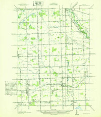
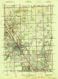
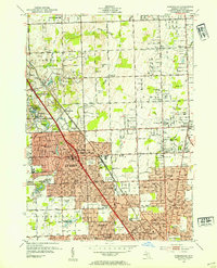
(24)- 1905 Map of Detroit
 1905 Detroit1905 Print · USGSCovers Madison Heights, including Detroit, Windsor, and other nearby areas2 unique versions available
 - 1908 Map of Rochester
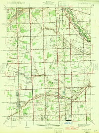
 1908 Rochester1908 Print · USGSCovers Madison Heights, including Sterling Heights, Warren, and other nearby areas3 unique versions available
 - 1918 Map of Detroit
 1918 Detroit1918 Print · USGSCovers Madison Heights, including Detroit, Windsor, and other nearby areas
 - 1924 Map of Detroit
 1924 Detroit1924 Print · USGSCovers Madison Heights, including Detroit, Windsor, and other nearby areas
 - 1934 Map of Detroit
 1934 Detroit1934 Print · USGSCovers Madison Heights, including Detroit, Windsor, and other nearby areas
 - 1936 Map of Warren
 1936 Warren1936 Print · USGSCovers Madison Heights, including Sterling Heights, Warren, and other nearby areas
 - 1936 Map of Birmingham
 1936 Birmingham1936 Print · USGSCovers Madison Heights, including Troy, Rochester Hills, and other nearby areas
 - 1936 Map of Highland Park
 1936 Highland Park1936 Print · USGSCovers Madison Heights, including Detroit, Warren, and other nearby areas
 - 1940 Map of Highland Park
 1940 Highland Park1940 Print · USGSCovers Madison Heights, including Detroit, Warren, and other nearby areas2 unique versions available
 - 1945 Map of Birmingham
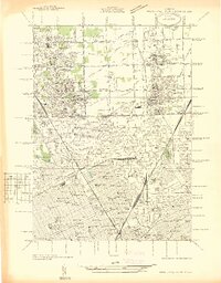
 1945 Birmingham1945 Print · USGSCovers Madison Heights, including Troy, Rochester Hills, and other nearby areas
 - 1946 Map of Warren
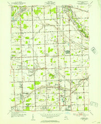
 1946 Warren1946 Print · USGSCovers Madison Heights, including Sterling Heights, Warren, and other nearby areas
 - 1952 Map of Warren, 1953 Print
 1952 Warren1953 Print · USGSCovers Madison Heights, including Sterling Heights, Warren, and other nearby areas2 unique versions available
 - 1952 Map of Highland Park, 1954 Print
 1952 Highland Park1954 Print · USGSCovers Madison Heights, including Detroit, Warren, and other nearby areas2 unique versions available
 - 1952 Map of Birmingham, 1954 Print
 1952 Birmingham1954 Print · USGSCovers Madison Heights, including Troy, Rochester Hills, and other nearby areas
 - 1954 Map of Detroit
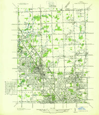
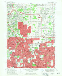
 1954 Detroit1954 Print · USGSCovers Madison Heights, including Detroit, Windsor, and other nearby areas
 - 1961 Map of Detroit, 1973 Print
 1961 Detroit1973 Print · USGSCovers Madison Heights, including Detroit, Windsor, and other nearby areas2 unique versions available
 - 1965 Map of Detroit
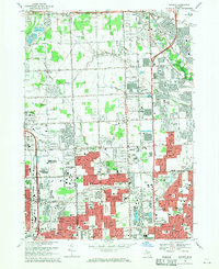
 1965 Detroit1965 Print · USGSCovers Madison Heights, including Detroit, Windsor, and other nearby areas
 - 1968 Map of Birmingham, 1971 Print
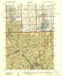
 1968 Birmingham1971 Print · USGSCovers Madison Heights, including Troy, Rochester Hills, and other nearby areas4 unique versions available
 - 1968 Map of Warren, 1971 Print
 1968 Warren1971 Print · USGSCovers Madison Heights, including Sterling Heights, Warren, and other nearby areas5 unique versions available
 - 1968 Map of Highland Park, 1971 Print
 1968 Highland Park1971 Print · USGSCovers Madison Heights, including Detroit, Warren, and other nearby areas4 unique versions available
 - 1981 Map of Birmingham, 1989 Print
 1981 Birmingham1989 Print · USGSCovers Madison Heights, including Troy, Rochester Hills, and other nearby areas
 - 1985 Map of Detroit
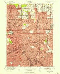
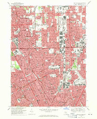
 1985 Detroit1985 Print · USGSCovers Madison Heights, including Detroit, Windsor, and other nearby areas
 - 1985 Map of Pontiac
 1985 Pontiac1985 Print · USGSCovers Madison Heights, including Sterling Heights, Warren, and other nearby areas2 unique versions available
 - 1989 Map of Detroit, 1991 Print
 1989 Detroit1991 Print · USGSCovers Madison Heights, including Detroit, Windsor, and other nearby areas
End of results
Showing maps 1-24 of 24
Top cities near Madison Heights
- Detroit historical maps
- Sterling Heights historical maps
- Warren historical maps
- Clinton Township historical maps
- Livonia historical maps
- Dearborn historical maps
See more
Frequently asked questions
- What are the different types of historical maps available for Madison Heights?
- What is the oldest map of Madison Heights?
- Where can I purchase historical maps of Madison Heights for my home or office?
- Where can I download high-res historical maps of Madison Heights?
- Are there historical topographic maps available for Madison Heights?
- Is there historical aerial imagery available for Madison Heights?
- Where are historical maps of Madison Heights sourced from?