Old Maps of Little Point Sable, Benona Township for Metal Detecting
Plan your next treasure hunt with 9 historic maps of Little Point Sable. Find old homesites, ghost towns, trails, and gathering spots that may be lost to time — perfect for identifying promising metal detecting locations.
- Locate forgotten sites: Uncover places like long-lost settlements, abandoned rail lines, or gathering spots.
- Plan better hunts: Use map overlays combined with LiDAR or satellite views to narrow in on historically rich areas.
- Made for detectorists: Thousands of hobbyists use these maps to discover relics, coins, and hidden history.
Use these historic maps to boost your research and find new opportunities beneath the surface of Little Point Sable.
Little Point Sable, Benona Township maps
(9)- 1954 Map of Milwaukee, 1967 Print
 1954 Milwaukee1967 Print · USGSCoastal life and maritime commerce across Lake Michigan are seen here during the mid-fifties, bridging Wisconsin's industrial hubs and Michigan's timberlands. Genealogists and historians can trace the rail lines of the Grand Trunk Western and find long-established ports like Ludington, Port Washington, and Muskegon.3 unique versions available
 - 1958 Map of Milwaukee
 1958 Milwaukee1958 Print · USGSThe shorelines of Lake Michigan in the late fifties reveal a landscape of bustling ferry ports and growing industrial suburbs. Genealogists and historians can trace rail networks like the Chesapeake & Ohio and locate landmarks such as Little Sable Point and Holy Cross Church.
 - 1983 Map of Little Point Sable
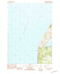 1983 Little Point Sable1983 Print · USGSThe Oceana County shoreline is documented here in the early 1980s, showcasing the transition from dramatic dunes to rural townships. Genealogists and historians can locate the iconic Little Point Sable Lighthouse and trace early road networks like Warren Road near Silver Lake.
 - 1983 Map of Ludington, 1984 Print
 1983 Ludington1984 Print · USGSThe Michigan shoreline during the early eighties comes alive in this survey of the dunes and woodlands. Trace the Chesapeake and Ohio rail route through Ludington and Hart, or find family landmarks like Meisenheimer Corners and Wiley.
 - 2011 Map of Little Point Sable, 2011 Print
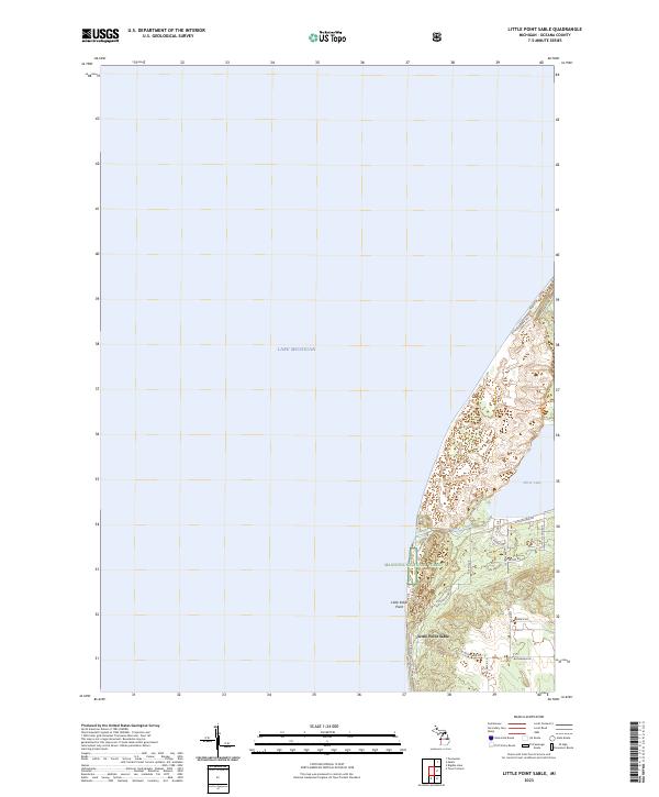
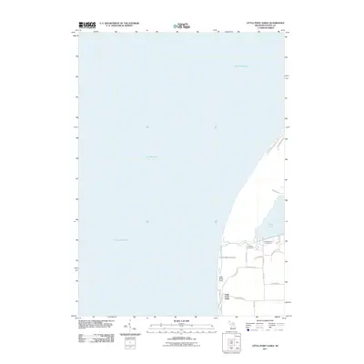 2011 Little Point Sable2011 Print · USGSCovers Little Point Sable, including Benona Township, Golden Township, and other nearby areas
 - 2014 Map of Little Point Sable, 2014 Print
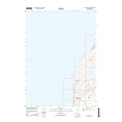 2014 Little Point Sable2014 Print · USGSCovers Little Point Sable, including Benona Township, Golden Township, and other nearby areas
 - 2017 Map of Little Point Sable, 2017 Print
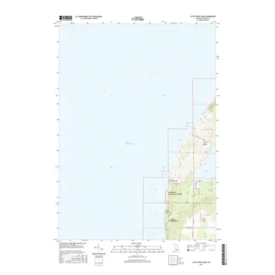 2017 Little Point Sable2017 Print · USGSCovers Little Point Sable, including Benona Township, Golden Township, and other nearby areas
 - 2019 Map of Little Point Sable, 2019 Print
 2019 Little Point Sable2019 Print · USGSCovers Little Point Sable, including Benona Township, Golden Township, and other nearby areas
 - 2023 Map of Little Point Sable, 2023 Print
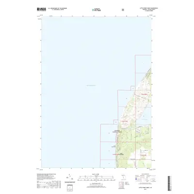
 2023 Little Point Sable2023 Print · USGSThe Oceana County shoreline is captured in this recent survey, showcasing the dynamic dunes between the great lake and Silver Lake. Property researchers can trace modern boundaries near Little Point Sable or follow routes like N Lighthouse Dr and S Stone Church Rd.
End of results
Showing maps 1-9 of 9
Top cities near Little Point Sable
- Whitehall historical maps
- Montague historical maps
- Hart historical maps
- Shelby historical maps
- Weare historical maps
- Pentwater historical maps
See more
Frequently asked questions
- What are the different types of historical maps available for Little Point Sable?
- What is the oldest map of Little Point Sable?
- Where can I purchase historical maps of Little Point Sable for my home or office?
- Where can I download high-res historical maps of Little Point Sable?
- Are there historical topographic maps available for Little Point Sable?
- Is there historical aerial imagery available for Little Point Sable?
- Where are historical maps of Little Point Sable sourced from?