1900s (20th Century) Maps of Bagley Township, Michigan
Explore 15 historic maps of Bagley Township from the 1900s (20th Century). These maps offer a rare glimpse into what life looked like during the 1900s — showing old roads, neighborhoods, homes, and landmarks that have changed or disappeared over time.
Whether you're researching your family's past, planning a metal detecting trip, or studying how Bagley Township's landscape evolved across the 1900s, these high-resolution maps are a powerful tool for exploring the history of this region.
- Focus on a specific era: All maps on this page are from the 1900s, giving you a focused view of this time period.
- See what’s changed: Compare century-old streets, trails, and buildings to today's modern landscape using overlays and satellite layers.
- Research with precision: Use these maps for genealogy, historical research, land use analysis, or educational projects.
- View, download, or print: Maps are fully viewable online in high resolution, and can be downloaded or printed for your own records.
Start exploring Bagley Township's history through authentic maps from the 1900s. This is your window into the past.
Bagley Township, MI maps
(15)- 1949 Map of Otsego Lake, 1954 Print
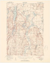 1949 Otsego Lake1954 Print · USGSCovers Bagley Township, including Gaylord, Otsego Lake, and other nearby areas2 unique versions available
 - 1950 Map of Turtle Lake, 1979 Print
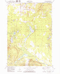 1950 Turtle Lake1979 Print · USGSCovers Bagley Township, including Whites Landing, Chester Township, and other nearby areas2 unique versions available
 - 1951 Map of Turtle Lake
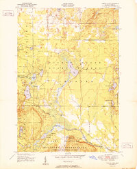 1951 Turtle Lake1951 Print · USGSCovers Bagley Township, including Whites Landing, Chester Township, and other nearby areas2 unique versions available
 - 1951 Map of Otsego Lake
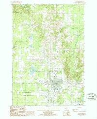
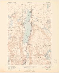 1951 Otsego Lake1951 Print · USGSCovers Bagley Township, including Gaylord, Otsego Lake, and other nearby areas5 unique versions available
 - 1954 Map of Gaylord
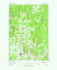 1954 Gaylord1954 Print · USGSCovers Bagley Township, including Gaylord, Vanderbilt, and other nearby areas3 unique versions available
 - 1954 Map of Traverse City, 1965 Print
 1954 Traverse City1965 Print · USGSCovers Bagley Township, including Garfield Township, Garfield Charter Township, and other nearby areas4 unique versions available
 - 1955 Map of Cheboygan, 1964 Print
 1955 Cheboygan1964 Print · USGSCovers Bagley Township, including Petoskey, Peninsula Township, and other nearby areas5 unique versions available
 - 1958 Map of Cheboygan
 1958 Cheboygan1958 Print · USGSCovers Bagley Township, including Petoskey, Peninsula Township, and other nearby areas2 unique versions available
 - 1958 Map of Traverse City
 1958 Traverse City1958 Print · USGSCovers Bagley Township, including Garfield Township, Garfield Charter Township, and other nearby areas2 unique versions available
 - 1975 Map of Gaylord SW, 1976 Print
 1975 Gaylord SW1976 Print · USGSCovers Bagley Township, including Gaylord, Hayes Township, and other nearby areas
 - 1982 Map of Petoskey
 1982 Petoskey1982 Print · USGSCovers Bagley Township, including Petoskey, Gaylord, and other nearby areas
 - 1983 Map of Grayling, 1984 Print
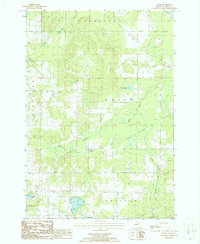
 1983 Grayling1984 Print · USGSCovers Bagley Township, including Gaylord, Otsego Lake, and other nearby areas2 unique versions available
 - 1986 Map of Gaylord
 1986 Gaylord1986 Print · USGSCovers Bagley Township, including Gaylord, Hayes Township, and other nearby areas2 unique versions available
 - 1986 Map of Sparr
 1986 Sparr1986 Print · USGSCovers Bagley Township, including Dover Township, Livingston Township, and other nearby areas
 - 1989 Map of Traverse City, 1990 Print
 1989 Traverse City1990 Print · USGSCovers Bagley Township, including Garfield Township, Garfield Charter Township, and other nearby areas
End of results
Showing maps 1-15 of 15
Top cities near Bagley Township
- Gaylord historical maps
- Otsego Lake historical maps
- Elmira historical maps
- Frederic historical maps
- Vanderbilt historical maps
- Lovells historical maps
Top neighborhoods of Bagley Township
- Oak Grove historical maps
- Pearll City historical maps
- Arbutus Beach historical maps
- Eyedylwild Beach historical maps
Frequently asked questions
- What are the different types of historical maps available for Bagley Township?
- What is the oldest map of Bagley Township?
- Where can I purchase historical maps of Bagley Township for my home or office?
- Where can I download high-res historical maps of Bagley Township?
- Are there historical topographic maps available for Bagley Township?
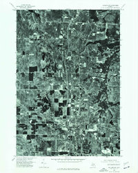
- Is there historical aerial imagery available for Bagley Township?
- Where are historical maps of Bagley Township sourced from?