2020s Maps of Hayes Township, Michigan
Explore 6 historic maps of Hayes Township from the 2020s. These maps offer a rare glimpse into what life looked like during the 2020s — showing old roads, neighborhoods, homes, and landmarks that have changed or disappeared over time.
Whether you're researching your family's past, planning a metal detecting trip, or studying how Hayes Township's landscape evolved across the 2020s, these high-resolution maps are a powerful tool for exploring the history of this region.
- Focus on a specific era: All maps on this page are from the 2020s, giving you a focused view of this time period.
- See what’s changed: Compare century-old streets, trails, and buildings to today's modern landscape using overlays and satellite layers.
- Research with precision: Use these maps for genealogy, historical research, land use analysis, or educational projects.
- View, download, or print: Maps are fully viewable online in high resolution, and can be downloaded or printed for your own records.
Start exploring Hayes Township's history through authentic maps from the 2020s. This is your window into the past.
Hayes Township, MI maps
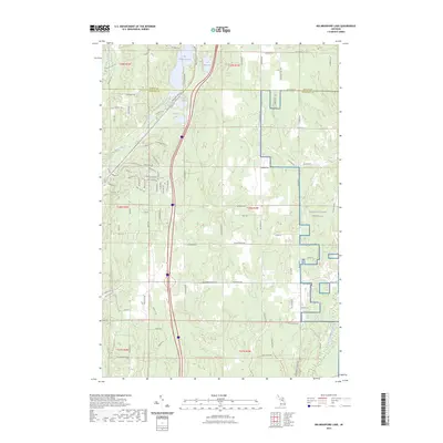
(6)- 2023 Map of Gaylord, 2023 Print
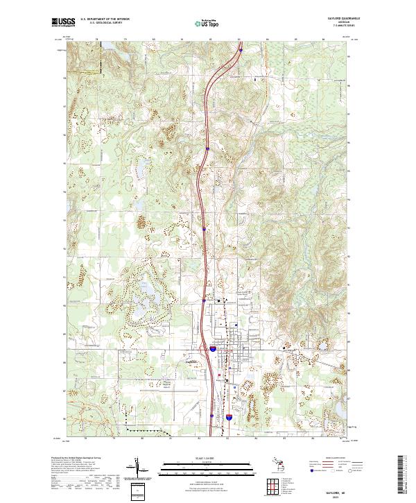 2023 Gaylord2023 Print · USGSGaylord and the surrounding Otsego County countryside are shown in high detail during this recent decade of development and preservation. Researchers can locate several burial grounds like Saint Mary Cem and Bagley Cem or trace the headwaters of the Sturgeon River.
 - 2023 Map of Elmira, 2023 Print
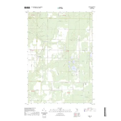 2023 Elmira2023 Print · USGSOtsego County's high country is captured here during the early twenty-first century, centered on the settlement of Elmira. Genealogists and local historians can locate several burial grounds including Saint Thomas Cem and Hayes Township Cem among the region's many glacial lakes.
 - 2023 Map of Frederic, 2023 Print
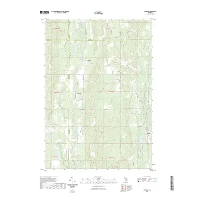 2023 Frederic2023 Print · USGSCrawford County's forested interior is captured here as a modern network of trails and historic river crossings. Genealogists can locate Shrine Cem and Oakwood Cem, while explorers can trace the heritage of Deward along the Manistee River.
 - 2023 Map of Otsego Lake, 2023 Print
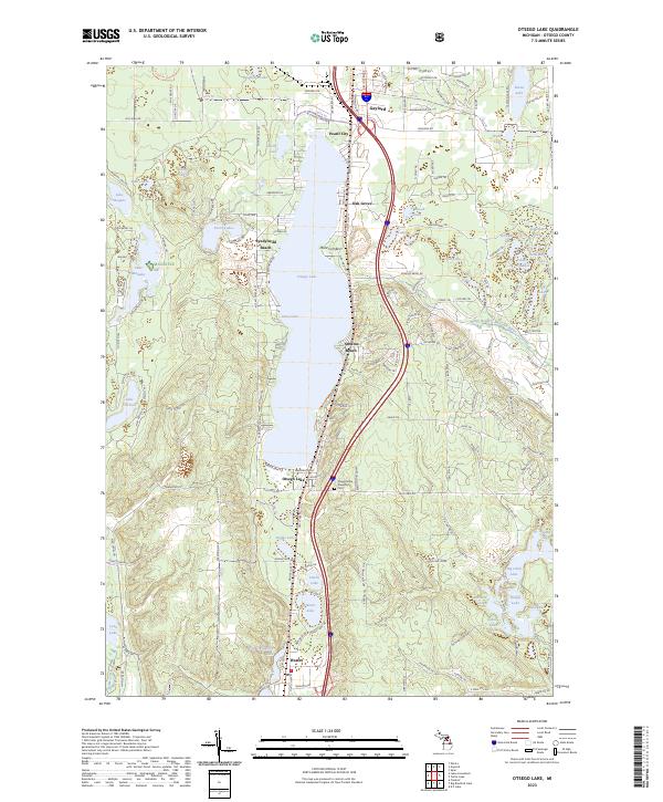 2023 Otsego Lake2023 Print · USGSOtsego Lake and its surrounding resort communities are documented in this recent survey, showcasing the region's dense network of glacial lakes. Genealogists and local historians can locate Otsego Lake Township Cem and trace the residential layout of Gaylord, Waters, and Pearll City.
 - 2023 Map of Lake Arrowhead, 2023 Print
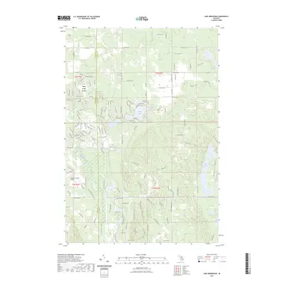 2023 Lake Arrowhead2023 Print · USGSOtsego County during the early twenty-first century reveals a landscape shaped by both private development and protected woodlands. Researchers can trace the layout of Lakes of the North and find secluded water bodies like Buhl Lakes and Lake Washwomen.
 - 2023 Map of Big Bradford Lake, 2023 Print
 2023 Big Bradford Lake2023 Print · USGSNorthern Michigan lakelands and forest trails characterize this modern Crawford County landscape. Researchers can locate the Maple Forest Cem and trace the eastern boundaries of NG MTC-H Camp Grayling near the headwaters of the East Branch Au Sable River.
End of results
Showing maps 1-6 of 6
Top cities near Hayes Township
- Gaylord historical maps
- Otsego Lake historical maps
- Elmira historical maps
- Frederic historical maps
- Vanderbilt historical maps
- Boyne Falls historical maps
Frequently asked questions
- What are the different types of historical maps available for Hayes Township?
- What is the oldest map of Hayes Township?
- Where can I purchase historical maps of Hayes Township for my home or office?
- Where can I download high-res historical maps of Hayes Township?
- Are there historical topographic maps available for Hayes Township?
- Is there historical aerial imagery available for Hayes Township?
- Where are historical maps of Hayes Township sourced from?