2020s Maps of Clay Township, Michigan
Explore 4 historic maps of Clay Township from the 2020s. These maps offer a rare glimpse into what life looked like during the 2020s — showing old roads, neighborhoods, homes, and landmarks that have changed or disappeared over time.
Whether you're researching your family's past, planning a metal detecting trip, or studying how Clay Township's landscape evolved across the 2020s, these high-resolution maps are a powerful tool for exploring the history of this region.
- Focus on a specific era: All maps on this page are from the 2020s, giving you a focused view of this time period.
- See what’s changed: Compare century-old streets, trails, and buildings to today's modern landscape using overlays and satellite layers.
- Research with precision: Use these maps for genealogy, historical research, land use analysis, or educational projects.
- View, download, or print: Maps are fully viewable online in high resolution, and can be downloaded or printed for your own records.
Start exploring Clay Township's history through authentic maps from the 2020s. This is your window into the past.
Clay Township, MI maps
(4)- 2023 Map of Algonac, 2023 Print
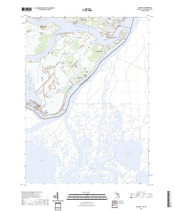 2023 Algonac2023 Print · USGSThe Saint Clair River delta comes alive in this contemporary record of Michigan's island communities and international borderlands. Trace local heritage through waterfront settlements like Sans Souci, find the Oaklawn Cem in Algonac, or follow the Walpole - Algonac Ferry.
 - 2023 Map of Marine City, 2023 Print
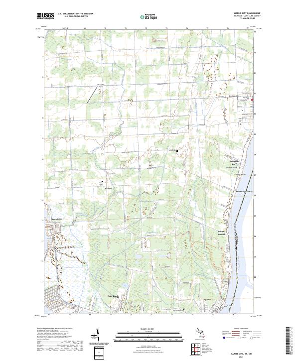 2023 Marine City2023 Print · USGSSt. Clair County's riverfront communities and inland drainage networks are detailed in this contemporary study. Genealogists can trace family sites at Holy Cross Cem and Maple Grove Cem or locate old settlements like Starville and Roberts Landing.
 - 2023 Map of Saint Clair Flats, 2023 Print
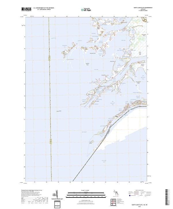 2023 Saint Clair Flats2023 Print · USGSThe St. Clair River delta is captured here in the 2020s, showing the complex international boundary and aquatic landscape of the Saint Clair Flats. Researchers can trace the unique water-based infrastructure of Harsens Island, from the Big Fisher Highway to the landmark at Miller.
 - 2023 Map of New Baltimore, 2023 Print
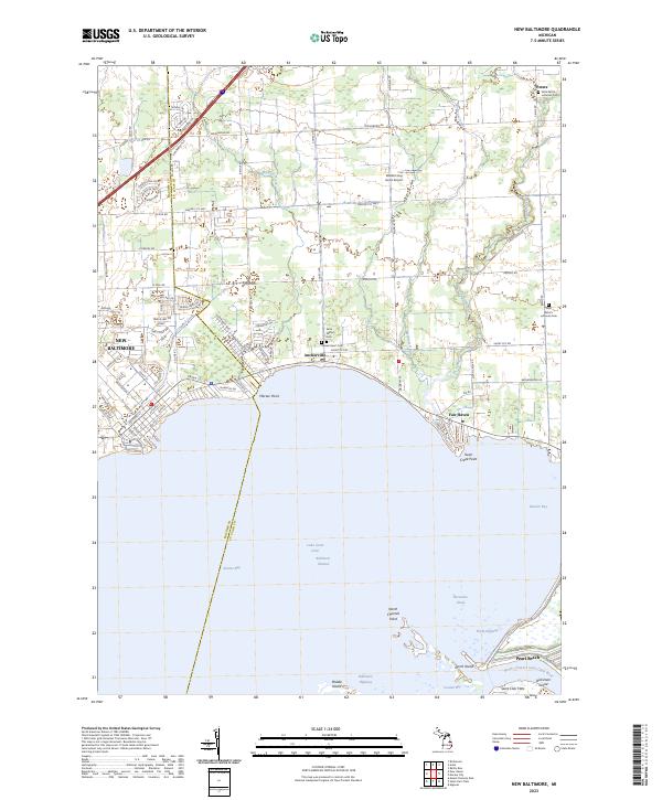 2023 New Baltimore2023 Print · USGSThe Macomb and St. Clair County shoreline comes alive in this contemporary map of the northern Lake Saint Clair coast. Trace the development of waterfront communities like Anchorville and Fair Haven, or locate family sites at Saint Peter's Lutheran Cem.
End of results
Showing maps 1-4 of 4
Top cities near Clay Township
- Chesterfield Township historical maps
- Harrison Township historical maps
- New Baltimore historical maps
- Grosse Pointe Farms historical maps
- New Haven historical maps
- Richmond historical maps
See more
Top neighborhoods of Clay Township
- San Souci historical maps
- Clays Landing historical maps
- Forster historical maps
- Middle Island historical maps
- Riverside historical maps
- Grande Pointe historical maps
See more
Frequently asked questions
- What are the different types of historical maps available for Clay Township?
- What is the oldest map of Clay Township?
- Where can I purchase historical maps of Clay Township for my home or office?
- Where can I download high-res historical maps of Clay Township?
- Are there historical topographic maps available for Clay Township?
- Is there historical aerial imagery available for Clay Township?
- Where are historical maps of Clay Township sourced from?