2020s Maps of Sanilac County, Michigan
Explore 24 historic maps of Sanilac County from the 2020s. These maps offer a rare glimpse into what life looked like during the 2020s — showing old roads, neighborhoods, homes, and landmarks that have changed or disappeared over time.
Whether you're researching your family's past, planning a metal detecting trip, or studying how Sanilac County's landscape evolved across the 2020s, these high-resolution maps are a powerful tool for exploring the history of this region.
- Focus on a specific era: All maps on this page are from the 2020s, giving you a focused view of this time period.
- See what’s changed: Compare century-old streets, trails, and buildings to today's modern landscape using overlays and satellite layers.
- Research with precision: Use these maps for genealogy, historical research, land use analysis, or educational projects.
- View, download, or print: Maps are fully viewable online in high resolution, and can be downloaded or printed for your own records.
Start exploring Sanilac County's history through authentic maps from the 2020s. This is your window into the past.
Sanilac County, MI maps
(24)- 2023 Map of New Greenleaf, 2023 Print
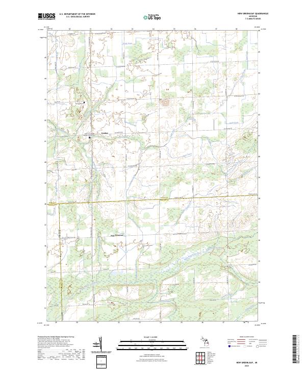 2023 New Greenleaf2023 Print · USGSAgricultural life in the Michigan Thumb is captured here at the triple-county boundary of Huron, Sanilac, and Tuscola. Family historians can trace local landmarks like Saint Columbkille Roman Catholic Cem and settlements at Ivanhoe and New Greenleaf.
 - 2023 Map of Peck, 2023 Print
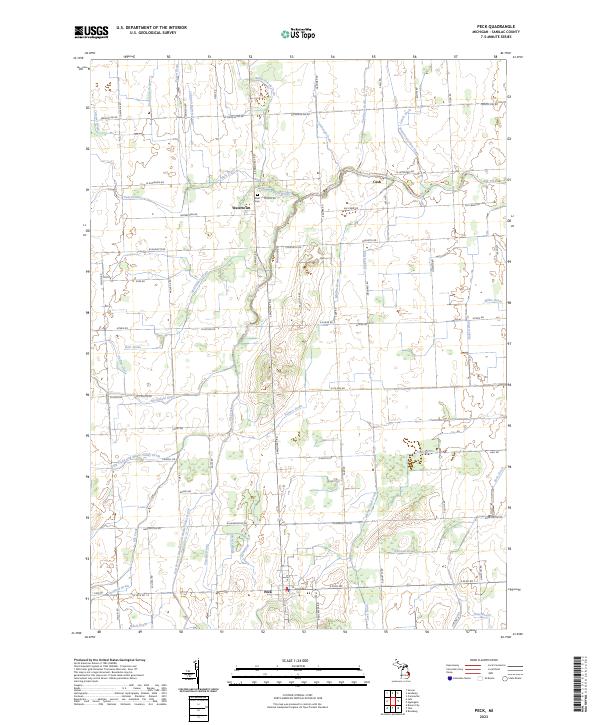 2023 Peck2023 Print · USGSSanilac County's agricultural heartland is captured in this modern survey of the Michigan thumb's rural interior. Genealogists and local historians can trace the grid of country roads and drainage networks connecting Peck, Watertown, and the Zion Cem.
 - 2023 Map of Deckerville, 2023 Print
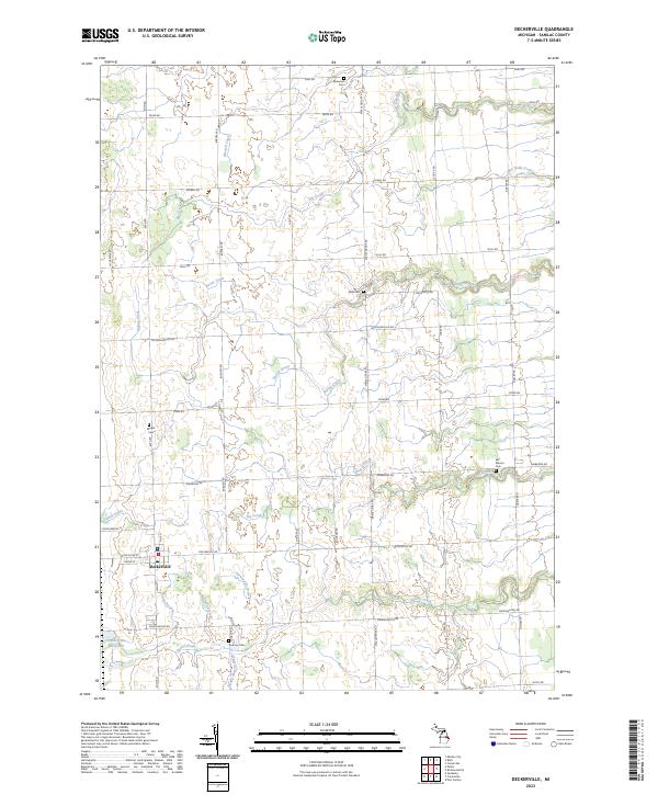 2023 Deckerville2023 Print · USGSSanilac County farming life and village growth are captured in this 2023 survey of the area surrounding Deckerville. Local historians can trace family roots through several rural burial sites like East Marion Cem and Wright Cem while mapping the region's complex network of agricultural drains.
 - 2023 Map of Juhl, 2023 Print
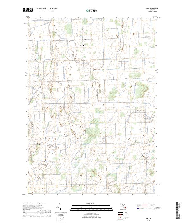 2023 Juhl2023 Print · USGSSanilac County remains a landscape of managed waterways and quiet rural corners in this 2023 study of the Thumb region. Genealogists can locate Juhl Cem and Omard Cem while tracing the South Branch Cass River and Elk Flynn and Maple Valley Drain.
 - 2023 Map of Shabbona, 2023 Print
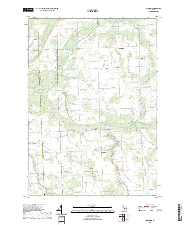 2023 Shabbona2023 Print · USGSThe Sanilac County countryside is captured here in the early twenty-first century as a complex network of agricultural drains and river branches. Genealogists and local historians can locate family landmarks like Nicol Family Cem and the crossroads at Shabbona or Wickware.
 - 2023 Map of Argyle, 2023 Print
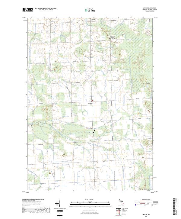 2023 Argyle2023 Print · USGSSanilac County's agricultural heartland appears here in the early twenty-first century, structured by section roads and an extensive drainage network. Genealogists can locate several key burial sites, including Saint Joseph and Saint Ignatius Cem, Argyle Cem, and Wheatland Cem.
 - 2023 Map of Sandusky, 2023 Print
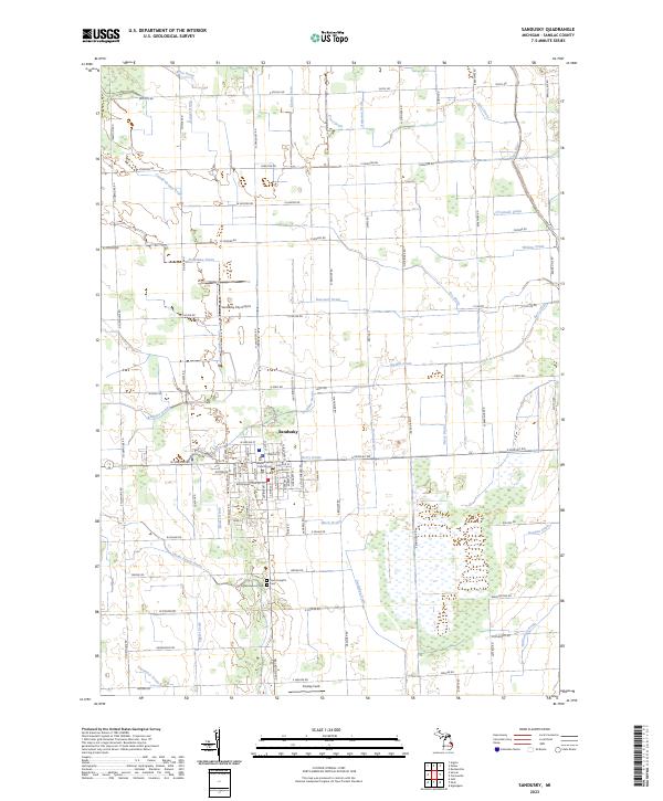 2023 Sandusky2023 Print · USGSThe city of Sandusky and its surrounding agricultural plains are captured in this modern survey of central Sanilac County. Researchers can trace land divisions across T12N R14E and locate local landmarks like the Sanilac County Courthouse, Greenwood Cem, and the Sandusky City Airport.
 - 2023 Map of Applegate, 2023 Print
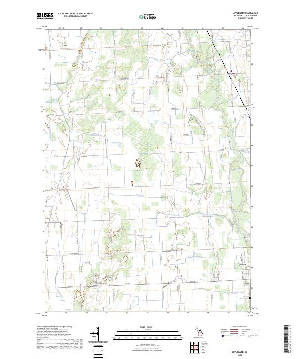 2023 Applegate2023 Print · USGSThe village of Applegate and the agricultural lands of Sanilac County are captured here during the 2020s. Genealogists and local historians can locate family landmarks like Steckley Cem, trace the course of the Black River, or explore the northern outskirts of Croswell.
 - 2023 Map of Ubly, 2023 Print
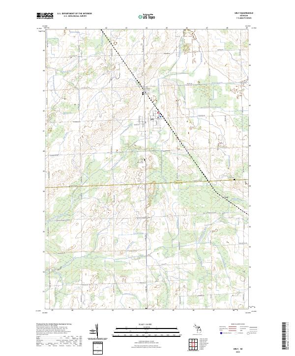 2023 Ubly2023 Print · USGSUbly and the surrounding farm country of Huron County are captured in this contemporary survey. Historians and genealogists can trace the rural landscape through family-named landmarks like Osentoski Branch and resting places such as Valley Cem and Tyre Cem.
 - 2023 Map of Snover, 2023 Print
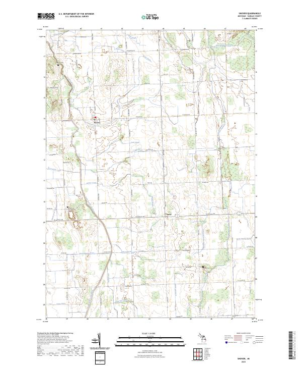 2023 Snover2023 Print · USGSSanilac County's agricultural heartland is documented here in the early twenty-first century, showing the established communities of Snover and Elmer. Researchers can trace family ties at the Moore Township Cem or follow the intricate network of local waterways like Beaver Creek and the South Branch Cass River.
 - 2023 Map of Decker, 2023 Print
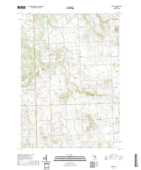 2023 Decker2023 Print · USGSSanilac County’s rural landscape is captured here in the early twenty-first century, showing the enduring agricultural character of the Michigan Thumb. Researchers can trace family roots through the Moshier Cem, explore the small community of Decker, or follow the South Branch Cass River through the plains.
 - 2023 Map of Palms, 2023 Print
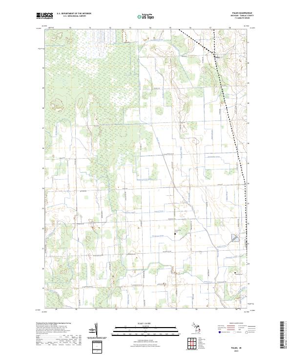 2023 Palms2023 Print · USGSThe community of Palms and its surrounding agricultural lands are documented in this recent survey. Genealogists and local historians can locate the Farnsworth Grave, Downing Cem, and the winding course of the Black River.
 - 2023 Map of Minden City, 2023 Print
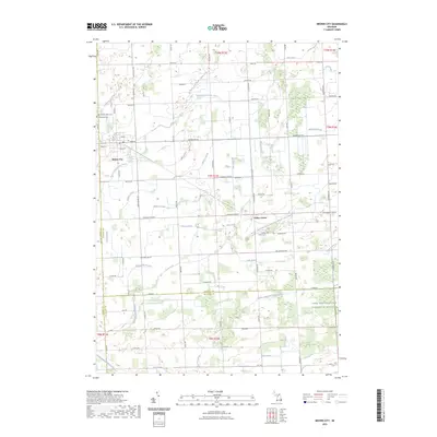
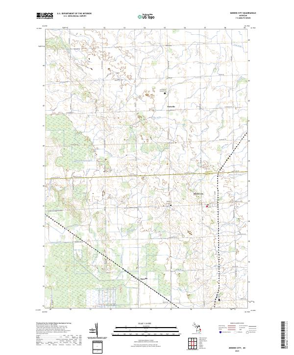 2023 Minden City2023 Print · USGSMinden City and its surrounding farmsteads are shown in this 2023 survey of the Sanilac and Huron county line. Genealogists can locate family landmarks like Saint Mary's Catholic Cem and the small settlements of Parisville and Peatville.
 - 2023 Map of Ruth, 2023 Print
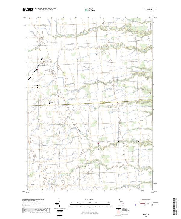 2023 Ruth2023 Print · USGSThe Michigan Thumb region comes into focus during this contemporary survey of the rural landscape bordering Sanilac and Huron counties. Genealogists can trace family footprints across numerous sites like Saints Peter and Paul Cem and Charleston.
 - 2023 Map of Brown City, 2023 Print
 2023 Brown City2023 Print · USGSThe borderlands of Sanilac and St. Clair counties are shown here in the 2020s, dominated by a vast agricultural drainage network. Researchers can pinpoint Evergreen Cem, Valley Center Cem, and the small community of Valley Center.
 - 2023 Map of Forestville, 2023 Print
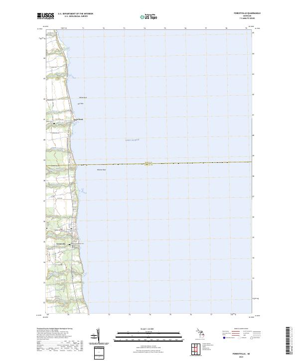 2023 Forestville2023 Print · USGSThe Lake Huron shoreline in eastern Michigan appears here in recent detail, showing the coastal villages and rural backroads of Sanilac and Huron Counties. Researchers can locate family landmarks like Saint Johns Cem and trace the paths of White River and Mill Creek through Forestville.
 - 2023 Map of Jeddo, 2023 Print
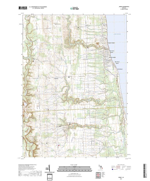 2023 Jeddo2023 Print · USGSThe Lake Huron shoreline and the rural interior of Sanilac County come together in this recent survey. Genealogists and local historians can trace family-named landmarks like Witham Field or locate numerous burial sites including Bardwell Cem and Baker Cem.
 - 2023 Map of Port Sanilac, 2023 Print
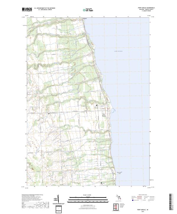 2023 Port Sanilac2023 Print · USGSThe Lake Huron coastline in Sanilac County is captured here in recent detail, focusing on the historic port villages and rural farmsteads. Researchers can locate family burial sites at Port Sanilac Cem and Ridge Cem or trace the winding courses of Forester Creek and Herron Creek.
 - 2023 Map of Croswell, 2023 Print
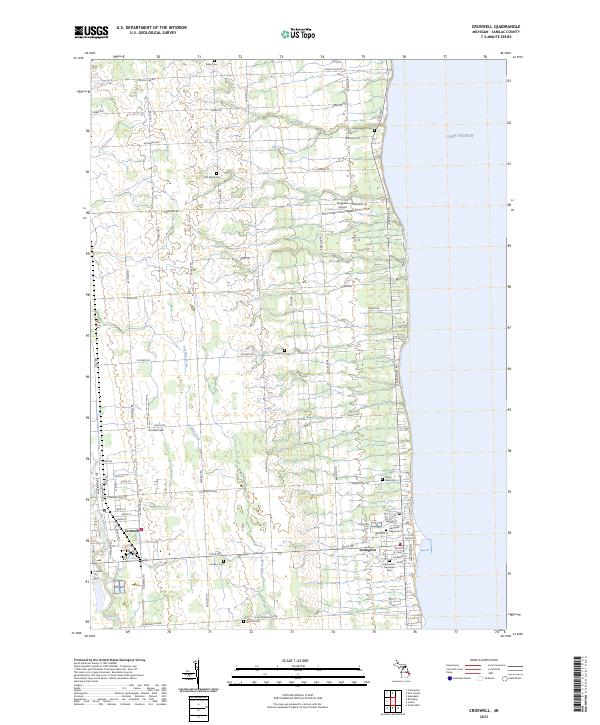 2023 Croswell2023 Print · USGSSanilac County's shoreline and inland farmsteads are shown in detail as they appeared recently. Researchers can locate family sites across a network of country burial grounds like Huckins Cem and Saint Denis Cem, or trace the paths of the Black River and Mill Creek.
 - 2023 Map of Carsonville, 2023 Print
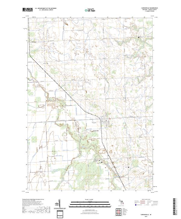 2023 Carsonville2023 Print · USGSCarsonville and the surrounding Sanilac County farmlands are captured in the early twenty-first century, showing the enduring agricultural character of the Michigan Thumb. Researchers can locate several historic burial sites, including Saint Marys Cem and Mount Zion Cem, while tracing the complex local waterways like the Black River and Elk Creek.
 - 2023 Map of Richmondville, 2023 Print
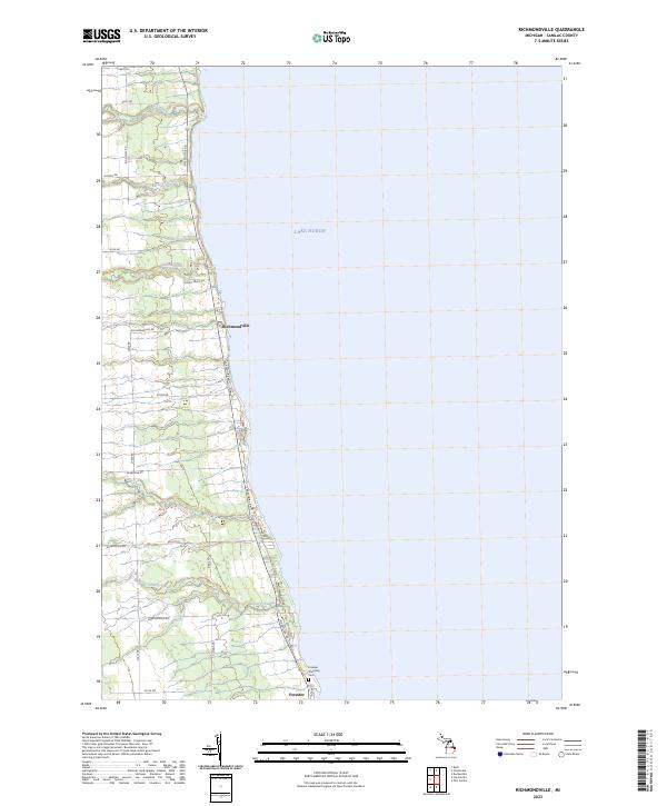 2023 Richmondville2023 Print · USGSCoastal Sanilac County is captured here along the western shores of the great lake during the early twenty-first century. Researchers can trace the layout of Richmondville and Forester, find the Forester Township Cem, and follow the winding courses of Elk Creek and Cherry Creek.
 - 2023 Map of Roseburg, 2023 Print
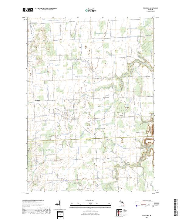 2023 Roseburg2023 Print · USGSAgricultural life in the Michigan thumb persists here in the early twenty-first century, centered on the settlement of Roseburg. Researchers can trace old family lands through drainage systems and landmarks like Fremont Cem, Lett Cem, and Seymour Creek.
 - 2023 Map of Yale, 2023 Print
 2023 Yale2023 Print · USGSThe Sanilac and Saint Clair county line comes alive in this survey of the Thumb region's rural townships and drain networks. Researchers can trace local heritage through numerous burial sites like Fairview Cem, Sacred Heart Cem, and the village of Melvin.
 - 2023 Map of Marlette, 2023 Print
 2023 Marlette2023 Print · USGSMarlette and the surrounding tri-county farm country are shown in this contemporary survey of Michigan's Thumb region. Local historians can locate the Saint Elizabeth Cem Marlette Cem, the Marlette Township Airport, and the headwaters of the South Branch Cass River.
End of results
Showing maps 1-24 of 24
Top cities of Sanilac County
- Sandusky historical maps
- Croswell historical maps
- Marlette historical maps
- Brown City historical maps
- Carsonville historical maps
Frequently asked questions
- What are the different types of historical maps available for Sanilac County?
- What is the oldest map of Sanilac County?
- Where can I purchase historical maps of Sanilac County for my home or office?
- Where can I download high-res historical maps of Sanilac County?
- Are there historical topographic maps available for Sanilac County?
- Is there historical aerial imagery available for Sanilac County?
- Where are historical maps of Sanilac County sourced from?