Old Maps of South Haven, Michigan
Explore 26 old maps of South Haven, spanning from 1927 to today. These high-resolution historic maps reveal how streets, neighborhoods, landmarks, and natural features evolved over time — perfect for genealogy, metal detecting, research, and local history exploration.
What you can do with these maps:
- See how South Haven changed over time: Compare historical maps to modern-day views to trace roads, homesites, rail lines & more.
- View detailed metadata: Each map includes creators, publishers, year, scale, and archive source.
- Overlay maps with satellite & LiDAR: Visualize the past alongside modern tools to explore terrain & human change.
- Trusted historical sources: Maps sourced from the USGS, Library of Congress, and other archives.
- Access maps your way: View online, download high-res files, or order prints for personal or research use.
Start exploring old maps of South Haven to uncover forgotten places, hidden landmarks, and the deep history beneath your feet.
South Haven, MI maps
(26)- 1927 Map of Bangor, 1959 Print
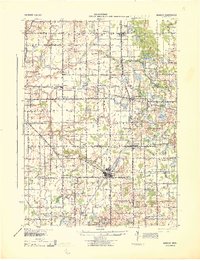
 1927 Bangor1959 Print · USGSVan Buren and Allegan counties show a landscape of thriving lakeside resorts and rail-fed farming towns in the late twenties. Trace family roots at Kibbie Chapel or the many local schools like Garden of Eden School and Arlington Center School.2 unique versions available
 - 1927 Map of South Haven, 1972 Print
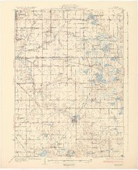
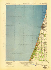
 1927 South Haven1972 Print · USGSThe Lake Michigan shoreline of Van Buren County flourished as a resort and agricultural destination during the late twenties. You can trace the Pere Marquette rail line through South Haven and Covert, or find old schoolhouses like Law Sch and Fish Sch.
 - 1930 Map of South Haven
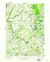
 1930 South Haven1930 Print · USGSSouthwest Michigan's lakeshore comes alive in this early Depression-era survey, showing the bustling port of South Haven and its surrounding resort beaches. Genealogists and local historians can trace rural school districts like Fish Sch and landmarks such as the Emanuel Home and Thunder Mtn.4 unique versions available
 - 1931 Map of Bangor
 1931 Bangor1931 Print · USGSCoastal resorts and interior farmsteads meet in this early 1930s survey of the Michigan lakefront and the Black River basin. Researchers can trace the PERE MARQUETTE rail line through Grand Junction or locate family sites like Kibbie Chapel and Gardner of Eden Sch.3 unique versions available
 - 1943 Map of South Haven
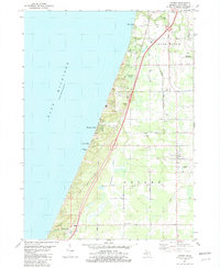
 1943 South Haven1943 Print · USGSThe Lake Michigan shoreline at South Haven was a bustling intersection of rail transport and lakeside tourism during the early 1940s. Genealogists and historians can trace old schoolhouses like Fish Sch, the path of the Pere Marquette railroad, and established retreats at Palisades Park.
 - 1943 Map of Bangor
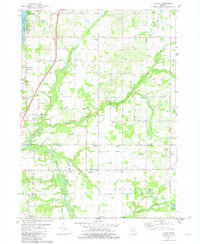
 1943 Bangor1943 Print · USGSVan Buren and Allegan counties appear here during the wartime years, when the railway was still the lifeblood of rural Michigan. Genealogists can trace hundreds of farmsteads near Grand Junction, Kibbie, and historic schools like Garden Of Eden Sch.
 - 1958 Map of Racine, 1971 Print
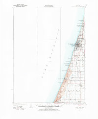
 1958 Racine1971 Print · USGSThe Lake Michigan shoreline in the late fifties was a study in contrasts between the industrial bustle of Kenosha and the quiet woods of the Allegan State Forest. Genealogists and historians can trace the urban footprint of Evanston or locate strategic sites like Fort Sheridan and the Wind Point Light.3 unique versions available
 - 1962 Map of Racine
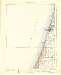
 1962 Racine1962 Print · USGSThe Lake Michigan shoreline in the early sixties reveals a fascinating contrast between the dense industrial rail hubs of RACINE and CHICAGO and the forested dunes of Michigan. Local historians can trace military installations like Fort Sheridan or explore the numerous inland retreats around Paw Paw Lake and Sister Lakes.
 - 1981 Map of Covert, 1982 Print
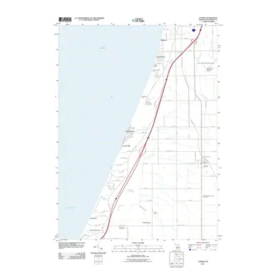
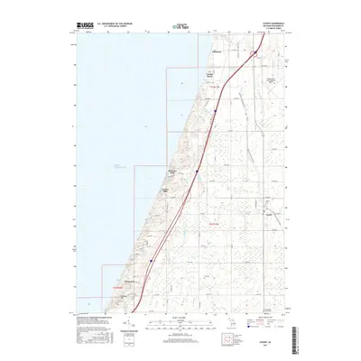
 1981 Covert1982 Print · USGSCoastal Van Buren County in the early eighties shows a landscape of dunes and developing lakeside communities along the lake. Researchers can trace family sites near Fish Corners, the Chesapeake and Ohio tracks, and the Fish Cem.
 - 1981 Map of Lacota, 1982 Print
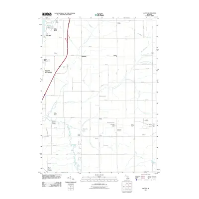
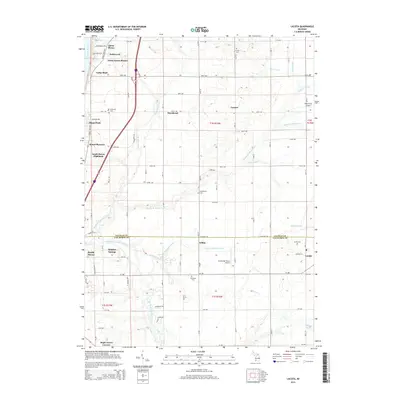
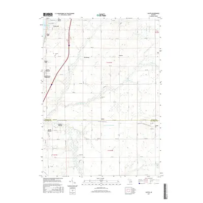
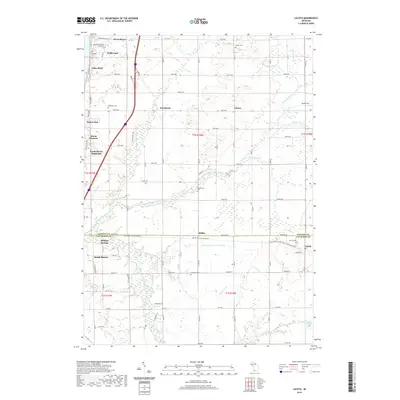
 1981 Lacota1982 Print · USGSLake Michigan's shoreline meets the rural townships of Casco and Geneva in the early eighties. Genealogists and local historians can trace family plots at Stuller Cemetery or Chambers Cemetery and explore the historic crossroads of Kibbie and Lacota.
 - 1981 Map of South Haven, 1982 Print
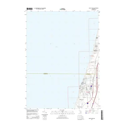
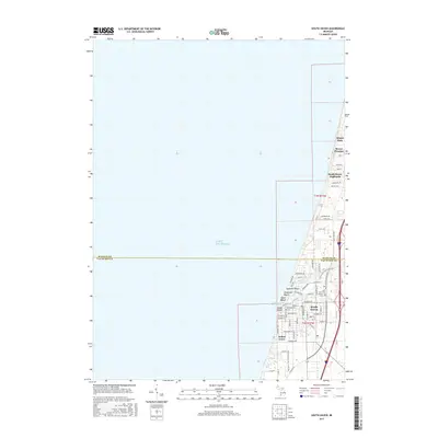
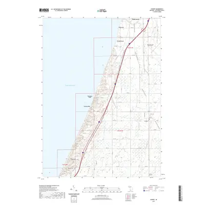
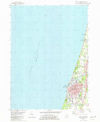 1981 South Haven1982 Print · USGSThe Lake Michigan shoreline of Van Buren County comes into focus in the early 1980s, centered on the busy port of South Haven. Genealogists and local historians can trace the town's growth through landmarks like the Hebrew Cemetery, the Chesapeake and Ohio rail line, and Miami Park.
 - 2011 Map of South Haven, 2011 Print
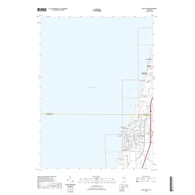
 2011 South Haven2011 Print · USGSCovers South Haven, including Indian Grove, South Haven Highlands, and other nearby areas
 - 2011 Map of Lacota, 2011 Print
 2011 Lacota2011 Print · USGSCovers South Haven, including Geneva Township, Maple Grove Corners, and other nearby areas
 - 2011 Map of Covert, 2011 Print
 2011 Covert2011 Print · USGSCovers South Haven, including Covert, Crystal Beach, and other nearby areas
 - 2014 Map of Covert, 2014 Print
 2014 Covert2014 Print · USGSCovers South Haven, including Covert, Crystal Beach, and other nearby areas
 - 2014 Map of South Haven, 2014 Print
 2014 South Haven2014 Print · USGSCovers South Haven, including Indian Grove, South Haven Highlands, and other nearby areas
 - 2014 Map of Lacota, 2014 Print
 2014 Lacota2014 Print · USGSCovers South Haven, including Geneva Township, Maple Grove Corners, and other nearby areas
 - 2017 Map of Lacota, 2017 Print
 2017 Lacota2017 Print · USGSCovers South Haven, including Geneva Township, Maple Grove Corners, and other nearby areas
 - 2017 Map of South Haven, 2017 Print
 2017 South Haven2017 Print · USGSCovers South Haven, including Indian Grove, South Haven Highlands, and other nearby areas
 - 2017 Map of Covert, 2017 Print
 2017 Covert2017 Print · USGSCovers South Haven, including Covert, Crystal Beach, and other nearby areas
 - 2019 Map of Lacota, 2019 Print
 2019 Lacota2019 Print · USGSCovers South Haven, including Geneva Township, Maple Grove Corners, and other nearby areas
 - 2019 Map of Covert, 2019 Print
 2019 Covert2019 Print · USGSCovers South Haven, including Covert, Crystal Beach, and other nearby areas
 - 2019 Map of South Haven, 2019 Print
 2019 South Haven2019 Print · USGSCovers South Haven, including Indian Grove, South Haven Highlands, and other nearby areas
 - 2023 Map of Covert, 2023 Print
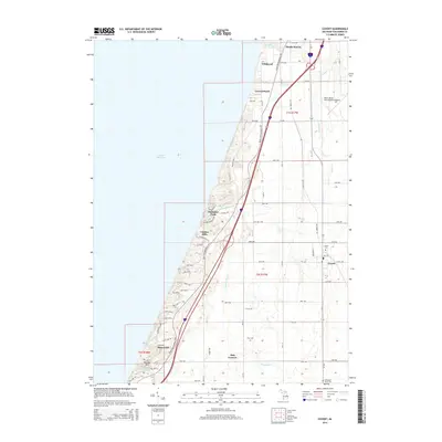
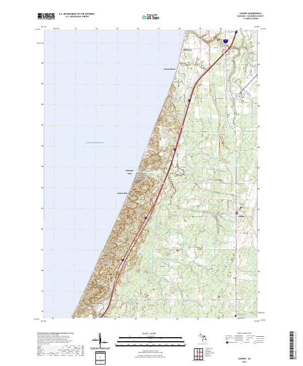 2023 Covert2023 Print · USGSThe Lake Michigan shoreline of Van Buren County appears here during a period of modern recreation and legacy agriculture. Researchers can trace the coastal bluffs of Thunder Mountain or locate family plots at Covert Cem and the Fish Cem near the town of Covert.
 - 2023 Map of Lacota, 2023 Print
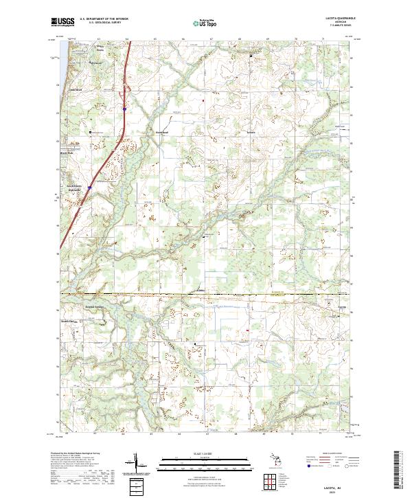 2023 Lacota2023 Print · USGSCoastal Allegan and Van Buren counties are captured here in the early twenty-first century as lakefront communities meet an inland river network. Trace local family roots at McDowell Cem and Lacota Cem, or explore the historical path of the Kal-haven Trail State Park Trl.
Showing maps 1-25 of 26
Top cities near South Haven
- Lee historical maps
- Covert historical maps
- Ganges historical maps
- Hartford historical maps
- Bangor historical maps
- Watervliet historical maps
See more
Top neighborhoods of South Haven
Frequently asked questions
- What are the different types of historical maps available for South Haven?
- What is the oldest map of South Haven?
- Where can I purchase historical maps of South Haven for my home or office?
- Where can I download high-res historical maps of South Haven?
- Are there historical topographic maps available for South Haven?
- Is there historical aerial imagery available for South Haven?
- Where are historical maps of South Haven sourced from?