Old Maps of Riverbend, Dearborn
Explore 30 old maps of Riverbend, spanning from 1905 to today. These high-resolution historic maps reveal how streets, neighborhoods, landmarks, and natural features evolved over time — perfect for genealogy, metal detecting, research, and local history exploration.
What you can do with these maps:
- See how Riverbend changed over time: Compare historical maps to modern-day views to trace roads, homesites, rail lines & more.
- View detailed metadata: Each map includes creators, publishers, year, scale, and archive source.
- Overlay maps with satellite & LiDAR: Visualize the past alongside modern tools to explore terrain & human change.
- Trusted historical sources: Maps sourced from the USGS, Library of Congress, and other archives.
- Access maps your way: View online, download high-res files, or order prints for personal or research use.
Start exploring old maps of Riverbend to uncover forgotten places, hidden landmarks, and the deep history beneath your feet.
Riverbend, Dearborn maps
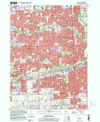
(30)- 1905 Map of Wayne
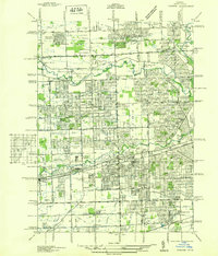
 1905 Wayne1905 Print · USGSWestern Wayne and southern Oakland counties are seen here at a pivotal moment when electric interurban railways first linked rural townships. Genealogists can trace family footprints in Northville, Plymouth, and Farmington, or locate vanished landmarks like Perrinville and the Wayne County Home.4 unique versions available
 - 1905 Map of Detroit
 1905 Detroit1905 Print · USGSDetroit and its surrounding townships are shown at a pivotal moment of expansion during the early 1900s. Genealogists and historians can trace the development of early suburbs like Highland Park and Royal Oak along major transit arteries like Grand River Ave. and the numerous electric railways.2 unique versions available
 - 1912 Map of Wayne
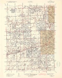
 1912 Wayne1912 Print · USGSWestern Wayne County in the early twentieth century shows a landscape being reshaped by the first concrete roads and a dense network of electric interurban railways. Trace the early development of Livonia, Redford, and Plymouth, or locate long-standing sites like Eloise and Perrinville.
 - 1918 Map of Detroit
 1918 Detroit1918 Print · USGSDetroit and its surrounding townships appear at the height of the early industrial era, captured just after the close of the Great War. Local researchers can trace the growth of the Ford Motor Co. empire near Navarre P.O. and explore the historic rail corridors of Hamtramck and Royal Oak.
 - 1924 Map of Detroit
 1924 Detroit1924 Print · USGSDetroit and its industrial satellites thrive during the peak of the automotive era. Genealogists and historians can trace the early factory footprints of Dodge Bros. or locate old neighborhood landmarks like Navarre P. O. and Mt. Olivet Cemetery.
 - 1934 Map of Detroit
 1934 Detroit1934 Print · USGSThe Detroit riverfront and its rising industrial suburbs are captured here during the peak of the automotive boom. Genealogists and historians can trace the early footprints of the Ford Motor Co and local landmarks like Olivet Cemetery or the State Fair Grounds.
 - 1936 Map of Inkster
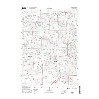
 1936 Inkster1936 Print · USGSWestern Wayne County was a landscape of institutions and early aviation in the years before the war. Researchers can trace the legacy of the Eloise Hospital and Infirmary, locate local landmarks like Wankin Mills, or find family roots near Perrinsville and St Marys Cem.
 - 1936 Map of Dearborn
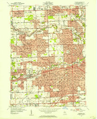
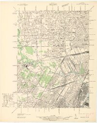 1936 Dearborn1936 Print · USGSMid-century Dearborn and West Detroit are captured in 1936, showing a landscape defined by the rise of the automotive industry. Genealogists and historians can locate early neighborhood schools like Mackenzie HS and landmark sites like Ford Airport and Greenfield Village.
 - 1942 Map of Dearborn
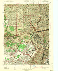 1942 Dearborn1942 Print · USGSDearborn and the industrial Detroit fringe are captured here at the height of the early war years. Genealogists and historians can trace dozens of neighborhoods and schools, from Fordson High Sch to the grounds of Greenfield Village and Camp Legion.2 unique versions available
 - 1942 Map of Inkster
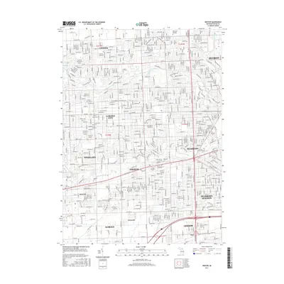
 1942 Inkster1942 Print · USGSWayne County at the onset of the 1940s shows a landscape of growing suburbs and vital transit hubs. Genealogists and local historians can trace the foundations of Garden City and Inkster or locate landmarks like Eloise Hospital and Nankin Mills.2 unique versions available
 - 1952 Map of Inkster, 1954 Print
 1952 Inkster1954 Print · USGSWestern Wayne County was rapidly transforming during the early fifties as the Detroit suburbs expanded toward the Rouge River forks. Genealogists and historians can locate numerous landmarks including Eloise Cem, the County Hospital, and the historic Nankin Mills.2 unique versions available
 - 1952 Map of Dearborn, 1954 Print
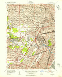 1952 Dearborn1954 Print · USGSMid-century Dearborn and western Detroit show a landscape defined by the automotive industry and rapid postwar expansion. Researchers can trace the massive rail yards, the Ford Rotunda, and neighborhood landmarks like Greenfield Village and Woodmere Cemetery.2 unique versions available
 - 1954 Map of Detroit
 1954 Detroit1954 Print · USGSThe Detroit metro and its Ontario neighbors are shown at the height of the mid-century industrial era, just as the suburbs were rapidly expanding. Researchers can trace the massive rail networks of the Wabash Railroad or locate landmarks like Grosse Ile and Selfridge Air Force Base.
 - 1961 Map of Detroit, 1973 Print
 1961 Detroit1973 Print · USGSThe international border between Michigan and Ontario was a bustling industrial corridor in the early sixties. Researchers can trace the transit networks and riverfront infrastructure connecting Detroit to Windsor via the Detroit-Windsor Tunnel and major air hubs like Willow Run Airport.2 unique versions available
 - 1965 Map of Detroit
 1965 Detroit1965 Print · USGSThe industrial corridor between Michigan and Ontario is captured here at mid-century, showing the dense rail and river networks of the Great Lakes. Local historians can trace the paths of the Grand Trunk Western RR and locate key landmarks like Selfridge Air Force Base and Grosse Ile.
 - 1968 Map of Inkster, 1970 Print
 1968 Inkster1970 Print · USGSThe suburban heart of Wayne County comes alive in this late-sixties study of the Rouge River valley. Researchers can trace the mid-century development of Livonia and Garden City, locating long-standing community markers like the Eloise Cem and Nankin Mills Sch.3 unique versions available
 - 1968 Map of Dearborn, 1970 Print
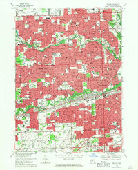
 1968 Dearborn1970 Print · USGSMid-century Dearborn and West Detroit are captured here at a peak of industrial and suburban development. Genealogists and local historians can locate dozens of neighborhood parish schools, the Evergreen Cem, and the iconic Greenfield Village grounds.4 unique versions available
 - 1985 Map of Detroit
 1985 Detroit1985 Print · USGSSoutheast Michigan in the mid-eighties shows a landscape defined by industrial power and suburban reach from the Detroit River to the Huron Valley. Researchers can trace the rail lines of the Conrail, explore the grounds of the University of Michigan, and locate numerous sites like Mt Olivet Cem.
 - 1989 Map of Detroit, 1991 Print
 1989 Detroit1991 Print · USGSSoutheast Michigan and across the river into Ontario reached a point of peak metropolitan density at the end of the 1980s. Local researchers can trace the footprint of the University of Michigan campus, the industrial waterfronts of Wyandotte, and the extensive grounds of Glen Eden Cem.
 - 1996 Map of Inkster, 2000 Print
 1996 Inkster2000 Print · USGSThe suburban heart of Wayne County comes into focus in the mid-nineties, showing the fully developed neighborhoods and river parkways of Westland and Garden City. Trace local history through landmarks like Nankin Mills, the St Bernard Seminary, and numerous family-named parks and parish schools.
 - 2011 Map of Dearborn, 2011 Print
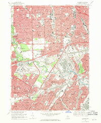
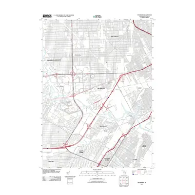 2011 Dearborn2011 Print · USGSCovers Riverbend, including Detroit, Dearborn, and other nearby areas
 - 2011 Map of Inkster, 2011 Print
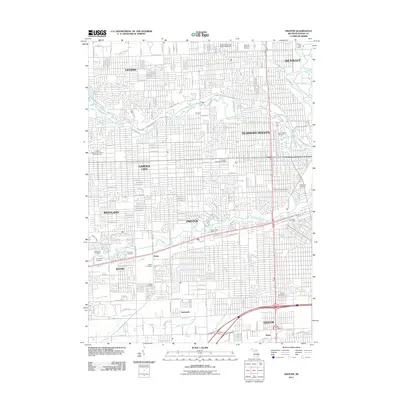 2011 Inkster2011 Print · USGSCovers Riverbend, including Detroit, Livonia, and other nearby areas
 - 2014 Map of Dearborn, 2014 Print
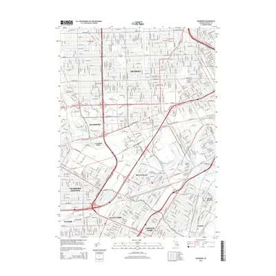 2014 Dearborn2014 Print · USGSCovers Riverbend, including Detroit, Dearborn, and other nearby areas
 - 2014 Map of Inkster, 2014 Print
 2014 Inkster2014 Print · USGSCovers Riverbend, including Detroit, Livonia, and other nearby areas
 - 2017 Map of Inkster, 2017 Print
 2017 Inkster2017 Print · USGSCovers Riverbend, including Detroit, Livonia, and other nearby areas
Showing maps 1-25 of 30
Frequently asked questions
- What are the different types of historical maps available for Riverbend?
- What is the oldest map of Riverbend?
- Where can I purchase historical maps of Riverbend for my home or office?
- Where can I download high-res historical maps of Riverbend?
- Are there historical topographic maps available for Riverbend?
- Is there historical aerial imagery available for Riverbend?
- Where are historical maps of Riverbend sourced from?