1950s Maps of Northwest Goldberg, Detroit
Explore 3 historic maps of Northwest Goldberg from the 1950s. These maps offer a rare glimpse into what life looked like during the 1950s — showing old roads, neighborhoods, homes, and landmarks that have changed or disappeared over time.
Whether you're researching your family's past, planning a metal detecting trip, or studying how Northwest Goldberg's landscape evolved across the 1950s, these high-resolution maps are a powerful tool for exploring the history of this region.
- Focus on a specific era: All maps on this page are from the 1950s, giving you a focused view of this time period.
- See what’s changed: Compare century-old streets, trails, and buildings to today's modern landscape using overlays and satellite layers.
- Research with precision: Use these maps for genealogy, historical research, land use analysis, or educational projects.
- View, download, or print: Maps are fully viewable online in high resolution, and can be downloaded or printed for your own records.
Start exploring Northwest Goldberg's history through authentic maps from the 1950s. This is your window into the past.
Northwest Goldberg, Detroit maps
(3)- 1952 Map of Detroit, 1954 Print
 1952 Detroit1954 Print · USGSThe industrial border between Michigan and Ontario is captured here at the mid-century peak of the automotive era. Researchers can trace the massive rail networks of the New York Central, locate neighborhood landmarks like Briggs Stadium, or find family sites near Mt Elliot Cemetery.2 unique versions available
 - 1954 Map of Detroit
 1954 Detroit1954 Print · USGSThe Detroit metro and its Ontario neighbors are shown at the height of the mid-century industrial era, just as the suburbs were rapidly expanding. Researchers can trace the massive rail networks of the Wabash Railroad or locate landmarks like Grosse Ile and Selfridge Air Force Base.
 - 1954 Map of Detroit
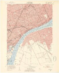
 1954 Detroit1954 Print · USGSDetroit and Windsor sit at their industrial peak in the early fifties, linked by the Ambassador Bridge and busy rail tunnels. Trace neighborhood roots across a dense grid of parish schools, the sprawling Wayne University campus, and landmarks like Briggs Stadium.2 unique versions available
End of results
Showing maps 1-3 of 3
Frequently asked questions
- What are the different types of historical maps available for Northwest Goldberg?
- What is the oldest map of Northwest Goldberg?
- Where can I purchase historical maps of Northwest Goldberg for my home or office?
- Where can I download high-res historical maps of Northwest Goldberg?
- Are there historical topographic maps available for Northwest Goldberg?
- Is there historical aerial imagery available for Northwest Goldberg?
- Where are historical maps of Northwest Goldberg sourced from?