Old Maps of Carlton County, Minnesota
Explore 176 old maps of Carlton County, spanning from 1949 to today. These high-resolution historic maps reveal how streets, neighborhoods, landmarks, and natural features evolved over time — perfect for genealogy, metal detecting, research, and local history exploration.
What you can do with these maps:
- See how Carlton County changed over time: Compare historical maps to modern-day views to trace roads, homesites, rail lines & more.
- View detailed metadata: Each map includes creators, publishers, year, scale, and archive source.
- Overlay maps with satellite & LiDAR: Visualize the past alongside modern tools to explore terrain & human change.
- Trusted historical sources: Maps sourced from the USGS, Library of Congress, and other archives.
- Access maps your way: View online, download high-res files, or order prints for personal or research use.
Start exploring old maps of Carlton County to uncover forgotten places, hidden landmarks, and the deep history beneath your feet.
Carlton County, MN maps
(176)- 1949 Map of Holyoke
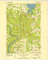
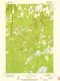
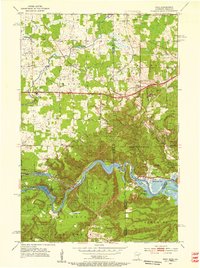
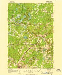
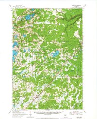
 1949 Holyoke1949 Print · USGSThe borderlands of Minnesota and Wisconsin are captured in the late 1940s, highlighting the transition from rail settlements to wild interior wetlands. Genealogists and historians can trace the Minneapolis St Paul and Sault Ste Marie RR through Foxboro and locate the rural Nelson Sch.2 unique versions available
 - 1953 Map of Saginaw, 1955 Print
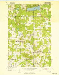
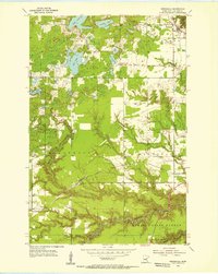
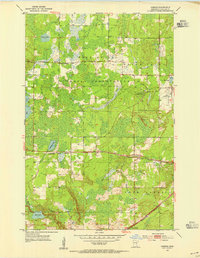
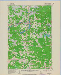
 1953 Saginaw1955 Print · USGSSt. Louis County is defined by its industrial rail corridors and the winding St. Louis River during the early 1950s. Genealogists and historians can trace the Fond Du Lac Indian Reservation boundary and find local landmarks like Holy Family Cem and Saginaw.4 unique versions available
 - 1953 Map of Adolph, 1955 Print
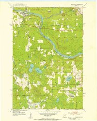
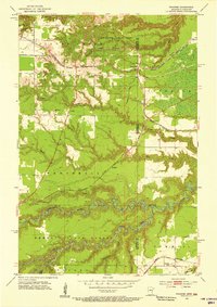
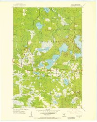
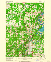
 1953 Adolph1955 Print · USGSSt. Louis County is captured here in the early fifties, showing a landscape defined by industrial rail lines and lakefront settlements. Genealogists and rail historians can trace the Duluth Missabe and Iron Range line through Adolph and Munger, or locate Canosia Cem and the Pike Lake Sch.5 unique versions available
 - 1953 Map of Brookston, 1955 Print
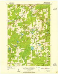
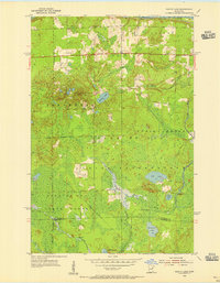
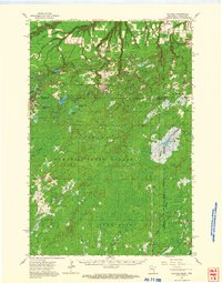
 1953 Brookston1955 Print · USGSBrookston and the surrounding St. Louis County wetlands are seen here in the early fifties, where the river-and-rail corridor meets tribal lands. Genealogists and local historians can trace the Great Northern rail line, identify the sites of Birch Lake Cem, and locate the old Landing Field.3 unique versions available
 - 1953 Map of Duluth, 1964 Print
 1953 Duluth1964 Print · USGSNortheastern Minnesota and northwestern Wisconsin are shown here during a period of industrial maturity and expanding conservation. Genealogists and historians can trace rail-connected towns like McGrath and Wahkon, or locate heritage sites within the Fond du Lac Indian Reservation.2 unique versions available
 - 1954 Map of Cloquet, 1955 Print
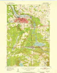 1954 Cloquet1955 Print · USGSCarlton County in the mid-1950s showcases a landscape of industrial power and rail-driven growth along the St Louis River. Genealogists and historians can trace the foundations of Cloquet through its many schools, cemeteries, and the rail lines of the Northern Pacific.5 unique versions available
 - 1954 Map of Foxboro, 1955 Print
 1954 Foxboro1955 Print · USGSThe borderlands of Minnesota and Wisconsin are depicted here in the mid-fifties, dominated by dense state forests and critical rail corridors. Researchers can locate the settlement of Foxboro, the Summit Cem, and various Gravel Pits along the Great Northern tracks.4 unique versions available
 - 1954 Map of Wrenshall, 1955 Print
 1954 Wrenshall1955 Print · USGSWrenshall and the surrounding Carlton County woodlands are mapped here in the mid-1950s during the height of the region's rail and gravel industry. Researchers can trace family sites near Maccabee Cem, follow the Railroad Grade, or locate old homesteads near Scotts Corner and Pleasant Valley.4 unique versions available
 - 1954 Map of Frogner, 1955 Print
 1954 Frogner1955 Print · USGSThe Minnesota and Wisconsin borderlands come alive in the 1950s, showing a landscape shaped by the Nemadji River and heavy rail traffic. Genealogists and rail historians can trace the paths of the Great Northern through Wrenshall or locate the Foxboro Sch and Maccabee Cem.4 unique versions available
 - 1954 Map of Atkinson, 1955 Print
 1954 Atkinson1955 Print · USGSCarlton County's rural townships are captured here in the mid-fifties, showing a landscape defined by intersecting rail lines and glacial lakes. Genealogists and local historians can trace family roots through landmarks like Bethel Cem, Blackhoof Valley Sch, and the settlement at Atkinson.3 unique versions available
 - 1954 Map of Esko, 1955 Print
 1954 Esko1955 Print · USGSThe St. Louis River valley and the community of Esko are shown here in the mid-1950s as the region's rail and park systems were fully established. Genealogists and local historians can trace the early footprints of Fond du Lac, the Finnish Ch, and the winding Duluth Missabe and Iron Range railroad.5 unique versions available
 - 1954 Map of Iverson, 1955 Print
 1954 Iverson1955 Print · USGSCarlton County's forested wetlands and rail corridors are captured here in the mid-1950s. Researchers can trace the Northern Pacific tracks through Iverson or locate historic local landmarks like the Big Lake Chapel and the Cloquet Forest Experiment Station.2 unique versions available
 - 1954 Map of Sawyer, 1956 Print
 1954 Sawyer1956 Print · USGSSawyer and the surrounding Carlton County wetlands are documented here in the mid-1950s during a period of forest management and rail transit. Genealogists and local historians can trace the community around Mary and Joseph Ch and the Northern Pacific line near Perch Lake.3 unique versions available
 - 1954 Map of Martin Lake, 1956 Print
 1954 Martin Lake1956 Print · USGSNortheastern Minnesota in the mid-fifties is captured here as a landscape of timber and wetlands within the Fond Du Lac Indian Reservation. Researchers can trace the Great Northern rail line near Brookston and locate local landmarks like the Town Hall and Martin Lake.3 unique versions available
 - 1956 Map of Barnum, 1958 Print
 1956 Barnum1958 Print · USGSIn the mid-fifties, the Northern Pacific railroad still served as the primary spine connecting Carlton County settlements. Genealogists and historians can trace the locations of Salem Cem, the Blackhoof Valley Sch, and the Zion Ch during this era.2 unique versions available
 - 1958 Map of Duluth
 1958 Duluth1958 Print · USGSNortheastern Minnesota and the Wisconsin borderlands are shown in detail during the late 1950s, centered on the bustling rail yards and ports of Duluth. You can trace the historic routes of the Soo Line and Duluth Missabe & Iron Range through small towns like McGrath, Bruno, and Wrenshall.
 - 1961 Map of Cromwell, 1963 Print
 1961 Cromwell1963 Print · USGSCarlton County in the early sixties remains a region of quiet rail towns and deep glacial lakes. Genealogists and historians can trace family roots through landmarks like Finnish Ch, Kalevala Sch, and the West Branch Cem.2 unique versions available
 - 1961 Map of Moose Lake, 1963 Print
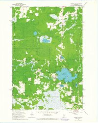
 1961 Moose Lake1963 Print · USGSNortheastern Minnesota lakeside communities and the Kettle River valley are captured in the early sixties as they balanced forestry and small-town industry. Genealogists and local historians can trace family-named landmarks and rural hubs like Nordland Cem, the State Hospital, and the rail stops at Willow River and Rutledge.2 unique versions available
 - 1962 Map of Holyoke, 1964 Print
 1962 Holyoke1964 Print · USGSCrossing the Minnesota and Wisconsin border in the early sixties, this survey shows the remote timberlands and rail-dependent hamlets of Pine and Carlton counties. Genealogists and historians can trace the Great Northern Grade through Holyoke, Foxboro, and the Summit Cemetery.2 unique versions available
 - 1962 Map of Bruno, 1964 Print
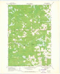
 1962 Bruno1964 Print · USGSNortheastern Minnesota at the dawn of the sixties shows a network of rail-towns and timberlands centered on the Great Northern line. Genealogists and historians can trace family locations through Moose Lake Cem, Blomskog Ch, and the many small settlements like Kerrick and Duquette.2 unique versions available
 - 1963 Map of Gowan, 1964 Print
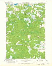
 1963 Gowan1964 Print · USGSNorthern Minnesota timberland and river valleys are captured here in the early sixties, showing the vital link between water and rail. Researchers can locate the small stations of Gowan and Paupores along the Great Northern railroad line.3 unique versions available
 - 1963 Map of Prairie Lake, 1964 Print
 1963 Prairie Lake1964 Print · USGSNorthern Minnesota lake country is captured here in the early sixties, showing the rural townships of Halden and Floodwood. Genealogists and local historians can trace family-named sites like Moberg Lake, find the old Townhall, and locate both the Prairie Lake Cem and Fine Lake Cem.
 - 1969 Map of Ronald, 1971 Print
 1969 Ronald1971 Print · USGSThe rural Minnesota landscape at the meeting point of Aitkin, Carlton, and Pine counties was dominated by timber and wetlands in the late sixties. Researchers can trace the small settlement at Ronald, find the Beaver Ch, and follow the winding Split Rock River through the Solina State Forest.2 unique versions available
 - 1969 Map of Automba, 1972 Print
 1969 Automba1972 Print · USGSThe Aitkin County backcountry in the late sixties is a mosaic of dense woods and winding waterways. Trace the Soo Line rail corridor through the settlement of Automba or explore the wetlands of the Salo Marsh State Wildlife Management Area.
 - 1970 Map of Little Prairie Lake, 1972 Print
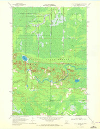 1970 Little Prairie Lake1972 Print · USGSThe northern Minnesota wilderness at the junction of three counties is captured here in the early seventies. Outdoorsmen and historians can trace the paths of the Snowmobile Trail and Winter Trail near Little Prairie Lake and the Savanna River.
Showing maps 1-25 of 176
Top cities of Carlton County
- Cloquet historical maps
- Moose Lake historical maps
- Scanlon historical maps
- Carlton historical maps
- Barnum historical maps
- Wrenshall historical maps
See more
Frequently asked questions
- What are the different types of historical maps available for Carlton County?
- What is the oldest map of Carlton County?
- Where can I purchase historical maps of Carlton County for my home or office?
- Where can I download high-res historical maps of Carlton County?
- Are there historical topographic maps available for Carlton County?
- Is there historical aerial imagery available for Carlton County?
- Where are historical maps of Carlton County sourced from?