Old Maps of Days High Landing, Minnesota for Genealogy
Trace your family roots with 12 historic maps of Days High Landing. These high-res maps reveal old neighborhoods, homesites, landmarks, and streets — helping you uncover where your ancestors lived and how the area evolved over time.
- Explore historic neighborhoods: Identify where your relatives may have lived in the 1800s or 1900s.
- Compare maps over time: Trace the changes in streets, buildings, and landmarks for multi-generational research.
- Perfect for genealogy & ancestry research: Used by family historians and researchers to map out lineage and migration.
These maps are an incredible resource for exploring your personal connection to Days High Landing's past.
Days High Landing, MN maps
(12)- 1954 Map of Hibbing, 1966 Print
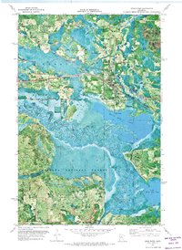
 1954 Hibbing1966 Print · USGSNorthern Minnesota's Iron Range thrives during the mid-1960s, showing the industrial landscape between the Mesabi Range and the Mississippi River. Genealogists and historians can trace the rail lines of the Great Northern RR through mining hubs like Hibbing and Virginia.3 unique versions available
 - 1957 Map of Hibbing
 1957 Hibbing1957 Print · USGSNorthern Minnesota's Iron Range is shown at its industrial peak in the mid-fifties, dominated by the massive iron pits and rail corridors of the Mesabi Range. Researchers can trace the rail networks of the Duluth Missabe and Iron Range and locate mining hubs like Hibbing, Virginia, and Bovey.
 - 1958 Map of Hibbing
 1958 Hibbing1958 Print · USGSThe Mesabi Iron Range reached its mid-century height during this era, defining the landscape between Grand Rapids and Virginia. Genealogists and historians can trace the mining-town networks of Hibbing and Chisholm or locate numerous iron mines and rail spurs.
 - 1964 Map of Hibbing
 1964 Hibbing1964 Print · USGSNorthern Minnesota’s iron-rich corridor is captured here during a peak era of mid-century industrial activity. Researchers can trace the rail-to-mine connections through Mesabi Range towns like Hibbing and Virginia or locate lakefront settlements near Pokegama Lake.
 - 1970 Map of Deer River, 1973 Print
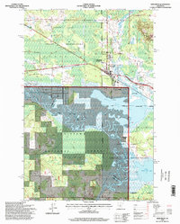
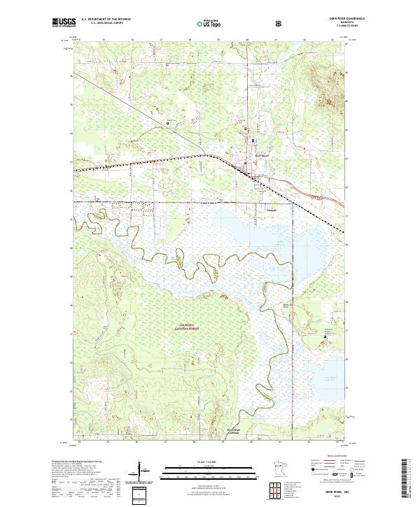
 1970 Deer River1973 Print · USGSItasca County at the start of the 1970s shows the bustling rail-and-river hub of Deer River alongside the winding Mississippi River. Researchers can locate Olivet Cem, the local High Sch, and rural landmarks like White Oak Point.
 - 1992 Map of Pokegama Lake
 1992 Pokegama Lake1992 Print · USGSItasca County in the early nineties showcases the industrial pulse of the Iron Range and the vast waters of the north woods. Trace the rail lines of the Duluth Missabe and Iron Range Railway or locate old settlements like Wawina and Calumet.
 - 1996 Map of Deer River, 1998 Print
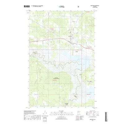
 1996 Deer River1998 Print · USGSThe Mississippi River and White Oak Lake define the Itasca County landscape in the 1990s. Researchers can locate Olivet Cemetery, King School, and the community of Zemple among the forest and wetlands.
 - 2011 Map of Deer River, 2011 Print
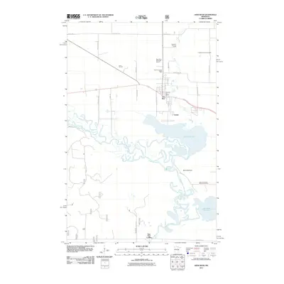 2011 Deer River2011 Print · USGSCovers Days High Landing, including Deer River, Zemple, and other nearby areas
 - 2013 Map of Deer River, 2013 Print
 2013 Deer River2013 Print · USGSCovers Days High Landing, including Deer River, Zemple, and other nearby areas
 - 2016 Map of Deer River, 2016 Print
 2016 Deer River2016 Print · USGSCovers Days High Landing, including Deer River, Zemple, and other nearby areas
 - 2019 Map of Deer River, 2019 Print
 2019 Deer River2019 Print · USGSCovers Days High Landing, including Deer River, Zemple, and other nearby areas
 - 2022 Map of Deer River, 2022 Print
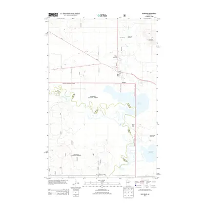
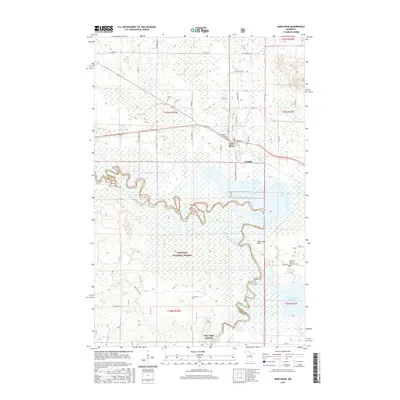
 2022 Deer River2022 Print · USGSDeer River and the neighboring village of Zemple are shown here at the edge of the Chippewa National Forest. You can trace the winding Mississippi River through White Oak Lake, find family roots at Olivet Cem, or explore the river landing at Days High Landing.
End of results
Showing maps 1-12 of 12
Top cities near Days High Landing
Frequently asked questions
- What are the different types of historical maps available for Days High Landing?
- What is the oldest map of Days High Landing?
- Where can I purchase historical maps of Days High Landing for my home or office?
- Where can I download high-res historical maps of Days High Landing?
- Are there historical topographic maps available for Days High Landing?
- Is there historical aerial imagery available for Days High Landing?
- Where are historical maps of Days High Landing sourced from?